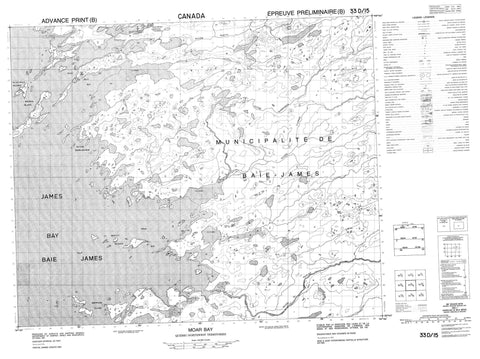
033D15 Moar Bay Canada topo map, 1:50,000 scale
033D15 Moar Bay NRCAN topographic map.
Includes UTM and GPS geographic coordinates (latitude and longitude). This 50k scale map is suitable for hiking, camping, and exploring, or you could frame it as a wall map.
Printed on-demand using high resolution, on heavy weight and acid free paper, or as an upgrade on a variety of synthetic materials.
Topos available on paper, Waterproof, Poly, or Tyvek. Usually shipping rolled, unless combined with other folded maps in one order.
- Product Number: NRCAN-033D15
- Parent Topo: TOPO-033D
- Map ID also known as: 033D15, 33D15
- Unfolded Size: Approximately 26" high by 36" wide
- Weight (paper map): ca. 55 grams
- Map Type: POD NRCAN Topographic Map
- Map Scale: 1:50,000
- Geographical region: Nunavut, Canada
Neighboring Maps:
All neighboring Canadian topo maps are available for sale online at 1:50,000 scale.
Purchase the smaller scale map covering this area: Topo-033D
Spatial coverage:
Topo map sheet 033D15 Moar Bay covers the following places:
- Anse Achahakawaytikw - Anse Achikuwasaw - Anse Awasasich - Baie Amichiwasach - Baie James - Baie Kakiyakwaumakak - Baie Sapwayaskunikap - James Bay - Moar Bay - Mouillage Aywakisipimanuch - Paint Hills Bay - Grève Chimon Astach - Pointe Achinapikunayaw - Pointe Achinwayapiskach - Pointe Akusasiwayach - Pointe Amutipanuch - Pointe Anasakach - Pointe Anaschukach - Pointe Anaskach - Pointe Anayaskwayach - Pointe Anayichusich - Pointe Apiskutikutasich - Pointe Askwasimwakwanan - Pointe Awamistikusu - Pointe Bourlamaque - Pointe Mitukan Aytakuch - Pointe Narrow Neck - Pointe Pamitinikan - Pointe Wamistikusis - Pointe Wamistikusu - Chenal Achikaywiskach - Chenal Asipwayasich - Chenal Mayisipawayaw - Passe Asipanikach - Passe Aupach - Passe Upicaunus - Île Achikayuyakausich - Île Achimumiskwanuch - Île Achinwanikach - Île Aminapiskach - Île Aminaukach - Île Aministikuschukach - Île Amiskusiunikasich - Île Amutayminanuch - Île Apisipawayasich - Île Asapuminiskasich - Île Chiyaskunapiskw - Île Kachinwaniskaw - Île Kachipikutich - Île Kachiwichinanuch - Île Kachiwichinayasich - Île Kamikustasiwnikw - Île Kapawaunikw - Île Kaupiskutach - Île Mamakwasukamik - Île May - Île Ministikus - Île Napaw - Île Pwatikamik Aytakuch - Île Wamistikusu Maki Aytakuch - Île Wapaskuch Apimisich - Île Yumin - Îles Iskwasiu - Îles Kapiskwapiskasich - Monkey Islands - Paint Hills Islands - Petite île Achikukan - Petite île Amikatinach - Petite île Apiskutikutasich - Petite île Awasasich - Petite île Aywapuwaw - Petite île Chisayakw - Petite île Wamistikusu Aytat - Petite île Wapikiyu - Sheppard Island - Walrus Islands - Lac Chinusaw - Lac Chinusaw Pachistiwakan - Lac Kanataukasi - Lac Kawastuwamach - Lac Michisu Ukusiun - Lac Ministikw - Lac Namakus - Lac Namapi - Lac Pikutipi - Lac Sapwayaskunikap - Lac Uchipakaw - Lac Wastiwawmaw - Petit lac Uchikachasu - Rapides Upichun - Rivière Clergue - Rivière du Peuplier - Rivière Maquatua - Rivière Namapistikw - Rivière Poplar - Rivière Sabascunica - Rivière Sculpin - Rivière Torviens - Ruisseau Kowitipitum - Ruisseau Wastiwawmaw - Portage Akapitakanusich - Achiwapaschikisit - Askwasimwakwanan - Kutawanis - Mikwasiskwaw Umitukap Aytakunich - Nouveau-Comptoir - Nouveau-Comptoir - Wemindji - Wemindji - Nouveau-Comptoir - Paint Hills - Wemindji


