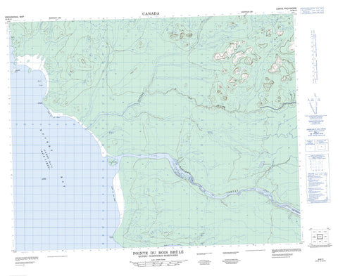
032M10 Pointe Du Bois Brule Canada topo map, 1:50,000 scale
032M10 Pointe Du Bois Brule NRCAN topographic map.
Includes UTM and GPS geographic coordinates (latitude and longitude). This 50k scale map is suitable for hiking, camping, and exploring, or you could frame it as a wall map.
Printed on-demand using high resolution, on heavy weight and acid free paper, or as an upgrade on a variety of synthetic materials.
Topos available on paper, Waterproof, Poly, or Tyvek. Usually shipping rolled, unless combined with other folded maps in one order.
- Product Number: NRCAN-032M10
- Parent Topo: TOPO-032M
- Map ID also known as: 032M10, 32M10
- Unfolded Size: Approximately 26" high by 36" wide
- Weight (paper map): ca. 55 grams
- Map Type: POD NRCAN Topographic Map
- Map Scale: 1:50,000
- Geographical region: Nunavut, Canada
Neighboring Maps:
All neighboring Canadian topo maps are available for sale online at 1:50,000 scale.
Purchase the smaller scale map covering this area: Topo-032M
Spatial coverage:
Topo map sheet 032M10 Pointe Du Bois Brule covers the following places:
- Anse Hall - Anse Mallet - Baie de Rupert - Baie James - Bras Mihkuchikash Pachistuwakan - Hall Cove - James Bay - Rupert Bay - Pointe Burntwood - Pointe du Bois Brûlé - Pointe du Peuplier - Pointe Lefaivre - Pointe Nord - Pointe Poplar - Pointe Stevens - Pointe Upemuew - Draulette Island - Île Draulette - Île Kamituskanikach - Îles Jolly - Îles Ministikuschukau - Jolly Islands - Lefaivre Island - Rocher Aschischikunaminastikuch - Rocher Barboteau - Rocher Eshipeweyamiskach - Rocher Stag - Rocher Upemuewschikush - Stevens Island - Étang Kauskuskach - Étangs Sakuteyapiniu - Colline Epimihchach - Colline Kachistuchiskakanukwau - Colline Kanistutinahkwau - Colline Kapiskuchistineu - Colline Natichuwew - Colline Pishu - Colline Upemuew - Rapides Machisipi - Rapides Nistam - Rapides Wapiskachmatawau - Rapides Wapushuyanish Kaakuchihk - Rivière à la Truite - Rivière Opamwastik - Rivière Pontax - Rivière Rupert - Ruisseau Apihtu Washau - Ruisseau Chiwetinutach - Ruisseau Emihkwanish Kapit - Ruisseau Kachakuschikwashich - Ruisseau Kamachistewekaputwau Minahikuch - Ruisseau Kaneyaskweyau - Ruisseau Kapemistikwanuch - Ruisseau Machisipi Echishipikaput Minahikuch - Ruisseau Pwapkachiwistamit - Ruisseau Shipanikw - Ruisseau Sipanikuch Kaishinakuhch - Ruisseau Skwaskekau - Ruisseau Uchikwachikanan - Ruisseau Ukau - Ruisseau Waskahikanu - Stag Rock - Meskanu - Marais Ememeniskach - Marais Kashakuschekach - Marais Mekweyauch Katakuch - Marais Sakuteyapihu


