
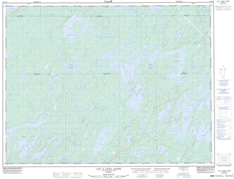
032G10 Lac A L Eau Jaune Canada topo map, 1:50,000 scale
032G10 Lac A L Eau Jaune NRCAN topographic map.
Includes UTM and GPS geographic coordinates (latitude and longitude). This 50k scale map is suitable for hiking, camping, and exploring, or you could frame it as a wall map.
Printed on-demand using high resolution, on heavy weight and acid free paper, or as an upgrade on a variety of synthetic materials.
Topos available on paper, Waterproof, Poly, or Tyvek. Usually shipping rolled, unless combined with other folded maps in one order.
- Product Number: NRCAN-032G10
- Parent Topo: TOPO-032G
- Map ID also known as: 032G10, 32G10
- Unfolded Size: Approximately 26" high by 36" wide
- Weight (paper map): ca. 55 grams
- Map Type: POD NRCAN Topographic Map
- Map Scale: 1:50,000
- Geographical region: Quebec, Canada
Neighboring Maps:
All neighboring Canadian topo maps are available for sale online at 1:50,000 scale.
Purchase the smaller scale map covering this area: Topo-032G
Spatial coverage:
Topo map sheet 032G10 Lac A L Eau Jaune covers the following places:
- Baie Anderson - Baie Tush - Passe du Verneuil - Brochant - Brongniart - Daubrée - Fancamp - Haüy - Lescure - Lévy - Rale - Rasles - Scott - Lac à l'Eau Jaune - Lac Agglomérat - Lac Andy - Lac Armi - Lac Baker - Lac Bossé - Lac Cavan - Lac Chevrier - Lac Chico - Lac Dawning - Lac de la Baie - Lac de la Presqu'île - Lac des Trois Îles - Lac des Vents - Lac du Bras Coupé - Lac du Muguet - Lac Erwin - Lac Esox - Lac Fancamp - Lac Goudreau - Lac Haüy - Lac Irène - Lac Keith - Lac la Ressource - Lac Le Gantier - Lac Lescure - Lac Merrill - Lac Muscocho - Lac Nodin - Lac Opawika - Lac Rane - Lac Sébastien - Lac Trenholme - Lac Verneuil - Lac Winchester - Lacs Obatogamau - Rivière Everglades - Rivière Irène - Rivière Obalomago - Rivière Obatogamau - Rivière Opawica


