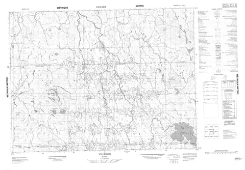
032E03 Villebois Canada topo map, 1:50,000 scale
032E03 Villebois NRCAN topographic map.
Includes UTM and GPS geographic coordinates (latitude and longitude). This 50k scale map is suitable for hiking, camping, and exploring, or you could frame it as a wall map.
Printed on-demand using high resolution, on heavy weight and acid free paper, or as an upgrade on a variety of synthetic materials.
Topos available on paper, Waterproof, Poly, or Tyvek. Usually shipping rolled, unless combined with other folded maps in one order.
- Product Number: NRCAN-032E03
- Parent Topo: TOPO-032E
- Map ID also known as: 032E03, 32E3, 32E03
- Unfolded Size: Approximately 26" high by 36" wide
- Weight (paper map): ca. 55 grams
- Map Type: POD NRCAN Topographic Map
- Map Scale: 1:50,000
- Geographical region: Quebec, Canada
Neighboring Maps:
All neighboring Canadian topo maps are available for sale online at 1:50,000 scale.
Purchase the smaller scale map covering this area: Topo-032E
Spatial coverage:
Topo map sheet 032E03 Villebois covers the following places:
- Baie Kinojeaminikami - Baie Kohokoho - Baie Nidokwagan - Baie Nigigami - Jupiter-30 - Jupiter-Trente - Pointe Tagwagici - Passage Obadawaga - Boivin - Chazel - Clermont - Des Méloizes - Lavergne - Lemaire - Paradis - Perron - Rousseau - Saint-Camille - Saint-Éphrem - Saint-Joachim - Île Cagawapani - Île Ikodjic - Île Kaicpabikinaga - Île Kakinwanaga - Île Kawigwasiginaga - Île Saban - Lac Aldas - Lac Altona - Lac Altura - Lac Calamité - Lac Des Méloizes - Lac des Montagnes - Lac Domède - Lac Domène - Lac Imbeau - Lac Jos-Doire - Lac Oloron - Lac Pajegasque - Lac Poison - Lac Trout - Lac Turgeon - Lac Vert - Nigigwadinibi - Collines Abitibi - Collines Fenouillet - Abitibi-Ouest - Rivière-Ojima - Rapide Kamiskawanamebinesiwag - Branche Blanchard - Branche Bradette - Branche Dufour - Branche Harvey - Branche Leblanc - Branche Lépine - Branche Noël - Branche Paiement - Branche Pearson - Branche Pilote - Branche Plourde - Branche Savard-Harvey - Branche Sivrais - Branche St-Amand - Branche Tremblay - Branche Vandal - Cours d'eau Aubé - Cours d'eau Belisle - Cours d'eau Belzil - Cours d'eau Bergeron - Cours d'eau Blais - Cours d'eau Boisvert - Cours d'eau Boivin - Cours d'eau Bouchard - Cours d'eau Boucher - Cours d'eau Boulet - Cours d'eau Clermont - Cours d'eau Côté - Cours d'eau Desgagné - Cours d'eau Desrochers - Cours d'eau Doire - Cours d'eau Fortin - Cours d'eau Gagnon - Cours d'eau Gauthier - Cours d'eau Girard - Cours d'eau Goulet - Cours d'eau Grenon - Cours d'eau Larouche - Cours d'eau Lavoie - Cours d'eau Lucien - Cours d'eau Mailloux - Cours d'eau Maltais - Cours d'eau Matte - Cours d'eau Ménard - Cours d'eau Meunier - Cours d'eau Moreau - Cours d'eau Morin - Cours d'eau Nadeau - Cours d'eau Ouellet - Cours d'eau Paquette - Cours d'eau Piché - Cours d'eau Poulin - Cours d'eau Prud'Homme - Cours d'eau Rousseau - Cours d'eau Sauvageau - Cours d'eau Servant - Cours d'eau Simard - Cours d'eau Taché - Cours d'eau Tanguay - Cours d'eau Thibeault - Cours d'eau Tremblay - Cours d'eau Trudeau - Name Sibi - Rivière Boivin - Rivière Calamité - Rivière Des Méloizes - Rivière Hannah - Rivière Hurricanaw - Rivière Lavergne - Rivière Ménard - Rivière Pajegasque - Rivière Turgeon - Ruisseau Grenier - Ruisseau Hal - Ruisseau Kodiga - Ruisseau Leslie - Coude Kaodoskwaniseg - Pont des Pionniers - Pont des Souvenirs - Pont Maurice-Duplessis - Pont Taschereau - Beaucanton - Beaucanton - Rivière-Turgeon - Val-Paradis - Val-Paradis - Villebois - Villebois - Clermont - Normétal - Saint-Lambert - Val-Saint-Gilles


