
031C03 Belleville Canada topo map, 1:50,000 scale
031C03 Belleville NRCAN topographic map.
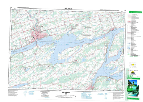
Includes UTM and GPS geographic coordinates (latitude and longitude). This 50k scale map is suitable for hiking, camping, and exploring, or you could frame it as a wall map.
Printed on-demand using high resolution, on heavy weight and acid free paper, or as an upgrade on a variety of synthetic materials.
Topos available on paper, Waterproof, Poly, or Tyvek. Usually shipping rolled, unless combined with other folded maps in one order.
- Product Number: NRCAN-031C03
- Parent Topo: TOPO-031C
- Map ID also known as: 031C03, 31C3, 31C03
- Unfolded Size: Approximately 26" high by 36" wide
- Weight (paper map): ca. 55 grams
- Map Type: POD NRCAN Topographic Map
- Map Scale: 1:50,000
- Geographical region: Ontario, Canada
Neighboring Maps:
All neighboring Canadian topo maps are available for sale online at 1:50,000 scale.
Purchase the smaller scale map covering this area: Topo-031C
Spatial coverage:
Topo map sheet 031C03 Belleville covers the following places:
- Bass Cove - Bay of Quinte - Belleville Harbour - Big Bay - Bygotts Bay - Carnachan Bay - Conger Cove - Hallowell Mills Cove - Hay Bay - Hungry Bay - Little Cove - Mallory Bay - Mallory Bay - Mohawk Bay - Muscote Bay - Perch Cove - Picton Bay - Picton Harbour - Robinson Cove - Sand Cove - Smith Bay - Bluff Point - Brick Kiln Point - Brick-kiln Point - Buckley Point - Casey Point - Chimney Point - Cole Point - Ferry Point - Grassy Point - Gravelly Point - Green Point - Hennessy Point - Horse Point - Le Nid Point - Massasauga Point - Miller Point - Ox Point - Pine Point - Potter Point - Pull Point - Quinte Point - Richson Point - Ruttan Point - Sand Point - Shermans Point - Thompson Point - Trident Point - Trumpour Point - Wallbridge Point - Witlow Point - Youngs Point - Nigger Narrows - Telegraph Narrows - The Narrows - Belleville - Prince Edward - Quinte West - Quinte West - Adolphustown - Ameliasburgh - Fredericksburgh - Hallowell - Hastings - Hillier - Lennox and Addington - Marysburgh - North Fredericksburgh - North Marysburgh - Prince Edward - Richmond - Sidney - Sophiasburgh - South Fredericksburgh - South Marysburgh - Thurlow - Tyendinaga - Réserve indienne Tyendinaga 38 - Réserve indienne Tyendinaga Mohawk Territory - Tyendinaga Indian Reserve 38 - Tyendinaga Mohawk Territory - Barnhart Island - Big Island - Cedar Island - Cow Island - Cressy Island - Fish House Island - Foresters Island - Fox Island - Francis Island - Glen Island - Goose Island - Grape Island - Grave Island - Grove Island - Huff Island - Huffs Island - Makatewis Island - Nigger Island - Ram Island - Salmon Island - Sawguin Island - Ship Islet - Snake Island - Solmes Island - Telegraph Island - Unger Island - Zwick Island - Ameliasburg Mill Pond - Consecon Lake - Fish Lake - Lac Ontario - Lake on the Mountain - Lake Ontario - Roblin Lake - Hastings - Lennox and Addington - Adolphustown - Ameliasburgh - Athol - Fredericksburgh - Hallowell - Hillier - Marysburgh - Murray - North Fredericksburgh - North Marysburgh - Richmond - Sidney - Sophiasburgh - South Fredericksburgh - South Marysburgh - Thurlow - Tyendinaga - Allisonville Conservation Area - Demorestville Conservation Area - H.J. McFarland Conservation Area - Hay Bay Conservation Area - Lake on the Mountain Provincial Park - Macaulay Mountain Conservation Area - Massasauga Point Conservation Area - Quinte Conservation Area - Tickell Wilderness Area - Blessington Creek - Bloomfield Creek - Cameron Creek - Consecon Creek - Demorestville Creek - Demorestville Creek - Duck Creek - Fisher Creek - Loyst Creek - Marsh Creek - Marysville Creek - Melville Creek - Moira River - Napanee River - Palliser Creek - Platts Creek - Potter Creek - Salmon River - Sawguin Creek - Selby Creek - Smiths Creek - Sucker Creek - Townline Creek - Waupoos Creek - Adolphus Reach - Long Reach - Anderson Shoal - Big Island Shoal - Carman Shoal - Catalaque Shoal - Conger Shoal - Hogsback - Minnie Blakely Shoal - Narrows Shoal - Nigger Narrows Shoal - North Port Shoal - Northport Shoal - Rush Bar - Deseronto - Greater Napanee - Adolphustown - Allisonville - Ameliasburg - Bardolph - Bayside - Belleville - Bethany - Bethel - Bethesda - Bowermans - Burr - Cannifton - Centre - Chatterton - Chisholm - Cole Wharf - Corbyville - Crofton - Demorestville - Dorland - Elm Brook - Elmbrook - Fawcettville - Fenwood Gardens - Foxboro - Gilbert Mills - Glenora - Gosport - Green Point - Greenpoint - Hay Bay - Hillcrest - Honeywell Corners - Huff Wharf - Huffs Corners - Huff's Corners - Lake on the Mountain - Marysville - Melville - Milltown - Mohawk - Mount Carmel - Mount Pleasant - Mountain View - North Port - Northport - Picton - Point Anne - Rednersville - Roblin Mills - Rossmore - Shannonville - Solmesville - The Pines - Thurlow - Victoria - Wallbridge - Watercombe - Waupoos - Woodville - Yerexville - The Big Swamp - The Little Swamp - Millpoint


