
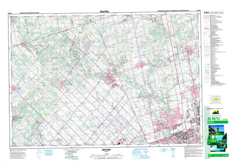
030M13 Bolton Canada topo map, 1:50,000 scale
030M13 Bolton NRCAN topographic map.
Includes UTM and GPS geographic coordinates (latitude and longitude). This 50k scale map is suitable for hiking, camping, and exploring, or you could frame it as a wall map.
Printed on-demand using high resolution, on heavy weight and acid free paper, or as an upgrade on a variety of synthetic materials.
Topos available on paper, Waterproof, Poly, or Tyvek. Usually shipping rolled, unless combined with other folded maps in one order.
- Product Number: NRCAN-030M13
- Parent Topo: TOPO-030M
- Map ID also known as: 030M13, 30M13
- Unfolded Size: Approximately 26" high by 36" wide
- Weight (paper map): ca. 55 grams
- Map Type: POD NRCAN Topographic Map
- Map Scale: 1:50,000
- Geographical region: Ontario, Canada
Neighboring Maps:
All neighboring Canadian topo maps are available for sale online at 1:50,000 scale.
Purchase the smaller scale map covering this area: Topo-030M
Spatial coverage:
Topo map sheet 030M13 Bolton covers the following places:
- Brampton - Toronto - Vaughan - Devils Pulpit - Niagara Escarpment - Adjala - Albion - Caledon - Chinguacousy - Dufferin - East York - Erin - Etobicoke - King - Mono - Nassagaweya - North York - Peel - Simcoe - Toronto Gore - Vaughan - Wellington - York - Recreation Island - Bell's Lake - Gibson Lake - Hackett Lake - Hall Lake - Innis Lake - Kelly Lake - Kennifick Lake - Lake Marie - Lake Seneca - Loch Erne - Mary Lake - Thompson Lake - Warnock Lake - Widgett Lake - Albion Hills - Caledon Hills - Caledon Mountain - Mono Hills - Mount Wolfe - Sligo Hill - Dufferin - Metropolitan Toronto - Peel - Simcoe - Wellington - York - Adjala - Adjala-Tosorontio - Chinguacousy - Erin - King - Tecumseth - West Garafraxa - Black Creek Conservation Area - Forks of the Credit Provincial Park - Bailey Creek - Black Creek - Black Creek - Caledon Creek - Centreville Creek - Cold Creek - Credit River - Credit River (Erin Branch) - Don River - Don River - Don River East Branch - Don River West Branch - East Humber River - Emery Creek - Etobicoke Creek - Holland River - Humber River - Keenansville Creek - Lindsay Creek - Little Credit River - Little Don River - Mimico Creek - Rivière Humber - Rowntree Creek - Salt Creek - Silver Creek - West Credit River - West Humber River - The Horse Shoe - Albion - Alliston, Beeton, Tecumseth and Tottenham - Aurora - Caledon - Erin - Milton - Mono - New Tecumseth - Albion - Ballycroy - Black Horse - Bolton - Bolton Station - Boston Mills - Caldwell - Caledon East - Caledon Village - Campbells Cross - Castlederg - Castlemore - Cedar Mills - Cedar Mills Station - Cedarville - Cheltenham - Claireville - Claude - Clearview Heights - Coleraine - Connor - Coventry - Credit Forks - Ebenezer - Edgeley - Elder Mills - Elder Station - Emery - Etobicoke - Eversley - Ferndale - Forks of the Credit - Glasgow - Hammertown - Happy Valley - Heritage Park - Hockley Valley - Holly Park - Hope - Humber - Humber Grove - Humber Summit - Inglewood - Kilmanagh - King - King City - King Creek - Kingcross Estates - Kinghorn - Kingscross Estates - Kleinburg - Kleinburg Station - Laskay - Linton - Lloydtown - Lockton - Lucille - Macville - Maple - Mayfield - Mono Mills - Mono Road - Mono Road Station - Mount Wolfe - Nashville - New Scotland - Nobleton - North York - Northwood Park - Palgrave - Palgrave Station - Pine Grove - Pottageville - Purpleville - Rockside - Sandhill - Schomberg - Sherwood - Silver Creek - Sleswick - Sligo - Snowball - Speersville - Stanley Mills - Star - Strange - Sunset Corners - Tamarac Estates - Teston - The Grange - Tormore - Tullamore - Vellore - Victoria - Wildfield - Woodbridge - The Dingle - Caledon


