
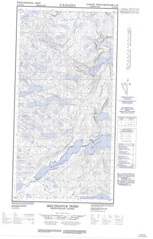
025A02E Ikkudliayuk Fiord Canada topo map, 1:50,000 scale
025A02E Ikkudliayuk Fiord NRCAN topographic map.
Includes UTM and GPS geographic coordinates (latitude and longitude). This 50k scale map is suitable for hiking, camping, and exploring, or you could frame it as a wall map.
Printed on-demand using high resolution, on heavy weight and acid free paper, or as an upgrade on a variety of synthetic materials.
Topos available on paper, Waterproof, Poly, or Tyvek. Usually shipping rolled, unless combined with other folded maps in one order.
- Halfsheet: This map was designed as a half sheet of NRCAN-025A02, and it is the Eastern half. Find the western half sheet here.
- Product Number: NRCAN-025A02E
- Parent Topo: TOPO-025A
- Map ID also known as: 025A02, 25A2, 25A02
- Unfolded Size: Approximately 26" high by 36" wide
- Weight (paper map): ca. 55 grams
- Map Type: POD NRCAN Topographic Map
- Map Scale: 1:50,000
- Geographical region: Newfoundland and Labrador, Canada
Neighboring Maps:
All neighboring Canadian topo maps are available for sale online at 1:50,000 scale.
Purchase the smaller scale map covering this area: Topo-025A
Spatial coverage:
Topo map sheet 025A02E Ikkudliayuk Fiord covers the following places:
- Baie Christopher - Baie Coates - Baie Polunin - Christopher Inlet - Coates Inlet - Ikkudliayuk Fiord - Nuvualup Tasiujanga Bay - Polunin Inlet - Shungmiyuk Inlet - Tunnissugjuak Inlet - Nuvualup Kangirsurulua Channel - Ikirasaaluk Island - Issikarvik Island - Pukuttuq Island - Uummanaq Island - Torngat Mountains - Torugak Mountains - Rivière Kauturiat


