
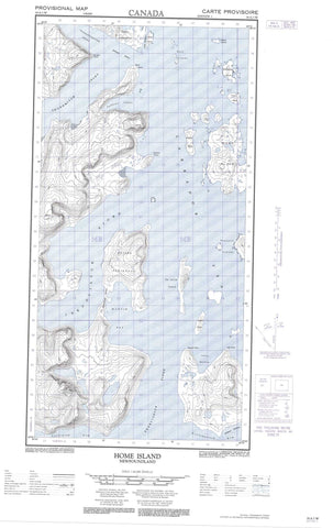
025A01W Home Island Canada topo map, 1:50,000 scale
025A01W Home Island NRCAN topographic map.
Includes UTM and GPS geographic coordinates (latitude and longitude). This 50k scale map is suitable for hiking, camping, and exploring, or you could frame it as a wall map.
Printed on-demand using high resolution, on heavy weight and acid free paper, or as an upgrade on a variety of synthetic materials.
Topos available on paper, Waterproof, Poly, or Tyvek. Usually shipping rolled, unless combined with other folded maps in one order.
- Halfsheet: This map was designed as a half sheet of NRCAN-025A01, and it is the Western half. Find the eastern half sheet here.
- Product Number: NRCAN-025A01W
- Parent Topo: TOPO-025A
- Map ID also known as: 025A01, 25A1, 25A01
- Unfolded Size: Approximately 26" high by 36" wide
- Weight (paper map): ca. 55 grams
- Map Type: POD NRCAN Topographic Map
- Map Scale: 1:50,000
- Geographical region: Newfoundland and Labrador, Canada
Neighboring Maps:
All neighboring Canadian topo maps are available for sale online at 1:50,000 scale.
Purchase the smaller scale map covering this area: Topo-025A
Spatial coverage:
Topo map sheet 025A01W Home Island covers the following places:
- Ekortiarsuk Fiord - Ikkudliayuk Fiord - Iselin Harbour - Joksut Inlet - Jolliet Inlet - Martin Bay - Shoal Bay - Shungmiyuk Inlet - Telliaosilk Fiord - Tunnissugjuak Inlet - Williams Harbour - Attinaukjuke - Beck Point - Black Rock Point - Bourgin Point - Cape Labrador - Gordon Point - Hutton Peninsula - Rowland Point - Tait Point - Amity Island - Avayalik Islands - Duck Islands - Gosling Island - Home Island - Kmoch Island - Kohlmeister Island - Landsat Island - Miguel Islands - Mikak Island - Nimbus Island - Oo-olilik Island - Pomiuk Island - Staffe Island - Ikordlearsuk Mountain - Mount Williams - Torngat Mountains - Torugak Mountains


