
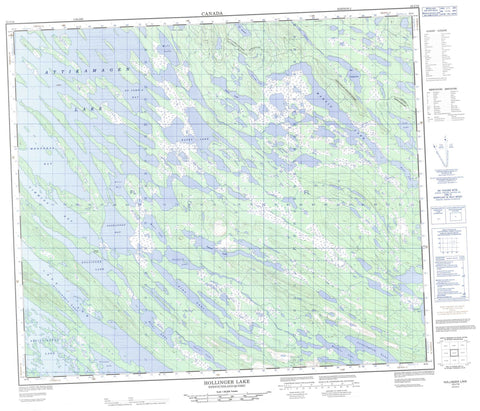
023J16 Hollinger Lake Canada topo map, 1:50,000 scale
023J16 Hollinger Lake NRCAN topographic map.
Includes UTM and GPS geographic coordinates (latitude and longitude). This 50k scale map is suitable for hiking, camping, and exploring, or you could frame it as a wall map.
Printed on-demand using high resolution, on heavy weight and acid free paper, or as an upgrade on a variety of synthetic materials.
Topos available on paper, Waterproof, Poly, or Tyvek. Usually shipping rolled, unless combined with other folded maps in one order.
- Product Number: NRCAN-023J16
- Parent Topo: TOPO-023J
- Map ID also known as: 023J16, 23J16
- Unfolded Size: Approximately 26" high by 36" wide
- Weight (paper map): ca. 55 grams
- Map Type: POD NRCAN Topographic Map
- Map Scale: 1:50,000
- Geographical region: Newfoundland and Labrador, Canada
Neighboring Maps:
All neighboring Canadian topo maps are available for sale online at 1:50,000 scale.
Purchase the smaller scale map covering this area: Topo-023J
Spatial coverage:
Topo map sheet 023J16 Hollinger Lake covers the following places:
- Iron Arm - Knox Bay - Saskatoon Bay - St. Johns Bay - Timmins Bay - Alma Lake - Attikamagen Lake - Cairn Lake - Chicago Lake - Cunningham Lake - Fox Lake - Gross Lake - Hollinger Lake - Katey Lake - Lac Jimmick - Lac Vallant - Lac Voixpreux - Laura Lake - Link Lake - Martin Lake - Mole Lake - Moore Lake - Mountain Lake - Mouse Lake - Muskrat Lake - Otter Lake - Peckford Lake - Petitsikapau Lake - Rusty Lake


