
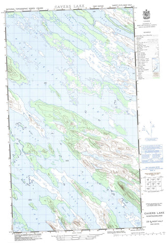
023J09W Cavers Lake Canada topo map, 1:50,000 scale
023J09W Cavers Lake NRCAN topographic map.
Includes UTM and GPS geographic coordinates (latitude and longitude). This 50k scale map is suitable for hiking, camping, and exploring, or you could frame it as a wall map.
Printed on-demand using high resolution, on heavy weight and acid free paper, or as an upgrade on a variety of synthetic materials.
Topos available on paper, Waterproof, Poly, or Tyvek. Usually shipping rolled, unless combined with other folded maps in one order.
- Halfsheet: This map was designed as a half sheet of NRCAN-023J09, and it is the Western half. Find the eastern half sheet here.
- Product Number: NRCAN-023J09W
- Parent Topo: TOPO-023J
- Map ID also known as: 023J09, 23J9, 23J09
- Unfolded Size: Approximately 26" high by 36" wide
- Weight (paper map): ca. 55 grams
- Map Type: POD NRCAN Topographic Map
- Map Scale: 1:50,000
- Geographical region: Newfoundland and Labrador, Canada
Neighboring Maps:
All neighboring Canadian topo maps are available for sale online at 1:50,000 scale.
Purchase the smaller scale map covering this area: Topo-023J
Spatial coverage:
Topo map sheet 023J09W Cavers Lake covers the following places:
- Iron Arm - McIntyre Bay - Astray Lake - Cairn Lake - Cavers Lake - Charlie Lake - Crowley Lake - Cunningham Lake - Dodette Lake - Dyke Lake - Eagle Lake - Fawley Lake - Freeman Lake - How Lake - Icomb Lake - Muskrat Lake - Petitsikapau Lake - Swamp Lakes - Ashuanipi River - Goose River


