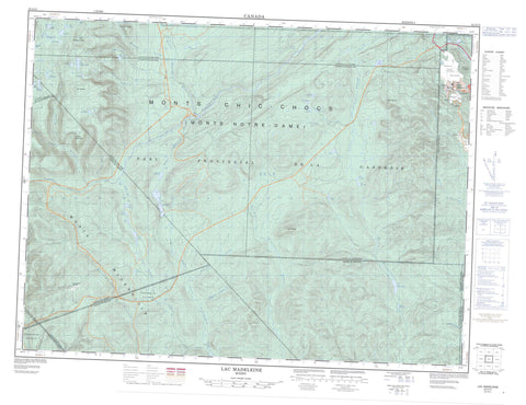
022A13 Lac Madeleine Canada topo map, 1:50,000 scale
022A13 Lac Madeleine NRCAN topographic map.
Includes UTM and GPS geographic coordinates (latitude and longitude). This 50k scale map is suitable for hiking, camping, and exploring, or you could frame it as a wall map.
Printed on-demand using high resolution, on heavy weight and acid free paper, or as an upgrade on a variety of synthetic materials.
Topos available on paper, Waterproof, Poly, or Tyvek. Usually shipping rolled, unless combined with other folded maps in one order.
- Product Number: NRCAN-022A13
- Parent Topo: TOPO-022A
- Map ID also known as: 022A13, 22A13
- Unfolded Size: Approximately 26" high by 36" wide
- Weight (paper map): ca. 55 grams
- Map Type: POD NRCAN Topographic Map
- Map Scale: 1:50,000
- Geographical region: Quebec, Canada
Neighboring Maps:
All neighboring Canadian topo maps are available for sale online at 1:50,000 scale.
Purchase the smaller scale map covering this area: Topo-022A
Spatial coverage:
Topo map sheet 022A13 Lac Madeleine covers the following places:
- Murdochville - Baldwin - Boisbuisson - Bonnécamp - Bonnécamps - Des Landes - Deslandes - Deville - Division d'enregistrement de Sainte-Anne-des-Monts - Gastonguay - Holland - La Potardière - La Rivière - Lefrançois - Lemieux - Lesseps - Walbank - Grand lac Madeleine - Lac à René - Lac Adam - Lac aux Gammares - Lac Barter - Lac Béland - Lac Bonaventure - Lac Bouliane - Lac Burntwood - Lac Cassivi - Lac Charles-Côté - Lac Chichenko - Lac Clavette - Lac Côté - Lac de la Botte - Lac de la Table - Lac de la Tête - Lac Desnouff - Lac Dolbeau - Lac du Crochet - Lac du Vieillard - Lac Element - Lac Fortin - Lac Gagnon - Lac Gasse - Lac Goulet - Lac Long - Lac Madeleine - Lac Martin - Lac Mathurin - Lac Paré - Lac Perré - Lac Porphyre - Lac Riffou - Lac Robitaille - Lac Samuel-Côté - Lac Servant - Lac Sohier - Lac Tanguay - Lac Turgio - Lac Vert - Lacs du Smelter - Petit lac Bonaventure - Petit lac Madeleine - L'Aiguille - Les Cônes - Mont Béland - Mont Brown - Mont Comte - Mont Copper - Mont Dos de Baleine - Mont du Porphyre - Mont Fernald - Mont Jacques-Cartier - Mont McWhirter - Mont Needle - Monts McGerrigle - Monts Tabletop - Pic des Os Perdus - Pic du Vieillard - Collines-du-Basque - Parc de conservation de la Gaspésie - Parc national de la Gaspésie - Réserve faunique des Chic-Chocs - Mine Gaspé - Branche Sud de la Rivière York - Petite rivière Cascapédia Est - Petite rivière Cascapédia Ouest - Rivière Bonaventure - Rivière Bonaventure Ouest - Rivière des Béland - Rivière Madeleine Nord - Rivière Madeleine Sud - Rivière North Branch - Rivière Saint-Jean - Rivière Saint-Jean Branche Sud - Rivière Saint-Jean Ouest - Ruisseau à Alcide - Ruisseau Auclair - Ruisseau aux Grenats - Ruisseau aux Pékans - Ruisseau Barter - Ruisseau Baxter - Ruisseau Burntwood - Ruisseau Copper - Ruisseau Copper - Ruisseau des Orignaux - Ruisseau du Lac Long - Ruisseau du Vieillard - Ruisseau Hardy - Ruisseau Lesseps - Ruisseau McWhirter - Ruisseau Miller - Ruisseau NoName - Ruisseau Pierre-Jean - Ruisseau Porphyre - Vallée des Asters - Vallée des Athyriums - Vallée des Calamagrostides - Vallée du Cor


