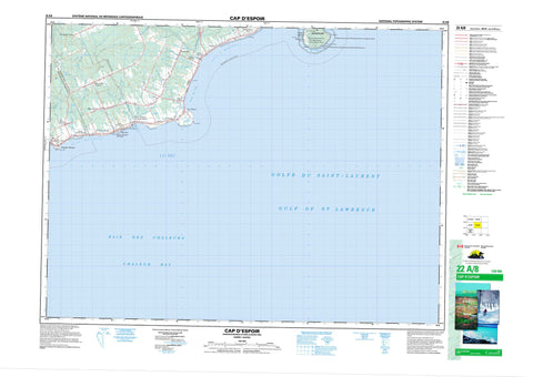
022A08 Cap D Espoir Canada topo map, 1:50,000 scale
022A08 Cap D Espoir NRCAN topographic map.
Includes UTM and GPS geographic coordinates (latitude and longitude). This 50k scale map is suitable for hiking, camping, and exploring, or you could frame it as a wall map.
Printed on-demand using high resolution, on heavy weight and acid free paper, or as an upgrade on a variety of synthetic materials.
Topos available on paper, Waterproof, Poly, or Tyvek. Usually shipping rolled, unless combined with other folded maps in one order.
- Product Number: NRCAN-022A08
- Parent Topo: TOPO-022A
- Map ID also known as: 022A08, 22A8, 22A08
- Unfolded Size: Approximately 26" high by 36" wide
- Weight (paper map): ca. 55 grams
- Map Type: POD NRCAN Topographic Map
- Map Scale: 1:50,000
- Geographical region: Quebec, Canada
Neighboring Maps:
All neighboring Canadian topo maps are available for sale online at 1:50,000 scale.
Purchase the smaller scale map covering this area: Topo-022A
Spatial coverage:
Topo map sheet 022A08 Cap D Espoir covers the following places:
- Anse à Beaufils - Anse à Brochet - Anse du Cap - Anse du Loup - Baie des Chaleurs - Baie des Marigots - Bull's Cove - Chaleur Bay - Gulf of St. Lawrence - Havre de Sainte-Thérèse - La Pinnerie - Lazy Beach - La Lazy Beach - Plage à Brochet - Plage du Bria - Plage Duval - Plage Paget - Cap d'Espoir - Cap Malin - Cap Rouge - Long Point of Gannet Ledge - Long Point of Kittiwake Cove - Pointe à Margaulx - Pointe Bull's Cove - Pointe du Square Rock - Pointe Lazy Beach - Pointe Lazy Beach - Pointe Paget - Pointe Peter-John-Duval - Pointe Robin - Pointe Verte - Pointe Wall - The Ewe - The Ram - Grande-Rivière - Percé - Corniche aux Goélands - Gannet Ledge - Gull Ledge - Rangs de Margaulx - Chute du Trois - Percé - Sainte-Thérèse - Saint-Joseph-de-Cap-d'Espoir - Île Bonaventure - The Root - Lac à Béliveau - Lac à Foin - Lac à Jack - Lac à la Truite - Lac à Lapierre - Lac à Savage - Cimetière des Saints-Anges - Bonaventure Island and Percé Rock Bird Sanctuary - Parc de conservation de l'Île-Bonaventure-et-du-Rocher-Percé - Refuge d'oiseaux de l'Île Bonaventure et du Rocher Percé - La Petite Rivière - Rivière à Gagnon - Rivière Brèche à Minot - Rivière de la Brèche à Manon - Rivière de la Chute - Rivière de l'Anse à Beaufils - Ruisseau à Albert-Ferguson - Ruisseau à Balleine - Ruisseau à Bateau - Ruisseau à Cass - Ruisseau à Émile-Couture - Ruisseau à Ferdinand - Ruisseau à Georges-Blais - Ruisseau à Moïse - Ruisseau à O'Henry - Ruisseau à Pete-Ferguson - Ruisseau de John-à-Betsy - Ruisseau de la Chute du Trois - Ruisseau de la Côte du Chômage - Ruisseau des Frères - Ruisseau des Vallée - Ruisseau du Bria - Ruisseau Duguay - Ruisseau Frank-Brochet - Ruisseau Legruiec - Ruisseau Mauger - Ruisseau Montagnais - Ruisseau Moreau - Ruisseau Paget - Ruisseau Philippe-Brochet - Ruisseau Plat - Ruisseau Windsor - Ruisseaude la Côte de la Fourche - Chemin du Roy - Côte des Pères - Sentier des Colonies - Sentier Paget - Haut-fond Leander - La Casquette - Le Récif - The Reef - Le Bria - Brèche-à-Manon - Cap-d'Espoir - Cap-d'Espoir - Cape Cove - Duguesclin - Grande-Rivière - Knoxbridge - La Montée - La Petite-France - L'Anse-à-Beaufils - Le Cimetière - Le Plain - Le Trou-du-Chat - Ligny-Saint-Flochel - Ory - Percé - Petite-France - Petite-Rivière-Est - Rail - Sainte-Thérèse-de-Gaspé - Sainte-Thérèse-de-Gaspé-Station - Saint-Isidore-de-Gaspé - Val-d'Espoir-Ouest - Weygand - White-Head-Percé - La Craque - Murre Hole - The Black Hole - The Blow Hole - Trou des Guillemots - Lacs à Erwin-Trachy - Barachois - Bridgeville - Cap-d'Espoir - Grand River - Grande-Rivière-Ouest - Petit-Pabos - Sainte-Thérèse-de-Gaspé - Saint-Pierre-de-la-Malbaie No 2


