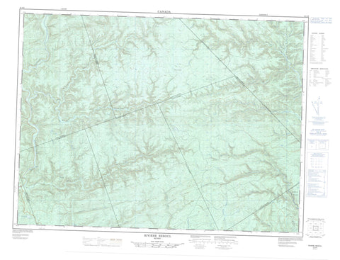
022A06 Riviere Reboul Canada topo map, 1:50,000 scale
022A06 Riviere Reboul NRCAN topographic map.
Includes UTM and GPS geographic coordinates (latitude and longitude). This 50k scale map is suitable for hiking, camping, and exploring, or you could frame it as a wall map.
Printed on-demand using high resolution, on heavy weight and acid free paper, or as an upgrade on a variety of synthetic materials.
Topos available on paper, Waterproof, Poly, or Tyvek. Usually shipping rolled, unless combined with other folded maps in one order.
- Product Number: NRCAN-022A06
- Parent Topo: TOPO-022A
- Map ID also known as: 022A06, 22A6, 22A06
- Unfolded Size: Approximately 26" high by 36" wide
- Weight (paper map): ca. 55 grams
- Map Type: POD NRCAN Topographic Map
- Map Scale: 1:50,000
- Geographical region: Quebec, Canada
Neighboring Maps:
All neighboring Canadian topo maps are available for sale online at 1:50,000 scale.
Purchase the smaller scale map covering this area: Topo-022A
Spatial coverage:
Topo map sheet 022A06 Riviere Reboul covers the following places:
- Les Trois Chenaux - Garin - Guéguen - Honorat - Newport - Port-Daniel - Randin - Raudin - Reboul - Robidoux - Weir - La Chaîne de Lacs - Lac à Huard - Lac Albert-Maltais - Lac Arsenault - Lac au Cèdre - Lac au Chagrin - Lac Blanc - Lac Bouteille - Lac du Bol - Lac Honorat - Lac Long - Lac Robidoux - Lac Rond - Lac Sec - Lac Sec - Lacs à Cyprien - Lacs Banane - Lacs Duval - La Petite Montagne - Montagne à Charles - Montagne du F - Rivière-Bonaventure - Réserve faunique de Port-Daniel - Zec de la Rivière-Bonaventure - Rapide Noir - Coulée à Glazer - Coulée du Camp à Huard - Le Gros Ruisseau - Petite rivière Port-Daniel - Rivière Bonaventure - Rivière de l'Ouest - Rivière du Grand Pabos - Rivière du Grand Pabos Ouest - Rivière du Grand Pabos Sud - Rivière Duval - Rivière Garin - Rivière Hall - Rivière Hall Ouest - Rivière Pabos Ouest - Rivière Port-Daniel - Rivière Port-Daniel du Milieu - Rivière Reboul - Rivière Reboul Nord - Ruisseau Alain - Ruisseau Beaudin - Ruisseau Béliveau - Ruisseau Bleu - Ruisseau Cantin - Ruisseau Caribou - Ruisseau Castor - Ruisseau Cotton - Ruisseau de la Grande Fourche - Ruisseau de la Scie - Ruisseau du Grand Ravin - Ruisseau du Milieu - Ruisseau du Ravin Vert - Ruisseau Duguay - Ruisseau Duval Est - Ruisseau Edgar - Ruisseau Flynn - Ruisseau Grant - Ruisseau Grants - Ruisseau Grenon - Ruisseau Grenon - Ruisseau Grum - Ruisseau Lévesque - Ruisseau Madeleine - Ruisseau McCallum - Ruisseau McCrea - Ruisseau McNeil - Ruisseau Mictaw - Ruisseau Nadeau - Ruisseau Neckwick - Ruisseau Noir - Ruisseau Orignal - Ruisseau Padoue - Ruisseau Ritchie - Ruisseau Robertson - Ruisseau Robertson - Ruisseau Saint-Pierre - Ruisseau Sutton - Ruisseau Tremblay - Ruisseau Twyman - Fosse Bogan Bridge - Fosse de la Deuxième Branche Est - Fosse de la Première Branche Est - Fosse des Trois Chenaux - Fosse du Trou à Dumas - Fosse Foster - Fosse Harbour Crossing - Fosse Little Keep Over - Fosse Mitchell - Fosse Ralph - Fosse Sandy Bar - Fosse Sinclair - Fosse Someone Hole - Le Grand Black - Le Petit Black - La Dame-à-Blanchet - La Pond - Le Bûché-à-Louis-Rehel - Coulée Lejeune - Coulée Ludger - La Porte de l'Enfer - La Nationale


