
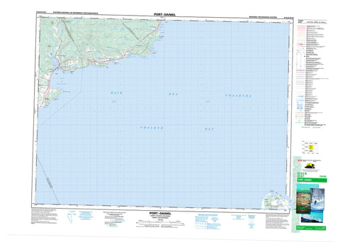
022A02 Port Daniel Canada topo map, 1:50,000 scale
022A02 Port Daniel NRCAN topographic map.
Includes UTM and GPS geographic coordinates (latitude and longitude). This 50k scale map is suitable for hiking, camping, and exploring, or you could frame it as a wall map.
Printed on-demand using high resolution, on heavy weight and acid free paper, or as an upgrade on a variety of synthetic materials.
Topos available on paper, Waterproof, Poly, or Tyvek. Usually shipping rolled, unless combined with other folded maps in one order.
- Product Number: NRCAN-022A02
- Parent Topo: TOPO-022A
- Map ID also known as: 022A02, 22A2, 22A02
- Unfolded Size: Approximately 26" high by 36" wide
- Weight (paper map): ca. 55 grams
- Map Type: POD NRCAN Topographic Map
- Map Scale: 1:50,000
- Geographical region: New Brunswick, Canada
Neighboring Maps:
All neighboring Canadian topo maps are available for sale online at 1:50,000 scale.
Purchase the smaller scale map covering this area: Topo-022A
Spatial coverage:
Topo map sheet 022A02 Port Daniel covers the following places:
- Anse à Acteson - Anse à Dominique - Anse à Fullum - Anse à la Barbe - Anse à la Croix - Anse à la Loutre - Anse à Pierre-Loiselle - Anse aux Crapauds - Anse aux Gascons - Anse aux Îlots - Anse Beebe - Anse des Morts - Anse du Quai - Anse du Ruisseau à Perré - Anse Elliot - Anse Harrington - Anse McInnes - Anse McInnis - Baie de Chaleur - Baie de Port-Daniel - Baie des Chaleurs - Baie des Chaleurs - Chaleur Bay - Chaleur Bay - La Petite Anse - Trou Noir - Miscou Beach - Plage de la Vieille - Plage Dow - Plain à Martial - Birch Point - Cap à Fahey - Cap de l'Enfer - La Vieille - Miscou Point - North Point - Northwest Miscou Point - Pointe à Fullum - Pointe à la Croix - Pointe à Martial - Pointe au Bouleau - Pointe au Maquereau - Pointe de l'Indien - Pointe de l'Ouest - Pointe du Sud-Ouest - Pointe Noire - Pointe Pillar - Pointe Reddish - Pointe Rouge - White Point - Cap Blanc - Cap Gris - Cap Rouge - Gloucester - Newport - Notre-Dame-du-Mont-Carmel - Port-Daniel - Sainte-Germaine-Cousin - Seigneurie de Port-Daniel - Île Miscou - Îles Mahy - La Maraîche - Les Îlots - Miscou Island - Rocher Curly - Black Brook Ponds - Grand lac au Castor - La Marche - Lac à Berger - Lac à James - Lac à la Pelle - Lac à Leslie - Lac Alain - Lac au Caribou - Lac Bob - Lac Chiasson - Lac de l'Anse aux Crapauds - Lac de l'Anse McInnes - Lac de l'Anse McInnis - Lac Duguay - Lac Frye - Lac Martel - Lac Plat - Lac Vignet - Lake of the Island - Le Barachois - Munroe Lake - Petit lac au Castor - Petit lac Chiasson - Queue of Mal Bay - Cap d'Ardoise - Colline Daniel - Colline de Port-Daniel - Le Gros Morne - Morne de l'Est - Bonaventure - Réserve faunique de Port-Daniel - Grande Plaine - New Brunswick - Nouveau-Brunswick - Cours d'eau Chouinard - Cours d'eau Deraiche - Cours d'eau Jones - Cours d'eau Lucien-Roussy - Cours d'eau Roussy - Décharge du Lac du Deuxième - Fleuve Saint-Laurent - Fond Baptiste-Cyr - Fond Fullum - Petite rivière Port-Daniel - Rivière de l'Anse à la Barbe - Rivière de l'Ouest - Rivière Port-Daniel - Rivière Port-Daniel du Milieu - Ruisseau à Guité - Ruisseau à Mon Rougeau - Ruisseau à Perré - Ruisseau Castilloux - Ruisseau Chapados - Ruisseau de la Vache Marine - Ruisseau de l'Anse à Perré - Ruisseau du Lac à la Pelle - Ruisseau du Milieu - Ruisseau du Moulin - Ruisseau du Pont Chouinard - Ruisseau du Pont de Fer - Ruisseau Grum - Ruisseau Hachey - Ruisseau Hurry - Ruisseau Maddigan - Pont Chouinard - La Barre - Cherisy - Gascons - Gascons - Gascons-Est - Gascons-Ouest - L'Anse-aux-Gascons - L'Anse-McInnes - L'Anse-McInnis - Miscou Lighthouse - Newport-Ouest - Port-Daniel - Port-Daniel - Port-Daniel-Centre - Port-Daniel-Est - Port-Daniel-Station - Rivière-Port-Daniel - Les Prés - Port-Daniel - Port-Daniel--Gascons - Sainte-Germaine-de-l'Anse-aux-Gascons


