
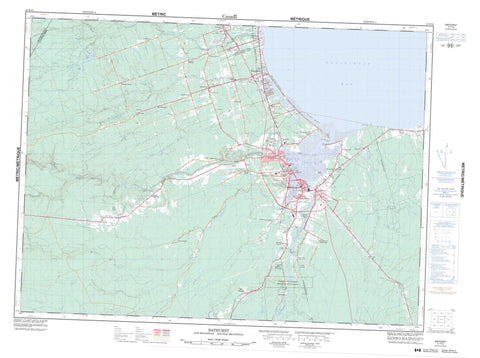
021P12 Bathurst Canada topo map, 1:50,000 scale
021P12 Bathurst NRCAN topographic map.
Includes UTM and GPS geographic coordinates (latitude and longitude). This 50k scale map is suitable for hiking, camping, and exploring, or you could frame it as a wall map.
Printed on-demand using high resolution, on heavy weight and acid free paper, or as an upgrade on a variety of synthetic materials.
Topos available on paper, Waterproof, Poly, or Tyvek. Usually shipping rolled, unless combined with other folded maps in one order.
- Product Number: NRCAN-021P12
- Parent Topo: TOPO-021P
- Map ID also known as: 021P12, 21P12
- Unfolded Size: Approximately 26" high by 36" wide
- Weight (paper map): ca. 55 grams
- Map Type: POD NRCAN Topographic Map
- Map Scale: 1:50,000
- Geographical region: New Brunswick, Canada
Neighboring Maps:
All neighboring Canadian topo maps are available for sale online at 1:50,000 scale.
Purchase the smaller scale map covering this area: Topo-021P
Spatial coverage:
Topo map sheet 021P12 Bathurst covers the following places:
- Baie de Chaleur - Baie des Chaleurs - Bathurst Basin - Bathurst Harbour - Chaleur Bay - Nepisiguit Bay - Nipisiguit Bay - Ronalds Cove - Beresford Beach - Youghall Beach - Alston Point - Belloni Point - Carron Point - Daly Point - Ferguson Point - Youghall Point - Ballast Channel - Big Narrows - Church Channel - Doherty Channel - Little Narrows - Middle River Channel - Outer Channel - Tetagouche River Channel - West Bathurst Channel - Whites Channel - Bathurst - Boucher Falls - Pabineau Falls - Tetagouche Falls - Allardville - Bathurst - Beresford - Durham - Gloucester - Restigouche - Pabineau 11 - Indian Island - Pabineau Island - Kents Pond - Meadow Lake - Nigadoo Lake - Otter Lake - Pabineau Lake - Champ de tir et champ de manoeuvre Gloucester Junction - Gloucester Junction Range and Training Area - Blue Mountain - College Hill - Tetagouche Hill - Tetagouche Falls Provincial Park - Youghall Beach Provincial Park - Armstrong Brook - Bass Brook - Bass River - Bateman Brook - Big Brook - Boucher Brook - Boucher Creek - Carney Brook - Carney Creek - Carters Brook - Cherry Brook - Comeau Brook - Cormier Brook - Cove Brook - Curries Brook - Curtis Brook - Daulnay Brook - Dawson Brook - Dempsey Brook - Dempsey Creek - Duguay Brook - Eddy Brook - Egans Brook - Ellis Brook - Falls Brook - Fleming Brook - Flemming Brook - Flemming Brook - Grants Brook - Haché Brook - Johnson Brook - Lavigne Brook - Little Bass River - Little River - Little River - Meadow Brook - Melanson Brook - Melanson Brook - Middle River - Miller Brook - Millstream River - Nepisiguit River - Nigadoo River - Nigadoo River - Nigadu River - Nigadu River - Nipisiguit River - North Branch Grants Brook - North Branch Nigadoo River - North Nigadoo River - Otter Brook - Pabineau River - Packard Brook - Patrick Brook - Paynes Brook - Peters River - Proctors Brook - Proctors Creek - Ramsey Brook - Red Pine Brook - Rocky Brook - Rocky Brook - Rocky Brook - Roughwater Brook - Round Rock Brook - Ruisseau à Laurent - Six Mile Brook - Sixmile Brook - South Branch Grants Brook - South Branch Little River - South Branch Nigadoo River - South Little River - South Middle River - South Nigadoo River - Stephens Brook - Sugary Brook - Tetagouche River - Upper South Little River - West Tetagouche River - The Forks - Round Rocks - Beresford - Bass River - Bathurst Station - Big River - Blue Mountain Settlement - Caron Point - Carron Point - Chaleur Beach - Chamberlain Settlement - Cross Roads - Dunlop - East Bathurst - Free Grant - Gloucester Junction - Goodwin Mill - Imhoff - Kanes - Legresley - Lincour - Lugar - Massabielle - Middle River - Nepisiguit Junction - Nicholas Denys - Nigadu - North Tetagouche - Peters River - Rio Grande - Robertville - Rose Hill - Rosehill - Rough Waters - Roy Settlement - Sainte-Anne - Sainte-Louise - Sainte-Rosette - Saint-Laurent - Salmon Beach - Sand Hill - Sormany - South Bathurst - South Tetagouche - St. George - St. Mary - Ste. Anne - Ste. Louise - Ste. Rosette - Ste-Anne - Ste-Louise - Ste-Rosette - St-Laurent - Tetagouche North - Tetagouche North Side - Tetagouche South - Tetagouche South Side - Tremblay - Tremblay Settlement - Upper Rosehill - Vallée Lourdes - Vallée-Lourdes - Val-Michaud - West Bathurst - Youghall - Nigadoo


