
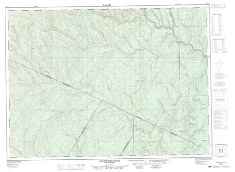
021O12 Gounamitz River Canada topo map, 1:50,000 scale
021O12 Gounamitz River NRCAN topographic map.
Includes UTM and GPS geographic coordinates (latitude and longitude). This 50k scale map is suitable for hiking, camping, and exploring, or you could frame it as a wall map.
Printed on-demand using high resolution, on heavy weight and acid free paper, or as an upgrade on a variety of synthetic materials.
Topos available on paper, Waterproof, Poly, or Tyvek. Usually shipping rolled, unless combined with other folded maps in one order.
- Product Number: NRCAN-021O12
- Parent Topo: TOPO-021O
- Map ID also known as: 021O12, 21O12
- Unfolded Size: Approximately 26" high by 36" wide
- Weight (paper map): ca. 55 grams
- Map Type: POD NRCAN Topographic Map
- Map Scale: 1:50,000
- Geographical region: New Brunswick, Canada
Neighboring Maps:
All neighboring Canadian topo maps are available for sale online at 1:50,000 scale.
Purchase the smaller scale map covering this area: Topo-021O
Spatial coverage:
Topo map sheet 021O12 Gounamitz River covers the following places:
- Graham Beach - Drummond - Restigouche - Saint-Quentin - County Line Island - Half Mile Island - Eightmile Lake - Gounamitz Lake - Mount Connacher - Alex Brook - Balm of Gilead Brook - Bells Brook - Benny Brook - Big Brook - Boston Brook - Bowman Brook - Burnt Hill Brook - Caribou Brook - Cherry Brook - Clark Brook - Clearwater Brook - Clearwater Brook - Cyr Brook - Dave Richards Brook - Dead Brook - Dunbar Brook - East Jardine Brook - Eightmile Brook - Fall Brook - Falls Brook - Falls Brook - Falls Brook - Five Finger Brook - Five Fingers Brook - Five Mile Brook - Fivemile Brook - Four Mile Brook - Fourmile Brook - Gounamitz River - Indian Brook - Jardine Brook - Kedgwick River - Left Hand Branch Falls Brook - Left Hand Fall Brook - Letourneau Brook - Little Main Restigouche River - Lower Eight Mile Brook - Lower Four Mile Brook - Lower Fourmile Brook - MacFarlane Brook - McIntosh Brook - McLaughlin Brook - Narrows Brook - Ninemile Brook - North Branch Clearwater Brook - North Branch Gounamitz River - North Falls Brook - North Fork Falls Brook - North Gounamitz River - One Mile Brook - One Mile Brook - Onemile Brook - Otter Brook - Range Brook - Restigouche River - Richard Brook - Richards Brook - Right Hand Branch Falls Brook - Right Hand Fall Brook - Rocky Brook - Ruisseau Rang-Cinq-et-Six - Seven Mile Brook - Sevenmile Brook - South Branch Clearwater Brook - South Clearwater Brook - South Fork Falls Brook - Taylor Brook - Two Mile Brook - Twomile Brook - Upper Eight Mile Brook - Upper Eightmile Brook - Upper Four Mile Brook - Upper Fourmile Brook - West Branch Gounamitz River - West Gounamitz River - West Gunamitz River - Whitewater Brook - Wilson Brook - Yellow Brook - Eight Mile Bogan - Fanton Bogan - Rang-Cinq-Et-Six - Bernier Gulch - Calder Gulch - Caron Gulch - Dry Gulch - Dunn Gulch - Fanton Gulch - Four Mile Gulch - Presto Gulch - Six Mile Gulch - Skin Gulch - Tank Gulch - Therriault Gulch - Wilkins Gulch


