
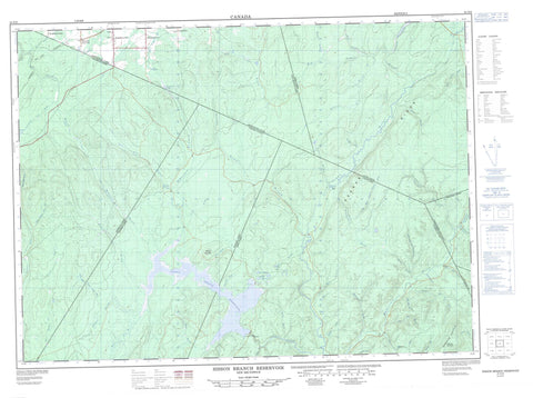
021O06 Sisson Branch Reservoir Canada topo map, 1:50,000 scale
021O06 Sisson Branch Reservoir NRCAN topographic map.
Includes UTM and GPS geographic coordinates (latitude and longitude). This 50k scale map is suitable for hiking, camping, and exploring, or you could frame it as a wall map.
Printed on-demand using high resolution, on heavy weight and acid free paper, or as an upgrade on a variety of synthetic materials.
Topos available on paper, Waterproof, Poly, or Tyvek. Usually shipping rolled, unless combined with other folded maps in one order.
- Product Number: NRCAN-021O06
- Parent Topo: TOPO-021O
- Map ID also known as: 021O06, 21O6, 21O06
- Unfolded Size: Approximately 26" high by 36" wide
- Weight (paper map): ca. 55 grams
- Map Type: POD NRCAN Topographic Map
- Map Scale: 1:50,000
- Geographical region: New Brunswick, Canada
Neighboring Maps:
All neighboring Canadian topo maps are available for sale online at 1:50,000 scale.
Purchase the smaller scale map covering this area: Topo-021O
Spatial coverage:
Topo map sheet 021O06 Sisson Branch Reservoir covers the following places:
- Denmark - Drummond - Northumberland - Restigouche - County Line Lake - Hammond Lake - Lac Tardif - Round Bogan Ponds - Sisson Branch Reservoir - Sisson Lake - Tardif Lake - Gesner Ridge - Moose Mountain - Reardon Mountain - Serpentine Mountain - Serpentine Mountains - Barkerhouse Brook - Bear Brook - Beaver Brook - Beaver Brook - Bernier Brook - Big Brook - Big Cedar Brook - Broad Brook - Bungalow Brook - Carr Brook - Dead Brook - Deadwater Brook - East Branch Pat Brook - East Jardine Brook - Eight Mile Brook - Eightmile Brook - Eleven Mile Brook - Elevenmile Brook - Everett Brook - Five Finger Brook - Five Fingers Brook - Five Mile Brook - Fivemile Brook - Four Mile Brook - Four Mile Brook - Fourmile Brook - Hammond Brook - Hammond Lake Brook - Hashey Brook - Jardine Brook - Jenkins Brook - Jenkins Brook - Left Hand Branch Mamozekel River - Left Hand Branch Wolverton Brook - Left Hand Wolverton Brook - Little Cedar Brook - Little Lawson Brook - Little Tobique River - Little Tobique River (Nictor Branch) - Mamozekel River - Mamozekel River - McDougall Brook - McGee Brook - Middle Brook - Nason Brook - Nine Mile Brook - Ninemile Brook - North Branch Salmon River - North Salmon River - North Sisson Branch - Nowlan Brook - O'Dare Brook - Pat Brook - Pat Brook - Price Brook - Reardon Brook - Red Brook - Right Hand Branch Mamozekel River - Right Hand Branch Trafton Brook - Right Hand Branch Waters Brook - Right Hand Jardine Brook - Right Hand Trafton Brook - Right Hand Waters Brook - Round Bogan Brook - Salmon River - Seven Mile Brook - Sevenmile Brook - Shanks Brook - Sisson Branch - Sisson River - South Branch Mamozekel River - South Mamozekel River - Three Mile Brook - Threemile Brook - Tobique River - Tom Pole Brook - Trafton Brook - Waters Brook - Whitefish Brook - Wilson Brook - Wolverton Brook - Côté - Drucour - Hazen - Nickel Mill - Rang-Dix - Rang-Douze - Rang-Douze-Sud - Rang-Quatorze - Rang-Seize - Rang-Sept-et-Huit - Sancta Anna - Blind Gulch - Grindstone Gulch


