
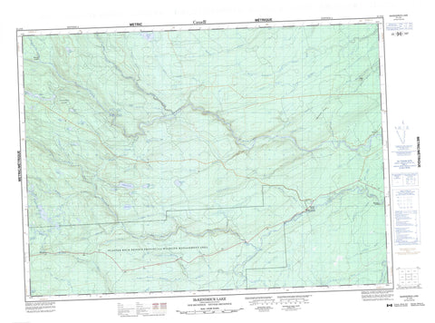
021J16 Mckendrick Lake Canada topo map, 1:50,000 scale
021J16 Mckendrick Lake NRCAN topographic map.
Includes UTM and GPS geographic coordinates (latitude and longitude). This 50k scale map is suitable for hiking, camping, and exploring, or you could frame it as a wall map.
Printed on-demand using high resolution, on heavy weight and acid free paper, or as an upgrade on a variety of synthetic materials.
Topos available on paper, Waterproof, Poly, or Tyvek. Usually shipping rolled, unless combined with other folded maps in one order.
- Product Number: NRCAN-021J16
- Parent Topo: TOPO-021J
- Map ID also known as: 021J16, 21J16
- Unfolded Size: Approximately 26" high by 36" wide
- Weight (paper map): ca. 55 grams
- Map Type: POD NRCAN Topographic Map
- Map Scale: 1:50,000
- Geographical region: New Brunswick, Canada
Neighboring Maps:
All neighboring Canadian topo maps are available for sale online at 1:50,000 scale.
Purchase the smaller scale map covering this area: Topo-021J
Spatial coverage:
Topo map sheet 021J16 Mckendrick Lake covers the following places:
- Blackville - Blissfield - Northumberland - Southesk - Blind Lake - Burnt Lake - Catamaran Lake - Fowler Lake - Kennedy Lake - Kennedy Lakes - Little McKendrick Lake - Little Trousers Lake - Lower Kennedy Lake - Main Kennedy Lake - Mains Lake - Malcolm Lake - McKendrick Lake - Moran Lake - Moran Ponds - Morrison Brook Lake - North Lake - Rock Ponds - Rocky Brook Lake - Second Fowler Lake - South Lake - Spikehorn Lake - Stinking Lake - Upper Libbies Pond - Whitney Pond - Hardwood Ridge - Maple Hill - Tomahawk Ridge - Gillices Rapids - Bamford Brook - Catamaran Brook - Crown Point Brook - Devils Back Brook - Devils Brook - Dungarvon River - Father Murdoch Brook - Guagus Stream - Jack O'Brien Brook - Lake Brook - Lake Brook - Libbies Brook - Libbies Brook - Little Ottawa Branch - Little Sevogle River - Little Sevogle River - Little South Branch Renous River - Little South Renous River - Little Southwest Miramichi River - Lower Libbies Brook - Lower North Branch Little Southwest Miramichi River - Mains Brook - Malcolm Brook - McGraw Brook - McKendrick Brook - McNeal Brook - Meadow Brook - Meadow Brook - Monaghan Brook - Monaghan Brook - Moran Brook - Morrison Brook - Mullin Stream - Nicholson Brook - North Branch Little Sevogle River - North Branch McNeal Brook - North Branch Monaghan Brook - North Branch Renous River - North Pole Brook - North Pole Stream - North Renous River - Orchard Brook - Otter Brook - Parks Brook - Porcupine Brook - Quigley Brook - Redstone Brook - Renous River - Rocky Brook - Shields Brook - Shore Camp Brook - South Branch Little Sevogle River - South Branch McNeal Brook - South Branch Monaghan Brook - South Branch Renous River - South Monaghan Brook - South Renous River - Sutherland Brook - Underwood Brook - Upper Libbies Brook - Upper McGraw Brook - Whetstone Brook - Whitestone Brook - Renous Forks - Dennis - McGraw Brook - Munsons Landing - Ramsay Lodge - Red Rock


