
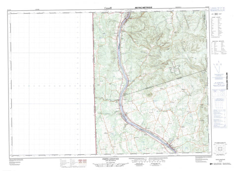
021J12 Perth Andover Canada topo map, 1:50,000 scale
021J12 Perth Andover NRCAN topographic map.
Includes UTM and GPS geographic coordinates (latitude and longitude). This 50k scale map is suitable for hiking, camping, and exploring, or you could frame it as a wall map.
Printed on-demand using high resolution, on heavy weight and acid free paper, or as an upgrade on a variety of synthetic materials.
Topos available on paper, Waterproof, Poly, or Tyvek. Usually shipping rolled, unless combined with other folded maps in one order.
- Product Number: NRCAN-021J12
- Parent Topo: TOPO-021J
- Map ID also known as: 021J12, 21J12
- Unfolded Size: Approximately 26" high by 36" wide
- Weight (paper map): ca. 55 grams
- Map Type: POD NRCAN Topographic Map
- Map Scale: 1:50,000
- Geographical region: New Brunswick, Canada
Neighboring Maps:
All neighboring Canadian topo maps are available for sale online at 1:50,000 scale.
Purchase the smaller scale map covering this area: Topo-021J
Spatial coverage:
Topo map sheet 021J12 Perth Andover covers the following places:
- Craig Falls - Monquart Falls - Andover - Perth - Wicklow - Bishop Lake - Blind Lake - Lawrence Lakes - Moose Lake - Moose Mountain Lake - Mud Lake - Murphy Lake - Priest Lake - Reid Lake - Round Lake - Tomlinson Lake - Tweedie Lake - Carrol Hill - Lawson Hill - Moose Mountain - Porcupine Mountain - Sweeney Hill - Muniac Provincial Park - Big Flat Brook - Bishop Brook - Blind Gully Brook - Blowdown Brook - Bobie Brook - Brown Brook - Browning Brook - Bryson Brook - Bumfrow Brook - Caldwell Brook - Carr Brook - Carrol Brook - Cochrane Brook - Craig Brook - Cuffman Brook - DeMerchant Brook - Dougherty Brook - Dyer Branch - East Branch Monquart Stream - East Monquart River - Finey Brook - Finnemore Brook - Gallop Brook - Giberson Brook - Grahams Brook - Hardwood Creek - Hiscock Brook - Holmes Brook - Huds Brook - Hurley Brook - Inman Branch - Inman Brook - Inman Brook - Jawbone Brook - Kilpatrick Brook - Lake Brook - Lake Brook - Larlee Creek - Left Hand Branch Caldwell Brook - Left Hand Branch Larlee Creek - Lovelly Brook - Lovelly Brook - Lovely Brook - Lovely Brook - Lower Guisiguit Brook - Lower Guisiguit Brook - Lower North Shikatehawk River - McCrae Brook - McDonald Brook - McGinley Brook - McMullen Brook - Monquart River - Monquart River - Monquart Stream - Muniac River - Muniac Stream - Murphy Brook - North Branch Monquart Stream - North Monquart River - O'Brien Brook - Patterson Brook - Patterson Gully Brook - Phillips Brook - Pickett Brook - Plant Brook - Price Brook - Quaker Brook - Randall Brook - Right Hand Branch Caldwell Brook - Right Hand Branch Larlee Creek - Right Hand Branch Trout Brook - Right Hand Trout Brook - Ring Brook - River de Chute - Rivière Saint-Jean - Saint John River - Scott Brook - Silver Brook - Smith Brook - South Gully Brook - Sweeney Brook - Tibbits Brook - Tibbitts Brook - Trout Brook - Upper Guisiguit Brook - Wark Brook - Watt Brook - West Caldwell Brook - Young Brook - Young Brook - Pickett Rock - Andover - Bairdsville - Beaconsfield - Beech Glen - Beechwood - Blue Hill - Bon Accord - Carlingford - Carlow - Clearview - Coronation - Demerchant Settlement - Dover Hill - Dover Hill - Giberson Settlement - Gladstone - Good Corner - Halls Corner - Hillandale - Holmesville - Inman - Johnville - Kilburn - Kilfoil - Killoween - Killowen - Kincardine - Kintore - Knoxford - Linville - Listerville - Lower Kintore - Lower Perth - Maplehurst - Mars Hill - Mineral - Monquart - Moose Mountain - Muniac - Murphy Corner - Piercemont - River de Chute - River de Chute Siding - Rosine - South Johnville - Summerfield - Sweeney Corner - Tarrtown - Tweedie - Upper Kent - Upper Kintore - Upper Knoxford - Upper Royalton - Upper Wicklow - Wicklow - Inman Gully - Andover-Perth - Bath - Perth - Perth-Andover


