
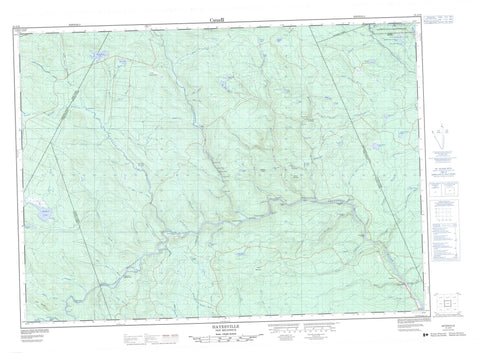
021J10 Hayesville Canada topo map, 1:50,000 scale
021J10 Hayesville NRCAN topographic map.
Includes UTM and GPS geographic coordinates (latitude and longitude). This 50k scale map is suitable for hiking, camping, and exploring, or you could frame it as a wall map.
Printed on-demand using high resolution, on heavy weight and acid free paper, or as an upgrade on a variety of synthetic materials.
Topos available on paper, Waterproof, Poly, or Tyvek. Usually shipping rolled, unless combined with other folded maps in one order.
- Product Number: NRCAN-021J10
- Parent Topo: TOPO-021J
- Map ID also known as: 021J10, 21J10
- Unfolded Size: Approximately 26" high by 36" wide
- Weight (paper map): ca. 55 grams
- Map Type: POD NRCAN Topographic Map
- Map Scale: 1:50,000
- Geographical region: New Brunswick, Canada
Neighboring Maps:
All neighboring Canadian topo maps are available for sale online at 1:50,000 scale.
Purchase the smaller scale map covering this area: Topo-021J
Spatial coverage:
Topo map sheet 021J10 Hayesville covers the following places:
- Hayes Bar - Slate Island Bar - Burnt Falls - Burnt Falls - Fall Brook Falls - Kettle Falls - Lambert Falls - Salmon Falls - Square Falls - Trout Brook Falls - Winding Falls - Douglas - Southesk - Stanley - Manzer Dam - Young Dam - Birch Island - Birch Islands - Clearwater Island - Gaspereau Island - Grassy Island - Lower Birch Island - Palmer Island - Phoebe Island - Slate Island - Upper Birch Island - Beaver Brook Lake - Big Sister Lake - Blind Lake - Brown Lake - Carson Lake - Deadman Lake - Deadmans Lake - Deer Lake - Diamond Lake - East Branch Lake - Four Mile Lake - Gilman Lake - Harris Lake - Hayden Lake - Hurd Lake - Indian Village Lake - Little Sister Lake - Long Lake - Lower Lake - Lower Peaked Mountain Lake - McKiel Lake - Middle Lake - Middle Peaked Mountain Lake - Mud Lake - Peaked Mountain Lake - Peaked Mountain Lakes - Peeked Mountain Lakes - Peeked Mountain Lakes - Peeked Mountain Lakes - Round Lake - Salmon Brook Lake - Tahoe Lake - The Sisters Lakes - The Sisters Lakes - Three Mile Lake - Trout Lake - Upper Peaked Mountain Lake - Gilman Peak - Louie Mountain - Peaked Mountain - Sisters Mountain - Todd Mountain - Burnthill Rapids - Company Line Rapids - Little Burnthill Rapids - Louie Rapids - Narrows Rapids - Push and Be Damned Rapids - Rocky Bend Rapids - Rocky Brook Rapids - Sisters Rapids - The Jaws - The Jaws - Three Mile Rapids - Bamford Brook - Bear Brook - Beatty Brook - Beaver Brook - Birch Brook - Black Brook - Bruce Brook - Burnthill Brook - Buttermilk Brook - Buttermilk Brook - Carson Brook - Clearwater Brook - Clearwater Brook - Colepaugh Brook - Conroy Brook - Deadman Brook - Deadmans Brook - Deer Brook - Donnelly Brook - Dungarvon River - East Branch Salmon Brook - East Salmon Brook - Fall Brook - Fall Brook - Four Mile Brook - Fullerton Brook - Gilman Brook - Green Brook - Green Brook - Green Brook - Griffin Brook - Harris Brook - Hayes Brook - Hinman Branch - Hovey Brook - Joe Brook - Joe Brook - Lake Brook - Little Dungarvon River - Little Northwest Branch Dungarvon River - Little South Branch Burnthill Brook - Little South Burnthill Brook - Little South Burnthill Brook - Lower Hayden Brook - Luke Brook - Main Southwest Miramichi River - McBean Brook - McConnell Brook - McDonald Brook - McKiel Brook - McLean Brook - Middle Hayden Brook - Molasses Brook - Moose Brook - Nine Mile Brook - North Branch Burnthill Brook - North Branch of Burnt Hill Brook - North Burnthill Brook - Otter Brook - Pig Brook - Ranger Brook - Rocky Brook - Salmon Brook - Sand Brook - Sand Pond Brook - Ships Bows Brook - Sisters Brook - Slate Island Brook - Snake Brook - Snake Brook - South Branch Burnthill Brook - South Burnthill Brook - South Burnthill Brook - Southwest Miramichi River - Spider Brook - Sprague Brook - Spud Brook - Three Mile Brook - Tom McKiel Brook - Trout Brook - Two and a Half Mile Brook - Upper Buttermilk Brook - West Branch Lower Hayden Brook - West Lower Hayden Brook - Burnthill Forks - Johnson Crossing - McKiel Bogan - Price Bend - Seeley Bogan - Rangers Rocks - Hayesville - Tugtown


