
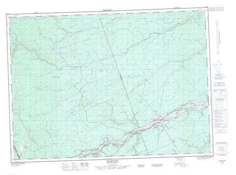
021J09 Doaktown Canada topo map, 1:50,000 scale
021J09 Doaktown NRCAN topographic map.
Includes UTM and GPS geographic coordinates (latitude and longitude). This 50k scale map is suitable for hiking, camping, and exploring, or you could frame it as a wall map.
Printed on-demand using high resolution, on heavy weight and acid free paper, or as an upgrade on a variety of synthetic materials.
Topos available on paper, Waterproof, Poly, or Tyvek. Usually shipping rolled, unless combined with other folded maps in one order.
- Product Number: NRCAN-021J09
- Parent Topo: TOPO-021J
- Map ID also known as: 021J09, 21J9, 21J09
- Unfolded Size: Approximately 26" high by 36" wide
- Weight (paper map): ca. 55 grams
- Map Type: POD NRCAN Topographic Map
- Map Scale: 1:50,000
- Geographical region: New Brunswick, Canada
Neighboring Maps:
All neighboring Canadian topo maps are available for sale online at 1:50,000 scale.
Purchase the smaller scale map covering this area: Topo-021J
Spatial coverage:
Topo map sheet 021J09 Doaktown covers the following places:
- McNamee Flats - Wasson Bar - Boars Head Narrows - Inside Channel - Kelly Channel - The Jaws - The Narrows - Blissfield - Ludlow - Northumberland - Stanley - Amos Islands - Brown Bar - Lyons Island - O'Donnell Island - Pine Island - Porcupine Island - Suter Island - Weaver Island - Bartholomew Lake - Big Hole Lake - Day Brook Lake - Day Brook Lakes - Day Brook Lakes - Day Lake - Devils Back Lake - Dungarvon Lake - Island Lake - Lake Brook Lake - Lake of the Plains - Little Lake - Long Lake - Mitchell Lake - Shakey Lake - Valentine Lake - Valentine Lake - Devils Back - Doak House - Lieu historique Doak - Russell Rapids - Bamford Brook - Bartholomew River - Bear Brook - Beaver Brook - Betts Mill Brook - Big Hole Brook - Big Hole Brook - Big Hole Lake Brook - Big Rocky Brook - Blunts Brook - Bobs Brook - Buttermilk Brook - Carson Brook - Crooked Bridge Brook - Davis Landing Brook - Day Brook - Doak Brook - Dungarvon Lake Brook - Dungarvon River - Four Mile Brook - Fowler Brook - Fowler Meadow Brook - Hurley Brook - Jacks Brook - King Brook - Lake Brook - Lake Brook - Ledbetters Brook - Little Day Brook - Little Dungarvon River - Little McGraw Brook - Little Meadow Brook - Little Rocky Brook - Little South Branch Renous River - Little South Renous River - Longs Brook - Longs Creek - Main Southwest Miramichi River - McDougald Brook - McKiel Brook - Meadow Brook - Mill Brook - Mitchell Brook - Moores Brook - Mud Brook - Muzroll Brook - North Bartholomew River - North Big Hole Brook - North Branch Bartholomew River - North Branch Muzroll Brook - North Branch Porter Brook - North Muzroll Brook - Otter Brook - Perogue Brook - Peters Brook - Peterson Brook - Porcupine Brook - Shakey Lake Brook - South Bartholomew River - South Branch Bartholomew River - South Branch Renous River - South Renous River - Southeast Branch Porter Brook - Southeast Porter Brook - Southwest Miramichi River - Spud Brook - Stephens Brook - Stewarts Brook - Upper Jardine Brook - Valentine Lake Brook - Whetstone Brook - Whitestone Brook - Drakes Perdue Bogan - Dudleys Bogan - Lucas Bogan - Mersereau Bogan - North Branch Deadwater - South Branch Deadwater - Travis Bogan - Amostown - Betts Mill Brook - Big Hole Brook - Blissfield - Breadalbane West - Carrolls Crossing - Gilks - Grand Lake Road - Hazelton - Hazelton Settlement - Holtville - McNamee - Nelson Hollow - O'Donnells - Porter Brook - Priceville - Russelltown - South Road Settlement - Storeytown - Doaktown


