
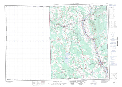
021J05 Florenceville Canada topo map, 1:50,000 scale
021J05 Florenceville NRCAN topographic map.
Includes UTM and GPS geographic coordinates (latitude and longitude). This 50k scale map is suitable for hiking, camping, and exploring, or you could frame it as a wall map.
Printed on-demand using high resolution, on heavy weight and acid free paper, or as an upgrade on a variety of synthetic materials.
Topos available on paper, Waterproof, Poly, or Tyvek. Usually shipping rolled, unless combined with other folded maps in one order.
- Product Number: NRCAN-021J05
- Parent Topo: TOPO-021J
- Map ID also known as: 021J05, 21J5, 21J05
- Unfolded Size: Approximately 26" high by 36" wide
- Weight (paper map): ca. 55 grams
- Map Type: POD NRCAN Topographic Map
- Map Scale: 1:50,000
- Geographical region: New Brunswick, Canada
Neighboring Maps:
All neighboring Canadian topo maps are available for sale online at 1:50,000 scale.
Purchase the smaller scale map covering this area: Topo-021J
Spatial coverage:
Topo map sheet 021J05 Florenceville covers the following places:
- Peel - Simonds - Wakefield - Wicklow - Wilmot - Becaguimec Island - Green Island - Lower Becaguimec Island - Lower Presque Isle Island - Lower Presquile Island - Middle Becaguimec Island - Presque Isle Island - Presquile Island - Barrett Lake - Carlisle Lakes - Cox Lake - Emery Lake - Gowan Lake - Ketch Lake - Leith Lake - Marvin Lake - McWaid Lake - Waters Lake - Williamston Lake - Williamstown Lake - York Lake - Carrs Mountain - Flagstaff Hill - Flanagan Hill - Flannigan Hill - Hannahs Hill - Oakland Mountain - Ritchie Hill - The Pinnacle - Wakem Hill - Hartland Covered Bridge Provincial Park Reserve - Ash Brook - Barren Brook - Beaver Brook - Becaguimec River - Becaguimec Stream - Big Presque Isle Stream - Bradley Brook - Bubar Brook - Buckwheat Brook - Burpee Brook - Buttermilk Brook - Clarke Brook - Clarks Brook - Cross Creek - Deep Creek - Dyer Branch - Gallop Brook - Ginson Brook - Gregg Brook - Hagerman Brook - Hales Brook - Hartley Brook - Hill Brook - Hunters Brook - Kennedy Brook - Little Pokiok Brook - Little Presque Isle Stream - Little Presquile River - Little Shikatehawk River - Little Shikatehawk Stream - Lower Guisiguit Brook - Lower Guisiguit Brook - Lower North Shikatehawk River - McLeary Brook - North Branch Meduxnekeag River - North Meduxnekeag River - Oakland Brook - Presquile River - Rivière Saint-Jean - Saint John River - Shikatehawk River - Shikatehawk Stream - Shiktahawk River - Stewart Brook - Stickney Brook - Sucker Brook - Two Mile Brook - Uptons Brook - Whitemarsh Creek - Young Brook - Waterville Deadwater - Hartland Covered Bridge - Hugh John Flemming Bridge - Hartland - Avondale - Avondale Road - Beckim Settlement - Bloomfield - Boundary Presquile - Bradley Corner - Brookville - Carlow - Carvell - Charleston - Chester - Connell - Deep Creek - Deerville - Digby Corner - East Centreville - East Centreville - East Florenceville - Farmerston - Fielding - Good Corner - Gordonsville - Greenfield - Greenfield - Greenfield Settlement - Gregg Settlement - Gregg Settlement - Hale - Hartley Settlement - Hunters Corner - Jacksontown - Knoxford - Lakeville - Lamoreaux Corner - Lansdowne - Lindsay - Lockharts Mill - Long Settlement - Lower Bloomfield - Lower Brighton - Lower Greenfield - Lower Royalton - Lower Waterville - McGrath Corner - McKeaghan - McMonagle Corner - Nixon - Oakland - Orchards Corner - Peel - Riverbank - Rosedale - Royalton - Simonds - Somerville - St. Thomas - Stickney - Strong Corner - Tracey Mills - Upper Brighton - Upper Peel - Upper Waterville - Victoria - Victoria Corner - Wakem Corner - Waterville - Weston - White Glen - Wicklow - Williamstown - Williamstown Settlement - Wilmot - Bristol - Centreville - Florenceville


