
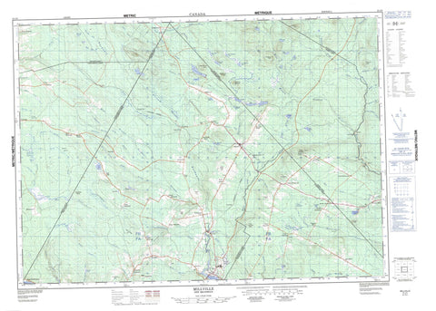
021J03 Millville Canada topo map, 1:50,000 scale
021J03 Millville NRCAN topographic map.
Includes UTM and GPS geographic coordinates (latitude and longitude). This 50k scale map is suitable for hiking, camping, and exploring, or you could frame it as a wall map.
Printed on-demand using high resolution, on heavy weight and acid free paper, or as an upgrade on a variety of synthetic materials.
Topos available on paper, Waterproof, Poly, or Tyvek. Usually shipping rolled, unless combined with other folded maps in one order.
- Product Number: NRCAN-021J03
- Parent Topo: TOPO-021J
- Map ID also known as: 021J03, 21J3, 21J03
- Unfolded Size: Approximately 26" high by 36" wide
- Weight (paper map): ca. 55 grams
- Map Type: POD NRCAN Topographic Map
- Map Scale: 1:50,000
- Geographical region: New Brunswick, Canada
Neighboring Maps:
All neighboring Canadian topo maps are available for sale online at 1:50,000 scale.
Purchase the smaller scale map covering this area: Topo-021J
Spatial coverage:
Topo map sheet 021J03 Millville covers the following places:
- Culliton Cove - The Narrows - Bright - Northampton - Queensbury - Southampton - York - Angle Hill Lake - Ayers Lake - Ayres Lake - Bear Lakes - Big Lake - Brooks Lake - Bull Lake - Burtt Lake - Campbell Lake - Carr Lake - Coac Lake - Colter Lake - Fiddle Lake - Fish Lake - Greenhill Lake - Indian Lake - Lower Bear Lake - Lower Northeast Lake - Mactaquac Lake - Mud Lake - Myshrall Pond - Otter Lake - Round Pond - Sisson Lake - Smith Lake - Square Pond - Taffy Lake - Trout Lake - Upper Bear Lake - Upper Northeast Lake - Big Spruce Peak - Climbatree Ridge - Crabbe Mountain - Crow Hill - Dunham Hill - Green Hill - Howland Ridge Hill - Lawrence Peak - Little Lawrence Peak - Little Spruce Peak - Maple Ridge Hill - Middle Brook Ridge - Mularchy Peak - Paddy Hill - Parent Ridge - Pikes Peak - Pughs Peak - Pugh's Peak - Sleeps Hill - Stairs Hill - Sugarloaf Mountain - Trail Ridge - Woodstock Hill - Ackers Brook - Ackers Creek - Bagley Brook - Beaver Brook - Belyea Brook - Broad Arrow Brook - Bulls Creek - Burtt Lake Branch - Buttermilk Creek - Coac Stream - Downey Brook - Dunham Brook - East Branch Nackawic Stream - Eight Mile Brook - Falls Brook - Farnham Brook - Fiddle Brook - Gibson Creek - Gibson Millstream - Greenlaw Brook - Greer Creek - Greers Creek - Gunter Brook - Ham Brook - Hamilton Brook - Howard Brook - Indian Brook - Jerry Brook - Johnny Brook - Jones Brook - Jones Landing Brook - Keswick River - Little Forks Brook - Little Patterson Brook - Mactaquac River - Mactaquac Stream - McDonald Brook - McKiel Brook - McLean Brook - Meadow Brook - Meadow Brook - Middle Brook - Mill Brook - Mularchy Brook - Nackawic River - Nackawic Stream - Negro Brook - Nine Mile Brook - North Branch Gibson Creek - North Gibson Millstream - Northeast Nackawic River - Northwest Nackawic River - Olmstead Brook - Otter Brook - Phillips Creek - Quigg Brook - Richardson Brook - Rivière Saint-Jean - Saint John River - Second Brook - Shaws Creek - Shea Brook - South Branch Mactaquac Stream - Squatty Brook - Stones Brook - Trout Brook - West Branch Keswick River - West Branch Nackawic Stream - West Keswick River - Greer Creek Deadwater - Kilmarnock Deadwater - Moosehorn Deadwater - Nason Deadwater - North Branch Deadwater - Prescott Deadwater - Refuge Deadwater - Round Turn - Barton - Bates Settlement - Brewer Mills - Brewers Mill - Brewers Mills - Briggs Corner - Bull Lake - Cahill - Campbell Settlement - Carr - Caverhill - Central Hainesville - Central Waterville - Clarkville - County Line - Cullerton - East Newbridge - East Waterville - Green Bush - Greenhill - Hainesville - Harten Corner - Hartfield - Hawkins Corner - Hayne - Howard Brook - Howland Ridge - Kilmarnock - Kilmarnock Settlement - Lower Brighton - Lower Caverhill - Lower Hainesville - Lower Southampton - Maple Ridge - Maplewood - Middle Hainesville - Nackawic - Newbridge - Newburg - Newburg Settlement - Norton Dale - Nortondale - Oldham Settlement - Parent Ridge Settlement - Pinder - Rossville - Shewan - South Newbridge - South Waterville - Southampton - Southampton Junction - Springfield - Staples Settlement - Temperance Vale - Upper Caverhill - Upper Hainesville - Upper Southampton - Upper Springfield - West Waterville - Wiggins Mill - Woodman - Woodstock Road - Beechman Swamp - Caribou Barren - Kaley Bog - Kaley Meadow - Long Swamp - Millville


