
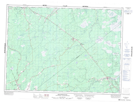
021I14 Kouchibouguac Canada topo map, 1:50,000 scale
021I14 Kouchibouguac NRCAN topographic map.
Includes UTM and GPS geographic coordinates (latitude and longitude). This 50k scale map is suitable for hiking, camping, and exploring, or you could frame it as a wall map.
Printed on-demand using high resolution, on heavy weight and acid free paper, or as an upgrade on a variety of synthetic materials.
Topos available on paper, Waterproof, Poly, or Tyvek. Usually shipping rolled, unless combined with other folded maps in one order.
- Product Number: NRCAN-021I14
- Parent Topo: TOPO-021I
- Map ID also known as: 021I14, 21I14
- Unfolded Size: Approximately 26" high by 36" wide
- Weight (paper map): ca. 55 grams
- Map Type: POD NRCAN Topographic Map
- Map Scale: 1:50,000
- Geographical region: New Brunswick, Canada
Neighboring Maps:
All neighboring Canadian topo maps are available for sale online at 1:50,000 scale.
Purchase the smaller scale map covering this area: Topo-021I
Spatial coverage:
Topo map sheet 021I14 Kouchibouguac covers the following places:
- Miramichi - Acadieville - Carleton - Chatham - Glenelg - Hardwicke - Kent - Nelson - Northumberland - Rogersville - Saint-Louis - Blackrock Lake - Goose Lake - Hells Gate Lake - Laketon Lake - Macs Lake - North Branch Lake - Rosaireville Lake - Round Lake - Sands Lake - Sullivans Lake - Trappist Fathers Pond - The Horseback - Kouchibouguac National Park of Canada - Parc national du Canada Kouchibouguac - Saint Margarets Provincial Park - Appleby Brook - Baldwins Brook - Barnaby River - Bay du Vin River - Big Brook - Big Hovel Brook - Black River - Black River - Carding Mill Brook - Carrigan Brook - East Branch Bay du Vin River - East Branch Eel River - East Branch Hortons Creek - Eel River - Ettrick Brook - Gallows Brook - Goodfellow Brook - Island Creek - Kouchibouguac River - Kouchibouguacis River - Lake Brook - Little Black River - Mackays Brook - McBeath Brook - McDonald Brook - McInnes Brook - McInnes Brook - Middle Barnaby River - Middle Branch Barnaby River - Napan River - North Branch McInnes Brook - North Branch Tweedie Brook - North Fork Black River - North McInnes Brook - North Tweedie Brook - Northwest Branch Napan River - Northwest Napan River - Peabody Brook - Pollys Creek - Portage River - Rankin Brook - Red Brook - Right Hand Branch Barnaby River - Rivière au Portage - Rivière du Vin - Rivière Fontaine - Ruisseau à Baptiste - Ruisseau des Babineau - South Branch McInnes Brook - South Branch Tweedie Brook - Tweedie Brook - Tweedie Brook - Two Mile Brook - Twomile Brook - Vandy Brook - Wells Brook - West Branch Eel River - West Branch Hortons Creek - Wiseman Brook - Barrieau - Bay du Vin Mills - Black River - Block 14 - Collette - Douglasfield - East Collette - East Rogersville - Fitzpatrick - Glenwood - Kouchibouguac - Lakeland - Laketon - Murray Settlement - North Rogersville - Redmondville - Richard Village - Richard-Village - Rosaireville - Shediac Ridge - St. Augustine - St. Margarets - St. Théodule - St-Augustine - Ste-Augustine - Tweedie Brook - Upper Baie du Vin - Upper Napan - Vautour - Village St. Jean - Village St. Pierre - Village-Saint-Jean - Village-Saint-Pierre - Village-St-Jean - Village-St-Pierre - Weldfield - West Collette - West Rosaireville - Wine River - Young Ridge - Blue Ridge Plain - Carrigan Plain - Grand macôque Rond - Grand mocauque Rond - Hells Gate Plain - Round Plain


