
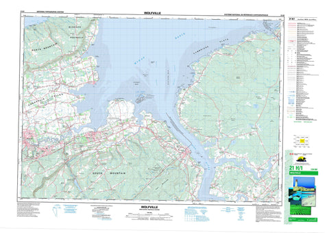
021H01 Wolfville Canada topo map, 1:50,000 scale
021H01 Wolfville NRCAN topographic map.
Includes UTM and GPS geographic coordinates (latitude and longitude). This 50k scale map is suitable for hiking, camping, and exploring, or you could frame it as a wall map.
Printed on-demand using high resolution, on heavy weight and acid free paper, or as an upgrade on a variety of synthetic materials.
Topos available on paper, Waterproof, Poly, or Tyvek. Usually shipping rolled, unless combined with other folded maps in one order.
- Product Number: NRCAN-021H01
- Parent Topo: TOPO-021H
- Map ID also known as: 021H01, 21H1, 21H01
- Unfolded Size: Approximately 26" high by 36" wide
- Weight (paper map): ca. 55 grams
- Map Type: POD NRCAN Topographic Map
- Map Scale: 1:50,000
- Geographical region: Nova Scotia, Canada
Neighboring Maps:
All neighboring Canadian topo maps are available for sale online at 1:50,000 scale.
Purchase the smaller scale map covering this area: Topo-021H
Spatial coverage:
Topo map sheet 021H01 Wolfville covers the following places:
- Bass Creek - Bass Creek - Bennett Bay - Bigelow Cove - Black Hole - Broad Cove - Cambridge Cove - Crowell Creek - Habitant Creek - Hales Creek - Harolds Creek - Hurd Creek - Johnson Cove - Lyons Cove - Mill Creek - Minas Basin - Mutton Cove - North Creek - Pereau Creek - Pereaux Creek - Rainy Cove - Ross Creek - Scots Bay - Scotsman Bay - Scotts Bay - Second Creek - Whale Cove - Whelan Cove - Woodburn Creek - Woodworth Bay - Aberdeen Beach - Blue Beach - Cambridge Flats - Caroline Beach - Causeway Beach - Crowells Bar - Eastern Bar - Evangeline Beach - Hiawatha Beach - Houston Beach - Kipps Beach - Medford Beach - Pineo Beach - Shad Bar - Stoney Bar - Blomidon Peninsula - Cheverie Point - Clarke Point - Dimock Point - Indian Point - Long Island Head - Longspell Point - Mitchener Point - Oak Point - Porter Point - Red Head - Starr Point - Starratt Point - Starrs Point - Starr's Point - Stubborn Head - Wallace Point - West Point - White Head - Eastern Channel - The Guzzle - The Hellgate - Western Channel - Horton Bluff - Hellgate Falls - Hants - Kings - Beau Dyke - Glooscap 35 - Horton 35 - Boot Island - Long Island - Oak Island - Paddy Island - Paddys Island - Hellgate Pond - Lily Lake - Little Lake - Lumsden Pond - Shey Lake - Wade Lake - White Rock Pond - Woodward Sanford Lake - Cheverie Mountain - Grey Mountain - North Mountain - North Mountain Range - Oak Hill - South Mountain - Wolfville Ridge - East Hants - Kings - West Hants - Boot Island National Wildlife Area - Dewey Creek Wildlife Management Area - Grand-Pré National Historic Site of Canada - Lieu historique national du Canada de Grand-Pré - Lumsden Pond Provincial Park - Minas Basin Wildlife Management Area - Réserve nationale de faune de l'Île Boot - Allen Brook - Anderson Brook - Avon River - Barkhouse Brook - Bass Brook - Bass Brook - Bass Creek - Bass Creek Brook - Baxters Harbour Brook - Bear Brook - Beaver Brook - Beckwith Brook - Bezanson Brook - Big Creek - Big Creek - Black Brook - Black Brook - Black Brook - Black Hole Brook - Black River - Bradleys Intervale Brook - Burntland Brook - Cambridge Creek - Canard River - Canard River - Cheverie Creek - Cobby Irving Brook - Cochrane Mill Brook - Cogmagun River - Cornwallis River - Crowell Creek - Crowell Creek Brook - Curry Brook - Deep Hollow Brook - Deep Hollow Brook - Dill Brook - Dixie Brook - Dixon Brook - Dodge Brook - Doyle Brook - Duncanson Brook - Elderkin Brook - Elderkin Creek - Ells Brook - Farnham Creek - Fielding Hollow Brook - First Creek - Fraser Brook - French Mill Brook - Gaspereau River - Gold Brook - Golf Links Brook - Grand Dyke - Greene Brook - Greene Brook - Habitant Creek - Habitant River - Halfway River - Hancock Brook - Hanson Brook - Harding Brook - Harolds Creek Brook - Herbert River - Hillcrest Brook - Hiltz Brook - Hollow Brook - Horse Brook - Hubbards Brook - Hurd Creek - Irving Brook - Kelly Brook - Kelly Stream - Kennetcook River - Levy Brook - Little Rainy Brook - McGowan Brook - Meadow Brook - Meander River - Middle Dyke - Mill Bridge Brook - Mill Brook - Mill Brook - Mill Creek - Mill Creek Brook - Miller Creek - Miner Brook - Miner Meadow Brook - Mitchells Brook - Moore Brook - Moores Brook - Nearys Brook - Newcombe Brook - North Brook - Oakland Brook - Peck Meadow Brook - Pencil Brook - Pereau Creek - Pereaux River - Pineo Vault Brook - Pines Brook - Porcupine Brook - Rainy Cove Brook - Ransom Creek - Red Brook - Reservoir Brook - Ridge Brook - Riley Brook - Ross Creek - Ross Creek Brook - Sanford Brook - Schofield Brook - Schoolhouse Brook - Shaw Brook - Sheddley Brook - Shey Brook - Sleepy Hollow Brook - Soldiers Creek - St. Croix River - Straddle Leg Brook - Teare Brook - Terrys Creek - Thompsons Brook - Thompson's Brook - Threemile Brook - Tinker Brook - Upper Dyke - Vaughn Brook - Wall Brook - Walton River - West Brook - Whale Brook - Whale Creek - Wheaton Brook - White Horse Brook - Whitten Brook - Willow Brook - Woodworth Creek - Cross Bar Shoal - Long Spell Rocks - Scotch Rocks - Split Rock - The Hogsback - Walton Bar - Western Bar - Hantsport - Kentville - Wolfville - Arlington - Avondale - Avonport - Avonport Station - Belcher Street - Belmont - Benjamin Bridge - Bishopville - Black River - Blomidon - Bramber - Brooklyn - Cambridge - Canaan - Canard - Centre Burlington - Cheverie - Chipman Corner - Chipmans Corner - Church Street - Cogmagun River - Davison Street - Delhaven - Etna - Falmouth - Forest Hill - Gaspereau - Gaspereau Mountain - Glenmont - Goshen - Grand Pré - Greenfield - Greenwich - Habitant - Hants Border - Highbury - Highfield - Hillaton - Horton Landing - Hortonville - Kempt Shore - Kingsport - Lockhartville - Long Island - Lower Blomidon - Lower Burlington - Lower Canard - Lower Church Street - Lower Wolfville - Lumsden Dam - Mantua - Medford - Melanson - Middle Pereaux - Miller Creek - Mount Denson - New Canaan - Newport - Newport Landing - Newtonville - North Grand Pré - North Medford - Norths - Norths Corner - Peck Meadow Corner - Pembroke - Pereau - Pereaux - Poplar Grove - Port Williams - Riverside - Robinson Corner - Scotch Village - Scots Bay Road - Scotts Bay Road - Shaws Bog - Shaw's Bog - Sheffield Mills - Sheffield Mills Station - Starrs Point - Summerville - Sunken Lake - Sunnyside - The Lookoff - Union Corner - Upper Burlington - Upper Canard - Upper Dyke Village - Upper Pereau - Upper Pereaux - Vesuvius - Wallbrook - Walton - West Brooklyn - West Medford - White Rock - White Rock Mills - Whiterock - Wolfville Ridge - Woodside - Annapolis Valley - Deep Hollow - Pineo Vault - Bentley Meadows - Bluegrass Meadow - Bradleys Meadow - Dixon Meadow - East Meadows - MacAulay Meadows - Nutten Bog - Rowe Meadow - Shaws Bog - Sheffield Mills Marsh - The Barrens - The Devils Burrow - The Intervale - Yellow Bog - Canning - New Minas - Port Williams


