
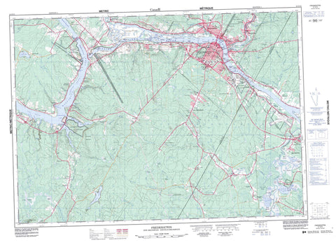
021G15 Fredericton Canada topo map, 1:50,000 scale
021G15 Fredericton NRCAN topographic map.
Includes UTM and GPS geographic coordinates (latitude and longitude). This 50k scale map is suitable for hiking, camping, and exploring, or you could frame it as a wall map.
Printed on-demand using high resolution, on heavy weight and acid free paper, or as an upgrade on a variety of synthetic materials.
Topos available on paper, Waterproof, Poly, or Tyvek. Usually shipping rolled, unless combined with other folded maps in one order.
- Product Number: NRCAN-021G15
- Parent Topo: TOPO-021G
- Map ID also known as: 021G15, 21G15
- Unfolded Size: Approximately 26" high by 36" wide
- Weight (paper map): ca. 55 grams
- Map Type: POD NRCAN Topographic Map
- Map Scale: 1:50,000
- Geographical region: New Brunswick, Canada
Neighboring Maps:
All neighboring Canadian topo maps are available for sale online at 1:50,000 scale.
Purchase the smaller scale map covering this area: Topo-021G
Spatial coverage:
Topo map sheet 021G15 Fredericton covers the following places:
- Burden Cove - Cliffs Cove - Courser Cove - Currier Creek Basin - Hammond Brook Basin - Jewetts Cove - Kellys Creek Basin - Longs Creek Arm - Mactaquac Park Arm - Mactaquac Stream Basin - McNallys Cove - Snowshoe Cove - Walinaik Cove - Wheeler Cove - Burpee Bar - Brick Hill Point - Brick Kiln Point - Crocks Point - Big Chokey - Grand Pass - Hilyard Dugway - Keswick Island Thoroughfare - Little Chokey - Morrow Dugway - Sugar Island Thoroughfare - The Gut - The Thoroughfare - Upper Thoroughfare - Fredericton - Split Rock Falls - Bright - Burton - Douglas - Gladstone - Kingsclear - Lincoln - Manners Sutton - Maugerville - New Maryland - Prince William - Queensbury - Sunbury - York - Mactaquac Dam - Devon 30 - Kingsclear 6 - St. Mary's 24 - Barkers Island - Breakwater Island - Burpee Island - Clements Island - Clements Island - Currie Island - Dunphy Island - Eccles Island - Eqpahak - Hartt Island - Hartts Island - Hawkins Island - Jewett Island - Jewett Island - Keswick Island - Lower Shores Island - Mactaquac Island - McGibbon Island - Merrithew Island - Merrithews Island - Mitchells Island - Murray Island - Nevers Island - Oromocto Island - Parsnip Island - Pitt Island - Ram Island - Ross Island - Savage Island - Shores Island - Snowshoe Island - Sugar Island - Upper Shores Island - Wheeler Island - Foss Pond - French Lake - Grieve Lake - Holden Pond - Holland Lake - Lake Erina - Little Lake - Mactaquac Lake - Morrow Pond - Murray Lake - Scotch Lake - Sterling Lake - Sunpoke Lake - Tower Lake - Waasis Pond - White Pond - Yoho Lake - Yoho Lake (Lake Erina) - Bunker Hill - Bunker Hill - College Hill - Currie Mountain - French Ridge - Harvey Mountain - Horseback Ridge - Horse-back Ridge - Keswick Ridge - Maryland Hill - Mount Harvey - Popple Hill - Porcupine Mountain - Rice Hill - Église anglicane Holy Trinity - Holy Trinity Anglican Church - Kings Landing - L'église anglicane St. Mary the Virgin - Mactaquac Provincial Park - Military Compound - Quartier militaire - Queensbury Provincial Park - Sunbury-Oromocto Provincial Park - The Church of St. Mary the Virgin - Woolastook Provincial Park - Alder Brook - Alder Brook - Alex Creek - Baker Brook - Banks Brook - Barlow Brook - Bear Brook - Bear Brook - Bear Creek - Berry Brook - Black Brook - Bully Brook - Burpee Brook - Buttermilk Brook - Campbell Creek - Carman Creek - Carr Brook - Charley Brook - Christie Brook - Coburn Brook - Corbett Brook - Corbett Brook - Corey Brook - Currie Brook - Currier Creek - Curry Creek - Deer Creek - Duffy Brook - Duncan Brook - East Branch Longs Creek - Farnham Brook - First Gore Brook - Fish Creek - Fisher Brook - Fletcher Brook - French Lake Creek - Friars Brook - Friels Brook - Garden Creek - Gardens Creek - Gardens Creek - Gardner Creek - Geary Brook - Gordon Brook - Grieves Creek - Gully Brook - Hammond Brook - Haunted Brook - Hazen Brook - Hazen Brook - Hughes Brook - Indian Brook - Jewetts Creek - Jim Knight Brook - Johnson Brook - Kaine Creek - Kane Brook - Kanes Brook - Kelly Brook - Kelly Brook - Kellys Creek - Kenney Creek - Keswick River - Killarney Brook - Kinney Creek - Kitchen Brook - Little Brook - Little Mactaquac River - Little Mactaquac Stream - Little Portobello Stream - Little Sunpoke Creek - Little Tracy Brook - Little Waasis Creek - Little Waasis Stream - Little Yoho Brook - Longs Creek - Maple Glen Brook - Mazerall Creek - Mazerol Creek - McConaghy Brook - McCullough Brook - McIntosh Brook - Meadow Brook - Mill Brook - Mill Creek - Mill Stream - Mowrey Brook - Mud Creek - Murray Brook - Nashwaak River - Nashwaaksis Stream - Nasonworth Millstream - North Branch Rusagonis Stream - North Rusagonis River - Northwest Branch Noonan Stream - O'Brien Brook - O'Leary Brook - Oromocto River - Peppers Brook - Peter Smith Brook - Phyllis Creek - Pinder Creek - Porcupine Stream - Portobello Creek - Portobello Stream - Reed Brook - Regiment Creek - Rice Brook - Rivière Saint-Jean - Rockwell Stream - Rusagonis River - Rusagonis Stream - Saint John River - Sandhill Brook - Sandy Creek - Second Bear Brook - Second Gore Brook - Shaw Creek - Shin Creek - Sinclair Brook - Snake Creek - South Branch Longs Creek - South Branch Mactaquac Stream - South Branch Rusagonis Stream - South Rusagonis River - Springhill Brook - Sunpoke Creek - Swale Creek - Tapley Creek - Waasis Creek - Waasis Stream - Weary Brook - Weaver Creek - Weeks Creek - Wilmot Creek - Woods Brook - Wright Brook - Wynott Brook - Yoho Stream - Coac Reach - Glooscap Reach - Little Forks - Maple Bend - Pickards Padou - Scoodawabscook Bend - Sugar Island Padou - The Oxbow - Chapel Bar - Chapel Bar - Hartts Island Bar - McCleary Bar - McIntosh Bar - Slaughter House Bar - Wheeler Rock - Oromocto - Barker - Barkers Point - Beaver Dam - Burden - Camp Road - Central Kingsclear - Charters Settlement - Cherry Bank - Clanfield - Devon - Doak - Doak Settlement - Douglas - French Lake - French Village - Garden Creek - Glasier - Hanwell - Island View - Jewetts Mills - Keswick - Keswick Ridge - Kingsclear - Lake George Road - Lincoln - Longs Creek - Lower French Village - Lower Lincoln - Lower Line Queensbury - Lower Prince William - Lower Queensbury - Lower Queensbury - Lower St. Marys - Mactaquac - Mactaquac - Marysville - Marysville Junction - Mazerall Settlement - Mazerolle Settlement - McGinley - McKeens Corner - McKinley - McKinley Ferry - McNallys - McNallys Ferry - Morrison - Mouth of Keswick - Nashwaaksis - Nasonworth - New Market - Newmarket - Noonan - North Devon - Oborne - Oromocto West - Rear Maugerville - Rockland - Rusagonis - Rusagonis Station - Salamanca - Sandyville - Scotch Lake - Scotch Settlement - Silverwood - Smithfield - Smithfield Settlement - South Devon - Springhill - Sugar Island - Sunpoke - Upper Maugerville - Veyseys - Victoria Mills - Waasis - Waterville - Wilmots - Woodside - Yoho - Youngs Crossing - Bear Creek Meadow - Big Meadow - Cogswell Meadow - Fish Creek Meadow - Foss Meadow - French Lake Meadow - Halfords Meadow - Hazen Meadows - Holden Meadow - Howland Meadow - Hurley Meadow - Jones Meadows - Longs Meadow - McKeevers Meadow - Mersereau Meadow - Morrow Meadow - Murray Meadows - Pickards Intervale - Rusagonis Meadow - Sunpoke Meadow - Tracys Meadow - Waasis Meadow - Wood Meadow - New Maryland


