
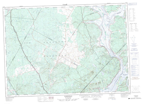
021G09 Hampstead Canada topo map, 1:50,000 scale
021G09 Hampstead NRCAN topographic map.
Includes UTM and GPS geographic coordinates (latitude and longitude). This 50k scale map is suitable for hiking, camping, and exploring, or you could frame it as a wall map.
Printed on-demand using high resolution, on heavy weight and acid free paper, or as an upgrade on a variety of synthetic materials.
Topos available on paper, Waterproof, Poly, or Tyvek. Usually shipping rolled, unless combined with other folded maps in one order.
- Product Number: NRCAN-021G09
- Parent Topo: TOPO-021G
- Map ID also known as: 021G09, 21G9, 21G09
- Unfolded Size: Approximately 26" high by 36" wide
- Weight (paper map): ca. 55 grams
- Map Type: POD NRCAN Topographic Map
- Map Scale: 1:50,000
- Geographical region: New Brunswick, Canada
Neighboring Maps:
All neighboring Canadian topo maps are available for sale online at 1:50,000 scale.
Purchase the smaller scale map covering this area: Topo-021G
Spatial coverage:
Topo map sheet 021G09 Hampstead covers the following places:
- Belleisle Bay - Belyeas Cove - Crafts Cove - Gorhams Creek - Kingston Creek - Marley Creek - Mistake Cove - Rouses Cove - Schampers Cove - Shampers Cove - Tennant Cove - Tennants Cove - The Mistake - Colwells Point - Kingston Peninsula - MacDonalds Point - McDonald Point - Oak Point - Palmer Point - Penrey Point - Picnic Point - Colwells Creek - Lawson Passage - Long Island Bend - Washademoak Creek - Gorhams Bluff - Schampers Bluff - Shampers Bluff - Blissville - Burton - Cambridge - Clarendon - Gagetown - Greenwich - Hampstead - Kars - Kings - Kingston - Petersville - Queens - Sunbury - Wickham - Belle Isle - Grassy Island - Hog Island - Hog Island - Killaboy Island - Killboy Island - Long Island - Lower Musquash Island - Pig Island - Rush Island - Spoon Island - Upper Musquash Island - Bacon Lake - Becketts Pond - Bogle Lake - Britain Lake - Brunswick (Grassy) Lake - Brunswick Lake - Clark Lake - Connors Lake - Cranberry Lake - Crowley Lake - Deep Lake - Fanning Lake - Fanning Lake - Fish Lake - Foshay Lake - Fowler Lake - Gaspereau Lake - George Lake - Island Lake - Island Lake - Jones Lake - Little Rocky Lake - Long Island Lake - McCutcheon Lake - Morgan Lake - Murphy Lake - Musquash Lake - Otnabog Lake - Quinn Lake - Rabbit Lake - Richards Round Lake - Rocky Lake - Rocky Lake - Roddys Lake - Sheriff Lake - Swain Lake - Vanwart Lake - Vanwart Lake - Washademoak Lake - Wirral Lake - Colwells Wharf - Motts Wharf - Canadian Forces Base Gagetown - Champ de tir et champ de manoeuvre Gagetown - Gagetown Range and Training Area - Bald Hill - Blue Mountain - Blue Mountain - Boone Mountain - Break Neck Hill - Campbell Hill - Coleman Hill - Cootehill Ridge - Cootes Hill - Crozier Hill - Daly Mountain - Day Hill - Doughnut Hill - Fanning Mountain - Finnegans Hill - Flaglor Mountain - Friendship Hill - Hamilton Mountain - Headline Ridge - Hogan Hill - Inchby Ridge - Jerusalem Ridge - Manor Ridge - Mary Ann Daly Hill - McGuire Hill - Mooneys Ridge - Nutter Hill - Oak Ridge - Otnabog Hill - Queens Brook Hill - Round Hill - Rush Hill - Summer Hill - Telegraph Hill - Tyng Hill - Wirral Mountain - Oak Point Provincial Park - Back (No. 10) Creek - Back Creek - Back Creek - Back Field Brook - Back Hollow Brook - Barnet Brook - Belyea Brook - Ben Brook - Birch Brook - Bradley Brook - Braydon Brook - Brizley Stream - Brown Brook - Carpenter Brook - Cochrane Brook - Coleman Brook - Crystal Brook - Daly Brook - Days Brook - Dunn Brook - Eastern Brook - Ellingham Brook - Elm Brook - Elm Stream - Factory Brook - Falls Brook - Fanning Brook - Fitch Creek - Flaglor Brook - Front Hollow Brook - Gamble Brook - Geary Brook - Glass Brook - Hogan Brook - Howe Brook - Hughes Brook - Hurley Brook - Image Brook - Irving Brook - Jones Brook - Jones Brook - Jones Creek - Kerr Brook - Killen Brook - Lake Stream - Little River - Little River - Lucifee Brook - MacDonalds Brook - Mad Brook - Malone Brook - McCain Brook - McCarthy Brook - McDonald Brook - McKeen Brook - McLean Brook - Menzie Brook - Mersereau Stream - Mile Brook - Mill Creek - Monaghan Brook - Moore Brook - Mountain Brook - Mud Brook - Nerepis River - North Brook - Number Ten Brook - Nutter Creek - Otnabog River - Otnabog Stream - Oxbow Brook - Palmer Creek - Pascal Brook - Patterson Brook - Pendar Brook - Pender Brook - Pender Brook - Popple Brook - Queen Brook - Queens Brook - Quinn Brook - Rathburn Brook - River George - Rivière Saint-Jean - Rockwell Stream - Rouses Brook - Saint John River - Sawmill Brook - Scott Brook - Shannon Brook - Sharpes Brook - Smith Brook - Snake Creek - Sucker Brook - Tantawanta Stream - Taylor Brook - Three Bridge Brook - Three Mile Brook - Valley Brook - Webster Brook - Welsh Brook - Wildcat Hollow Brook - Long Reach - Crow Rock - Armstrong Corner - Belyea Cove - Belyeas Cove - Beulah - Blakely - Browns Corner - Carpenter - Central Cambridge - Central Greenwich - Central Hampstead - Clones - Cootes Hill - Crafts Cove - Dunham - Dunns Corner - Elm Hill - Enniskillen - Enniskillen Station - Evandale - Fentons - Ferris - Gaspereau Forks - Geary - Gerow - Gillans Corner - Glenwood - Grays Mills - Hamilton Mountain - Hampstead - Headline - Hibernia - Inchby - Jerusalem - Lawfield - Loisville - London Settlement - Lower Cambridge - Lower Gagetown - Lynch Corner - MacDonalds Point - McAlpines - McDonald Point - McPherson - New Jerusalem - New Jerusalem - Oak Point - Olinville - Petersville - Pleasant Villa - Polleyhurst - Quarries - Queenstown - Schampers - Shampers - Shannon - South Clones - Summer Hill - Tennant Cove - Tennants Cove - The Bluffs - The Manor - Tweedsmuir - Upper Greenwich - Upper Hampstead - Upper Otnabog - Victoria Settlement - Vincent - West Jerusalem - Wickham - Wirral - Wirral Station - Big Bog - Boyds Marsh - Hughes Meadow - Kelly Meadow - Little Bog - Mersereau Meadow - Mistake Interval - Mistake Intervale


