
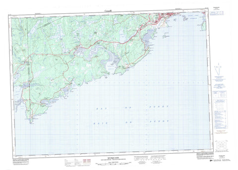
021G01 Musquash Canada topo map, 1:50,000 scale
021G01 Musquash NRCAN topographic map.
Includes UTM and GPS geographic coordinates (latitude and longitude). This 50k scale map is suitable for hiking, camping, and exploring, or you could frame it as a wall map.
Printed on-demand using high resolution, on heavy weight and acid free paper, or as an upgrade on a variety of synthetic materials.
Topos available on paper, Waterproof, Poly, or Tyvek. Usually shipping rolled, unless combined with other folded maps in one order.
- Product Number: NRCAN-021G01
- Parent Topo: TOPO-021G
- Map ID also known as: 021G01, 21G1, 21G01
- Unfolded Size: Approximately 26" high by 36" wide
- Weight (paper map): ca. 55 grams
- Map Type: POD NRCAN Topographic Map
- Map Scale: 1:50,000
- Geographical region: New Brunswick, Canada
Neighboring Maps:
All neighboring Canadian topo maps are available for sale online at 1:50,000 scale.
Purchase the smaller scale map covering this area: Topo-021G
Spatial coverage:
Topo map sheet 021G01 Musquash covers the following places:
- Anthonys Cove - Back Cove - Baie de Fundy - Bay of Fundy - Beldings Cove - Black Duck Hole - Boyles Cove - Campbells Back Cove - Campbells Cove - Chance Harbour - Cobb Cove - Coleson Cove - Connor Cove - Connors Cove - Crafts Cove - Dipper Harbour - Dipper Harbour Back Cove - Duck Cove - Duck Cove - Five Fathom Hole - Gooseberry Cove - Haleys Cove - Halls Bay - Halls Cove - Harbour by Chance - Harbour by Chance - Hepburn Basin - Indian Cove - Lepreau Harbour - Lighthouse Cove - Little Dipper Harbour - Little Lepreau Basin - Little Musquash Cove - Lobster Cove - Lorneville Cove - Lorneville Creek - Lorneville Harbour - Maces Bay - Maguires Cove - Manawagonish Cove - Mill Cove - Musquash Harbour - Plumper Hole - Round Meadow Cove - Saint John Harbour - Sand Cove - Spillanes Cove - Wallace Cove - Welch Cove - Black Beach - Cheeseman Beach - Evans Beach - McLarens Beach - McLaren's Beach - Saints Rest Beach - Barbours Point - Black Point - Campbells Point - Cranberry Head - Cranberry Point - Devine Point - Fishing Point - Franks Head - Hardy Point - Lighthouse Point - Lorneville Point - McPhersons Point - Musquash Head - Negro Head - Negro Point - Negro Town Point - Negrotown Point - Point Lepreau - Red Point - Reef Point - Reid Point - Seely Point - Shaws Point - Sheldon Point - Taylor Peninsula - The Bar - Tims Point - Tiner Point - Western Head - Wilson Point - Back Channel - The Narrows - West Channel - Saint John - Big Falls - Lepreau Falls - Little Falls - Ragged Falls - Charlotte - Kings - Lancaster - Lepreau - Musquash - Saint John - Westfield - Log Falls Dam - Lorneville Breakwater - Negro Point Breakwater - Scott Falls Dam - Anderson Island - Crow Island - Gooseberry Island - Hardy Island - Head Island - Manawagonish Island - Musquash Island - Partridge Island - Salkeld Islands - Stillwater Island - Taylors Island - Thrumcap Island - Thumb Cap - Anderson Lake - Black Lake - Bonny Doone Lake - Cain Lake - Clear Lake - Connor Lake - Connors Lake - Cranberry Lake - Deer Lake - Dicks Lake - East Branch Reservoir - East Musquash Reservoir - Ferguson Lake - Garbutt Lake - Grassy Lake - Grassy Lakes - Green Lake - Halls Lake - Hanson Long Lake - Hay Flats Lake - Hideaway Lake - Holman Lake - Jarvies Lakes - Joshua Lake - Lindy Lake - Little John Lake - Loch Alva - Ludgate Lake - Ludgates Lake - Lugrin Lake - Maguires Lake - Marchs Lake - Mawhinney Lake - McKnight Lake - Menzies Lake - Perch Lake - Ragged Falls Flowage - Retreat Lake - Rogers Lake - Scotchman Lake - Scott Lake - Seven Mile Lake - Shadow Lake - Shannons Lake - Spectacle Lakes - Spruce Lake - West Branch Reservoir - West Musquash Reservoir - Wolf Lake - Andy Mountain - Crane Mountain - Giants Steps - Hardwood Hill - Harvey Hill - Jarvies Mountain - Jarvis Hill - Keyhole Hills - Liberty Hill - Marshall Mountain - Paddys Hill - Sams Hill - Squaw Cap - HMS Plumper - Île Partridge - Lepreau Falls Provincial Park - Partridge Island - Anthonys Brook - Atkinson Brook - Bean Brook - Belvidere Stream - Beyea Brook - Burchills Brook - Deer Lake Stream - Dipper Harbour Creek - East Branch Musquash River - East Musquash River - East Musquash River - Falls Brook - Ferguson Creek - First Brook - Fishing Stream - Frenchmans Creek - Goose Creek - Hanson Stream - Hay Brook - Lepreau River - Little Lepreau River - Lorneville Creek - Manawagonish Creek - Marsh Brook - Matthews Lake Brook - McLaughlin Creek - Meadow Brook - Menzies Creek - Menzies Stream - Mill Creek - Mill Creek - Mill Creek - Moose Creek - Musquash River - Perch Brook - Perch Brook - Quigley Meadow Brook - Roachs Creek - Second Creek - Serpentine Stream - Smith Lake Brook - Spruce Lake Outlet - Spruce Lake Stream - Stinsons Brook - Stony Creek - Stony Creek - West Branch Musquash River - West Musquash River - Wetmore Creek - Dipper Ledges - Dog Rocks - Dry Ledge - Island Bar - Maces Bay Ledges - Man Rock - Mann Rock - Molly Brown Rock - Musquash Ledges - Plumper Rock - Pork Ledge - Shag Rocks - Split Rock - White Rocks - Allan Cot - Anthonys Cove - Bay Shore - Black Beach - Chance Harbour - Churchill Heights - Colpitts - Dipper Harbour - Dipper Harbour East - Dipper Harbour West - Duck Cove - Fairville Plateau - Five Fathom Cove - Five Fathom Hole - Frenchmans Creek - Fundy Heights - Gooseberry Cove - Island View Heights - Lepreau - Little Lepreau - Lorneville - Ludgate Lake - Maces Bay - Menzies - Mink Brook - Musquash - Old Ridge - Prince of Wales - Purdys Corner - Quinton Heights - Red Head - Seaview - South Musquash - Spruce Lake - Taylors - Welch Cove


