
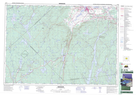
021A16 Windsor Canada topo map, 1:50,000 scale
021A16 Windsor NRCAN topographic map.
Includes UTM and GPS geographic coordinates (latitude and longitude). This 50k scale map is suitable for hiking, camping, and exploring, or you could frame it as a wall map.
Printed on-demand using high resolution, on heavy weight and acid free paper, or as an upgrade on a variety of synthetic materials.
Topos available on paper, Waterproof, Poly, or Tyvek. Usually shipping rolled, unless combined with other folded maps in one order.
- Product Number: NRCAN-021A16
- Parent Topo: TOPO-021A
- Map ID also known as: 021A16, 21A16
- Unfolded Size: Approximately 26" high by 36" wide
- Weight (paper map): ca. 55 grams
- Map Type: POD NRCAN Topographic Map
- Map Scale: 1:50,000
- Geographical region: Nova Scotia, Canada
Neighboring Maps:
All neighboring Canadian topo maps are available for sale online at 1:50,000 scale.
Purchase the smaller scale map covering this area: Topo-021A
Spatial coverage:
Topo map sheet 021A16 Windsor covers the following places:
- Blind Bay - Ducks Nest - Eagle Cove - Goose Neck - Lebreau Creek - Long Bay - Northeast Cove - Thumb Hill Creek - Armstrong Point - Halfway Point - Oak Point - Blind Run - Baker Falls - Little River Falls - Millet Falls - Halifax - Hants - Kings - Lunenburg - New Ross 20 - Pennal 19 - St. Croix 34 - Briar Island - Erns Island - McGlones Island - Pine Island - Adams Lake - Anthony Lake - Armstrong Lake - Bag Lake - Baptist Lake - Barrens Lakes - Bear Lake - Bear Trap Lake - Bearskin Lake - Bennett Lake - Big Black Lake - Big Otter Lake - Big Pine Lake - Big St. Margarets Bay Lake - Big St. Margaret's Bay Lake - Bill Lake - Bills Lake - Birchbark Lake - Black Brook Lake - Black River Lake - Blind Lake - Bog Lake - Burnt Lake - Burnt Lake - Camp Lake - Card Lake - Chain Lake - Chain Lakes - Christy Lake - Clearwater Lake - Cooney Lake - Davidson Lake - De Adder Lake - Dean Chapter Lake - Duck Pond - Duck Pond - Duck Pond - Duck Ponds - Euchre Lake - Falls Lake - Falls Lake - Falls Lake - Five Island Lake - Gold River Lake - Grassy Lake - Green Lake - Halfmoon Lake - Halfmoon Lake - Halls Lake - Hand Lake - Harris Lake - Hebbs Mill Pond - Holloway Lake - Horseshoe Lake - Indian Lake - Island Lake - Joe Long Lake - Kellys Lake - Lake Lewis - Lewis Lake - Lily Pond - Little Armstrong Lake - Little Barrens Lakes - Little Bear Trap Lake - Little Island Lake - Little Joe Long Lake - Little Otter Lake - Little Pine Lake - Little River Lake - Little Salter Lake - Little St. Margarets Bay Lake - Little St. Margaret's Bay Lake - Lizard Lake - Long Lake - Long Lake - Long Lake - Lower Canoe Lake - Lower Salter Lake - MacDonald Pond - Marshy Lake - Meadow Pond - Methals Lake - Methal's Lake - Middle Lake - Mill Lakes - Miller Lake - Mockingigh Lake - Moose Lake - Moosehorn Lake - Moosehorn Lake - Mosquito Lake - Mud Lake - Mud Lake - Mud Lake - Muddy Lake - Murphy Lake - Murphy Lake - North Canoe Lake - Northwest Lakes - Nova Scotia Lake - Otter Lake - Palmer Lake - Panuke Lake - Pesaquid Lake - Pine Lake - Ponhook Lake - Porcupine Lake - Rollaway Lake - Round Lake - Sallys Hole - Sallys Lake - Salter Lake - Shady Lake - Sheffield Lake - Simey Lake - South Canoe Lake - South Lake - Splash Dam Lake - St. Croix Lake - Starch Lake - Starks Lake - Sunken Lake - Taylor Lake - Three Cornered Lake - Three Lakes - Upper Canoe Lake - Upper Chain Lake - Upper Salter Lake - Walker Lake - Wallaback Lake - West Lake - West Moose Lake - Whalen Lake - Zwicker Lake - Big Hill - Colpitt Hill - First Hill - Froth Hole Hill - Grey Mountain - Hemlock Hill - Martock Mountain - Moses Mountain - Round Mountain - South Mountain - Chester - East Hants - Halifax - Kings - West Hants - Falls Lake Provincial Park - Fort Edward National Historic Site of Canada - Lieu historique national du Canada du Fort-Edward - Simey Lake Run - Aalders Lang Brook - Allen Brook - Armstrong River - Avon River - Baptist Brook - Barkhouse Brook - Bear Trap Lake Brook - Becky Bog Brook - Bills Brook - Black Brook - Black Brook - Black Brook - Black Brook - Black River - Bog Brook - Bog Brook - Brandywine Brook - Burnt Lake Brook - Burntwoods Brook - Collins Brook - Cross Brook - Dead Brook - Deep Hollow Brook - Eagle Cove Brook - East Branch Gold River - Fall Brook - First Run - Five Island Lake Brook - French Mill Brook - French Mill Brook - French Mill Brook - Gaspereau Canal - Gaspereau River - Gold River - Grassy Brook - Green Lake Brook - Gudgeon Brook - Gully Brook - Halfmoon Lake Brook - Halfway River - Halls Lake Brook - Hollow Bridge Canal - Horton Meadow Brook - Hunts Lake Brook - Lebreau Creek - Lebreau Creek Brook - Levy Meadow Brook - Little Lake Brook - Little River - Maple Brook - Maple Run - Marsh Brook - Marshy Lake Brook - Meadow Brook - Meander River - Methals Brook - Methal's Brook - Mill Brook - Mill Brook - Millet Brook - Mint Brook - Mint River - Moose Brook - Mud Lake Brook - Otter Lake Brook - Peck Meadow Brook - Piney Stream - Poplar Run - Porcupine Brook - Porcupine Gully - Roachs Brook - Roaring Brook - Rocky Brook - Salmontail River - Salmontail River - Sam Brook - Sams Brook - Sandy Brook - Schofield Brook - Schofield Meadow Brook - Second Run - Shady Brook - Shady Lake Brook - Shaw Brook - Shaw Creek - Shinglemill Brook - Simms Brook - Smelt Brook - Smeltzer Brook - South Branch - Southwest Avon River - Southwest Avon River - Southwest Branch Avon River - Southwest Brook - Southwest River - St. Croix River - Stoney Brook - Stony Brook - Sucker Brook - Swinamers Brook - Thans Brook - The Carry - Thompsons Brook - Thompson's Brook - Thumb Hill Creek - Toad River - Toney Brook - Trout River - Walsh Brook - Weir Brook - West Avon River - West Branch Avon River - West Branch Gold River - Whitney River - Baker Stillwater - Big Bend - Black Brook Deadwaters - Burnt Stillwater - Conrad Stillwater - Crooked Gully - Crooked Stillwater - Duncanson Hole - Eagles Nest - First Stillwater - Fox Stillwater - Froth Hole - Gilberts Stillwater - Juniper Stillwater - Juniper Stillwater - Larders Stillwater - Leary Stillwater - Long Stillwater - McInnis Stillwaters - Mud Lake Deadwaters - Piney Deadwaters - Second Stillwater - Stoney Brook Deadwater - The Stillwater - Thompsons Stillwaters - Titus Dam Stillwater - Trout Hole - Williams Deadwaters - Windsor - Benjamins Mill - Benjamin's Mill - Currys Corner - Curry's Corner - Ellershouse - Falmouth - Five Mile Plains - Garlands Crossing - Gypsum Mines - Harriston - Hartville - Leminster - Lower Vaughan - Martock - Mill Road - Mill Section - New Russel - New Russell - Newport Station - Panuke Road - Pemberton's - Smiths Corner - Smith's Corner - St. Croix - Sunken Lake - Sweets Corner - Sweets Corners - Sweet's Corners - Three Mile Plains - Upper Falmouth - Upper Vaughan - Vaughan - Waterville - Wentworth Creek - Wile Settlement - Windsor Forks - Aalders Lang Meadow - Becky Bog - Caribou Bog - Cherrytree Meadow - Deal Bog - Driscolls Meadows - Duncan Meadow - Falls Bog - Fielding Meadows - Floating Bog - Halfmoon Meadow - Indian Bog - Jollymores Meadow - Levy Meadows - Meisners Meadow - Murphy Mill Pond Bog - Peck Meadow - Quinlan Bog - Redman Meadow - Richards Meadow - Salts Meadow - Schofield Meadow - Sefferns Meadow - Toms Meadow - Wiles Meadow


