
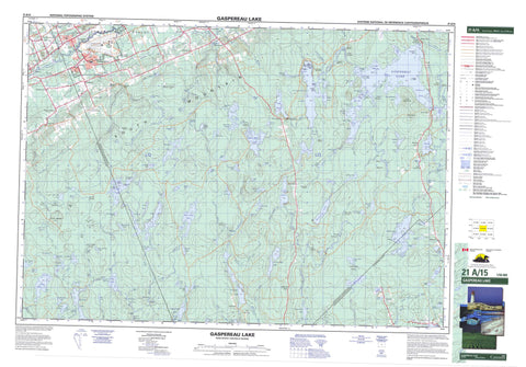
021A15 Gaspereau Lake Canada topo map, 1:50,000 scale
021A15 Gaspereau Lake NRCAN topographic map.
Includes UTM and GPS geographic coordinates (latitude and longitude). This 50k scale map is suitable for hiking, camping, and exploring, or you could frame it as a wall map.
Printed on-demand using high resolution, on heavy weight and acid free paper, or as an upgrade on a variety of synthetic materials.
Topos available on paper, Waterproof, Poly, or Tyvek. Usually shipping rolled, unless combined with other folded maps in one order.
- Product Number: NRCAN-021A15
- Parent Topo: TOPO-021A
- Map ID also known as: 021A15, 21A15
- Unfolded Size: Approximately 26" high by 36" wide
- Weight (paper map): ca. 55 grams
- Map Type: POD NRCAN Topographic Map
- Map Scale: 1:50,000
- Geographical region: Nova Scotia, Canada
Neighboring Maps:
All neighboring Canadian topo maps are available for sale online at 1:50,000 scale.
Purchase the smaller scale map covering this area: Topo-021A
Spatial coverage:
Topo map sheet 021A15 Gaspereau Lake covers the following places:
- Banks Cove - Devils Hole - Fancy Cove - Foley Cove - Lockharts Cove - Lower North Bay - Mosquito Hole - Northeast Arm - Northwest Arm - Simpsons Cove - Upper North Bay - West Arm La Have Lake - West Arm Lahave Lake - Wildcat Cove - Lanes Point - The Peninsula - Four Mile Lake Channel - Loon Lake Channel - Spruce Narrows - The Carry - Two Mile Lake Channel - Shinglemill Falls - Annapolis - Kings - Lunenburg - Air Force Island - Black Island - Camp Island - Davison Island - Dodge Island - Green Island - Moose Island - Nabs Island - Paul Websters Island - Pineo Island - Shaws Island - Stovepipe Island - The Calves - The Old Bull - The Old Cow - Weaver Island - Archies Hole - Armstrong Lake - Aylesford Lake - Banks Lake - Barteaux Lake - Big Marshall Lake - Big Sucker Lake - Birch Lake - Birchbark Lake - Blue Mountain Lake - Blue Mountain Pond - Bog Lake - Boot Lake - Boot Lake - Burnt Dam Flowage - Camp Four Lake - Campbell Lake - Caribou Lake - Chain Lakes - Chimney Lake - Cloud Lake - Colwell Lake - Colwell Round Lake - County Line Lake - Crooked Lake - Cross Lake - Crowell Lake - Dodge Hole - Donnellan Lake - East Allen Lake - East Branch Lake - East Twin Lake - Edwin Lake - Factorydale Pond - Flinn Lake - Foster Woodbury Lake - Four Mile Lake - Fourmile Lake - Fox Lake - Freds Lake - Frog Lake - Gaspereau Lake - Gull Lake - Gully Lake - Halfmoon Lake - Hamilton Lake - Hamilton Lake - Hardwood Lake - Harris Lake - Hatchard Lake - Hatcher Lake - Horton Lake - Hudson Lake - Hunt Lake - Hunts Lake - Joe Simon Lake - Johnson Pond - Joudreys Mill Pond - Kerr Lake - Kidney Lake - La Have Lake - Lahave Lake - Lake Ezra - Lake George - Lake Paul - Lake Ramsay - Lake Torment - Lily Lake - Lily Lake - Little Bear Lake - Little Lake - Little Marshall Lake - Little River Lake - Little Sucker Lake - Long Lake - Loon Lake - Lower Mud Lake - Lower Palmer Lake - Lower Round Pond - Lower Uhlman Lake - Lunenburg Lake - Mack Lake - Marsh Lake - Marshall Lake - McInnis Lake - Midconner Lake - Mistake Lake - Molasses Lake - Mud Lake - Muddy Lake - Murphy Lake - Nicholas Lake - Nimchin Page Lake - North River Lake - North Twin Lake - Oak Lake - Owen Lake - Palmer Lake - Palmer Lake - Parker Lake - Peter Lake - Randall Lake - Roast Lake - Round Lake - Salmontail Lake - Sand Lake - Scrag Lake - Seffern Lake - Sefferns Lake - Shell Camp Lake - Sherbrooke Lake - Simon Lake - South River Lake - South Twin Lake - Spry Lake - Sucker Flowage - Sucker Lakes - Tanner Lake - Tener Lake - The Moosepit - Tomahawk Lake - Trout River Pond - Turbitt Lake - Turbot Lake - Twin Lakes - Two Mile Lake - Twomile Lake - Upper Gully Lake - Upper Mud Lake - Upper Palmer Lake - Upper Round Pond - Upper Sixty Lake - Upper Uhlman Lake - West Allen Lake - West Twin Lake - Wilson Pond - Zeke Lake - Base des Forces canadiennes Greenwood - Canadian Forces Base Greenwood - Clements Park - Blue Mountain - Boars Back - Lockharts Hill - Peter Moores Hill - South Mountain - Wilson Hill - Annapolis - Chester - Kings - Lake George Provincial Park - Black Rattle - Annapolis River - Arenburgs Meadows Brook - Bear Brook - Beaver Brook - Berry Brook - Birch Lake Stream - Birchbark Brook - Black Brook - Black Brook - Black River - Bog Brook - Camp Four Lake Brook - Cloud Brook - Cloud Lake Brook - Colwell Brook - Crooked Lake Brook - Crossburn Brook - DeWolfe Brook - Donnellan Brook - East La Have River - East Lahave River - Ell Lake Brook - Fales River - Forties River - Forty River - Gaspereau Canal - Gaspereau River - Gould Brook - Gracie Brook - Gully Brook - Gully River - Hamilton Brook - Hamilton Brook - Hunts Lake Brook - Hutchinson Brook - Joe Simon Stream - Jones Brook - Kelley Brook - La Have River - La Have River - LaHave River - Lahave River - Lake George Brook - Lake Paul Brook - Lanes Brook - Larder River - Little Brook - Little River - Lucifee Brook - McClintock Brook - McGarvies Run - Meadow Brook - Mill Brook - Muddy Lake Brook - Mumford Brook - Mumford Brook - Newcombe Brook - Nimchin Brook - North Gaspereau River - North River - Oak Lake Brook - Ozie Meadow Brook - Palmer Lakes Stream - Patterson Meadow Brook - Rocky Run - Round Pond Brook - Salmontail River - Salmontail River - Sand Brook - Sanford Brook - Sarty Brook - Sarty Brook - Scrag Brook - Sharpe Brook - Shell Camp Stream - Sherbrooke River - South Annapolis River - South Branch - South River - Spinney Brook - Spry River - Sucker Brook - Tomahawk Stream - Torbrook River - Trout River - Twin Brooks - Uhlman Stream - Walker Brook - Waterloo River - Wentzell Brook - West Lahave River - West River - Wiswal Brook - Zeke Brook - Bear Trap Pool - Birch Lake Stillwater - Donnellan Stillwaters - Fales River Pool - Government Stillwater - Keddy Stillwater - Manthorne Stillwaters - Peter Moores Stillwaters - Peters Stillwater - Peter's Stillwater - The Horseshoe - The Horseshoe - The Juicer Stillwater - Trout Hole - Upper Fishing Pool - Walker Brook Pool - Wiswal Pool - Fishermans Rock - Aalders Landing - Aldersville - Blue Mountain - Dalhousie Road - East Tremont - Factorydale - Forest Home - Fraxville - Harmony - Kingston Village - Lake George - Lake Paul - Lake Ramsay - Lakeview - Meadowvale - Melvern Square - Millville - Morristown - Murphy Lake - New Ross Road - Nicholsville - Rockville Notch - South Alton - South Farmington - South Greenwood - South Tremont - Torbrook - Torbrook East - Torbrook Mines - Tremont - Welton - Welton Landing - Annapolis Valley - Rockville Notch - Arenburgs Meadows - Barkhouse Meadow - Big Bog - Blue Joint Meadow - Bog Meadows - Colwell Meadows - Doyle Meadows - Doyles Meadows - Driscolls Meadows - Foster Woodbury Meadow - Hamilton Meadows - Hanleys Meadow - Horseshoe Meadows - Lanes Meadows - Lindsay Hiltz Marsh - Little North Bog - Mosher Meadow - Moshers Meadows - Ozie Meadows - Parker Meadows - Samuel Parker Bog - Schaffer Meadows - West River Meadows - Wheaton Bog - Wilson Meadow - Zwicker Meadows - Greenwood - Kingston


