
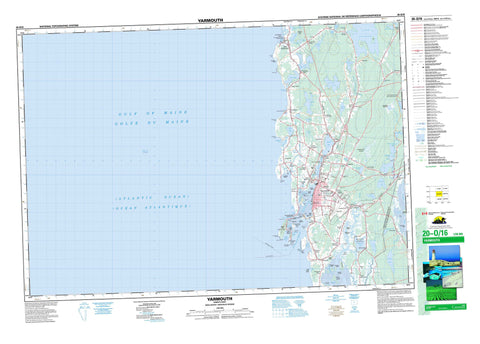
020O16 Yarmouth Canada topo map, 1:50,000 scale
020O16 Yarmouth NRCAN topographic map.
Includes UTM and GPS geographic coordinates (latitude and longitude). This 50k scale map is suitable for hiking, camping, and exploring, or you could frame it as a wall map.
Printed on-demand using high resolution, on heavy weight and acid free paper, or as an upgrade on a variety of synthetic materials.
Topos available on paper, Waterproof, Poly, or Tyvek. Usually shipping rolled, unless combined with other folded maps in one order.
- Product Number: NRCAN-020O16
- Parent Topo: TOPO-020O
- Map ID also known as: 020O16, 20O16
- Unfolded Size: Approximately 26" high by 36" wide
- Weight (paper map): ca. 55 grams
- Map Type: POD NRCAN Topographic Map
- Map Scale: 1:50,000
- Geographical region: Nova Scotia, Canada
Neighboring Maps:
All neighboring Canadian topo maps are available for sale online at 1:50,000 scale.
Purchase the smaller scale map covering this area: Topo-020O
Spatial coverage:
Topo map sheet 020O16 Yarmouth covers the following places:
- Alder Cove - Careys Cove - Green Cove - Inner False Bay - Inner False Harbour - John Cove - Johns Cove - Johnson Cove - Kelleys Cove - Kelly Cove - Lamonts Cove - Mill Creek - Mountain Island Creek - Outer False Bay - Outer False Harbour - Pembroke Cove - Perrys Creek - Sand Bay - Southwest Cove - The Churn - The Creek - Yarmouth Harbour - Yarmouth Sound - Chegoggin Flats - False Harbour Bar - False Harbour Beach - Kelp Hauler Shore - Lobster Bar - Pembroke Beach - Pitmans Beach - Port Maitland Beach - Stanwoods Beach - Battery Point - Bay View Point - Bells Point - Bird Point - Burns Point - Cape Forchu - Cape Forchu (East Cape) - Cape Forchu (West Cape) - Cape Fourchu (East Cape) - Cape Fourchu (West Cape) - Carls Point - Chegoggin Point - Cranberry Point - Doanes Point - East Cape - Elders Head - Fish Point - Gunner Point - Gunners Point - Hemeons Point - High Head - Johnsons Point - Nickersons Point - Northern Peak - Pitmans Point - Potato Field Point - Red Head - Rum Nubble - Ships Stern - Southwest Point - Spruce Point - Sunday Point - West Cape - Wyman Head - Back Channel - Main Channel - Pembroke Dyke - South Channel - Yarmouth Bar Channel - Glovers Falls - Sweeneys Falls - Yarmouth - Yarmouth 33 - Baker Island - Bakers Island - Bear Island - Big Island - Blackberry Island - Bunker Island - Clements Island - Clemment Island - Doctor Island - Doctors Island - Jacco Island - Jacquard Island - Kayes Island - Kelley Island - Kelly Island - Little Bunker Island - Little Thrum Cap - Lovitts Island - Maple Island - Mountain Island - Nubble Island - Perry Island - Perrys Island - Rat Island - Sunny Slope Island - The Nubble - Thrum Cap - Tympanys Island - Websters Island - Agard Lake - Allen Lake - Allens Lake - Beaver Lake - Bells Ponds - Big Pond - Brazil Lake - Brenton Lake - Bunker Lake - Bunkers Lake - Butlers Lake - Chandler Lake - Chebogue Lake - Chegoggin Lake - Churchill Lake - Churchills Lake - Churchills Mill Lake - Coggins Lake - Darling Lake - Darlings Lake - Deveaus Pond - Doctor Lake - Doctors Lake - Duck Pond - Dunn Lake - Footes Pond - Goose Lake - Harris Lake - Island (Utley) Lake - Island Pond - Killam Lake - Killams Lake - Lake George - Lake Milo - Leapfrog Lake - Lily Lake - Little Brazil Lake - Little Lake - Little Plymouth Lake - Melbourne Lake - Milton Lake - Mud Lake - Pleasant Lake - Porcupine Lake - Porter Lake - Reubens Lake - Robbins Lake - Rodneys Lake - Rodney's Lake - Salmon Lake - Sandyland Ponds - Second Lake - Sunday Lake - Taylors Lake - The Salt Pond - Trefry Lake - Utley Lake - Wellington Lake - Crockers Hill - Holmes Hill - Holmes Hill - Hotel Hill - Pinkney Hill - Sidon Hill - Town Point - Argyle - Yarmouth - Ellenwood Lake Provincial Park - Melbourne Lake Sanctuary - Port Maitland Beach Provincial Park - Annis River - Anthonys Creek - Broad Brook - Chebogue River - Chegoggin River - Cloverhill Brook - Coggins Brook - Cooks Creek - Government Brook - Little River - Ohio Millstream - Silver River - The Heath Brook - Tusket River - Black Rocks - Boudreaus Rock - Cat Rock - Clam Bank - County Line Shoal - Footes Ledge - Foul Ground - Hen and Chickens - Herring Rocks - Little Lurcher - Lobster Rock - Lurcher Shoal - Mackerel Shoal - Northeast Shoal - Northwest Shoal - Pollock Shoal - Privateer Rock - Rams Horn - Roaring Bull - Sentinel Rock - Sollows Rock - Southwest Shoal - Spectacle Ledge - Trinity Ledge - Yarmouth Bar - Yarmouth - Arcadia - Brazil Lake - Brenton - Brooklyn - Cape Forchu - Central Chebogue - Chebogue Point - Chegoggin - Darling Lake - Darlings Lake - Dayton - Deerfield - Deviller - East Brenton - East Chebogue - Foote Corner - Greenville - Hebron - Hillview - Ireton - Kelleys Cove - Kelly Cove - Lake George - Lakeside - Lower Melbourne - Markland - Melbourne - Milton - Milton Highlands - North Chegoggin - Nubble - Ohio - Overton - Pembroke - Pembroke Shore - Pleasant Lake - Plymouth - Port Maitland - Richmond Road - Rockville - Salem - Sand Beach - Sandbeach - Sandford - Short Beach - South Chegoggin - South Ohio - Summerville - Wellington - Yarmouth Bar - Beaverdam Meadows - Chebogue River Meadows - Chegoggin Marsh - Goose Flats - The Meadows - The Swale


