
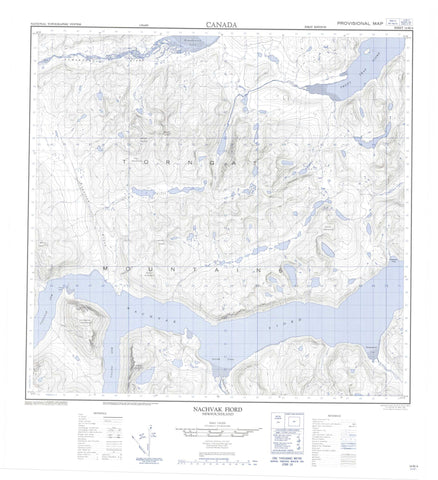
014M04 Nachvak Fiord Canada topo map, 1:50,000 scale
014M04 Nachvak Fiord NRCAN topographic map.
Includes UTM and GPS geographic coordinates (latitude and longitude). This 50k scale map is suitable for hiking, camping, and exploring, or you could frame it as a wall map.
Printed on-demand using high resolution, on heavy weight and acid free paper, or as an upgrade on a variety of synthetic materials.
Topos available on paper, Waterproof, Poly, or Tyvek. Usually shipping rolled, unless combined with other folded maps in one order.
- Product Number: NRCAN-014M04
- Parent Topo: TOPO-014M
- Map ID also known as: 014M04, 14M4, 14M04
- Unfolded Size: Approximately 26" high by 36" wide
- Weight (paper map): ca. 55 grams
- Map Type: POD NRCAN Topographic Map
- Map Scale: 1:50,000
- Geographical region: Newfoundland and Labrador, Canada
Neighboring Maps:
All neighboring Canadian topo maps are available for sale online at 1:50,000 scale.
Purchase the smaller scale map covering this area: Topo-014M
Spatial coverage:
Topo map sheet 014M04 Nachvak Fiord covers the following places:
- Ivitak Cove - Kitsemarvik Cove - KomaktorvikFiord - Nachvak Fiord - Schooner Cove - Tallek Arm - Tasiuyak Arm - Tinutyarvik Cove - Trout Trap Fiord - Townley Head - The Tall Bride - Fall Mountain - Idyutak Mountain - Kitsemarviub Mountain - Kutyaupak Mountain - Kutyautak Mountain - Mount Eliot - Mount Elizabeth - Mount Faunce - Mount Ford - Mount Gerfalcon - Mount Kaputyat - Torngat Mountains - Torugak Mountains - Ivitab Konga River - Kogarsok Brook - Komaktorvik River - McCormick River - McCornick River - Sennerkitte Brook - Torngat Lair


