
013O03E Makkovik Canada topo map, 1:50,000 scale
013O03E Makkovik NRCAN topographic map.
Includes UTM and GPS geographic coordinates (latitude and longitude). This 50k scale map is suitable for hiking, camping, and exploring, or you could frame it as a wall map.
Printed on-demand using high resolution, on heavy weight and acid free paper, or as an upgrade on a variety of synthetic materials.
Topos available on paper, Waterproof, Poly, or Tyvek. Usually shipping rolled, unless combined with other folded maps in one order.
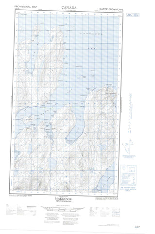
- Halfsheet: This map was designed as a half sheet of NRCAN-013O03, and it is the Eastern half. Find the western half sheet here.
- Product Number: NRCAN-013O03E
- Parent Topo: TOPO-013O
- Map ID also known as: 013O03, 13O3, 13O03
- Unfolded Size: Approximately 26" high by 36" wide
- Weight (paper map): ca. 55 grams
- Map Type: POD NRCAN Topographic Map
- Map Scale: 1:50,000
- Geographical region: Newfoundland and Labrador, Canada
Neighboring Maps:
All neighboring Canadian topo maps are available for sale online at 1:50,000 scale.
Purchase the smaller scale map covering this area: Topo-013O
Spatial coverage:
Topo map sheet 013O03E Makkovik covers the following places:
- Ailik Bay - Aillik Bay - Alcock's Cove - Bar Harbour - Bens Cove - Bents Cove - Big Bight - Broompeel Cove - Canuck's Cove - Cape Cove - Children's Cove - Clones Cove - Daughter Cove - Dawe's Cove - Doter Cove - Doughnut Cove - Edwards Cove - Fitzgerald's Cove - Ford's Bight - Humby's Cove - Jockos Bight - Johns Cove - Kaipokok Bay - Kennedy's Cove - Little Paradise Cove - Little Strawberry Cove - Long Point Cove - Lower North Head Cove - Makkovik Bay - Makkovik Harbour - Marks Bight - Monkey Bight - Monkeys Bight - Morgan's Cove - Nesbit Harbour - New Harbour - Nipper Cove - Old House Cove - Peters Cove - Ranger Bight - Sally's Cove - Shoal Cove - Strawberry Harbour - Summer Cove - Taylor's Table Cove - Tilt Cove - Toms Cove - Tom's Cove - Upper North Head Cove - Woody Cove - Yetman's Cove - Northeast Breaker - Big Head - Blackberry Point - Brassy Point - Burntwood Point - Cape Ailik - Cape Aillik - Cape Makkovik - Cape Point - Cape Roy - Cape Strawberry - Ford's Bight Point - Grassy Point - Gull Island Point - High Point - Ikey's Point - Indian Head - Jackos Point - Kaipokok Cape - Long Point - Lookout Point - Low Point - Measles Point - Middle Head - Nipper Cove Point - North Head - North Point - Northwest Point - Old Man's Head - Perret's Point - Point of the Bight - Ranger Bight Point - Samuel's Point - Southwest Point - Strawberry Head - Talasinimavik - Tickle Point - Tom's Point - Trap Point - White Nap Head - White Point - Yetman's Point - Narrows - The Narrows - The Tickle - Red Cliff - The Bluff - Ailik Islands - Aillik Islands - Bar Islands - Big Duck Island - Big Island - Black Islands - Can Islands - Drunken Harbour Island - Groundy Island - Gull Island - Gull Island - Inside Pigeon Island - Jackos Island - Jackos Islands - Jacques Island - Jockos Island - Long Island - Loyal Island - Lyalls Islands - Man Island - Man Islands - Outside Pigeon Island - Passing Islands - Pigeon Island - Punching Island - Red Islands - The Gull - The Little Gull - The Sisters Islands - Turnavik Islands - West Turnavik Island - Banana Lake - Bens Cove Pond - Broomfields Pond - Kits Pond - Long Hill Pond - Makkovik Pond - Marks Bight Pond - Ranger Bight Pond - Round Pond - Stillwater Pond - Kaipokok Hill - Big Bight Brook - Corner Brook - Dry Tree Brook - Halibut Brook - Makkovik Brook - Mink Trap Brook - Ranger Bight Brook - Ranger Brook - Rattling Brook - Labrador Sea - Mer du Labrador - Black Rock - Harbour Rock - North Sister - Punching Island Rock - South Sister - The Black Family - Ailik - Aillik - Makkovik


