
013N08E Hopedale Canada topo map, 1:50,000 scale
013N08E Hopedale NRCAN topographic map.
Includes UTM and GPS geographic coordinates (latitude and longitude). This 50k scale map is suitable for hiking, camping, and exploring, or you could frame it as a wall map.
Printed on-demand using high resolution, on heavy weight and acid free paper, or as an upgrade on a variety of synthetic materials.
Topos available on paper, Waterproof, Poly, or Tyvek. Usually shipping rolled, unless combined with other folded maps in one order.
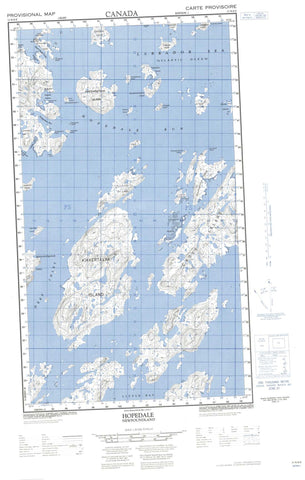
- Halfsheet: This map was designed as a half sheet of NRCAN-013N08, and it is the Eastern half. Find the western half sheet here.
- Product Number: NRCAN-013N08E
- Parent Topo: TOPO-013N
- Map ID also known as: 013N08, 13N8, 13N08
- Unfolded Size: Approximately 26" high by 36" wide
- Weight (paper map): ca. 55 grams
- Map Type: POD NRCAN Topographic Map
- Map Scale: 1:50,000
- Geographical region: Newfoundland and Labrador, Canada
Neighboring Maps:
All neighboring Canadian topo maps are available for sale online at 1:50,000 scale.
Purchase the smaller scale map covering this area: Topo-013N
Spatial coverage:
Topo map sheet 013N08E Hopedale covers the following places:
- Adlatok Bay - Akigaratarikulluk Cove - Attanek Cove - Deep Inlet - Ekalulik Cove - Hopedale Harbour - Ingergarnekulluk Cove - Kammakulluk Cove - Kanairiktok Bay - Kangerdlulugasak Bay - Kittusak Cove - Little Bay - Neksarsoak Cove - Pinatik Cove - Tooktoosner Bay - Umeakovik Anchorage - Ussiranniak Cove - Uvidluk Cove - Akkuliakattak Point - Attanik Head - Inner Black Head - Kenangoak Point - Kikkertaujak Peninsula - Kukkiniarvik Point - Landmark Point - Middle Black Head - Nuvutannak Point - Outer Black Head - Piliarusek Point - Siutik Head - Uivak Point - Black Head Tickle - Hopedale Run - Ingargarnekulluk Tickle - Sevluak Tickle - Windy Tickle - Achvitoaksoak Island - Amomajokutak Island - Anniowaktook Island - Burnt Island - Comma Island - Cross Island - Double Islands - Ellen Island (Anniowaktorusek) - Iglosoaktaligarsuk Island - Igluksoatulligarsuk Island - Illuviktalik Island - Inunganik Island - Inunganit Islands - Kejuksoatalik Island - Kemaktulliviktalik Island - Kikkertavak Island - Kretschmer Island - Kujaunak Island - Naujalekulluk Island - Naujalikulluk Island - Neksalikulluk Island - Nigordlek Island - Nuvutsuakulluk Island - Oganiovik Island - Okaliak Island - Okalik Island - Perkuservik Island - Pilik Island - Pitsiulaksikulluk Island - Pitsiulakulluk Island - Pitsiutatsitikulluk Island - Potongak Island - Ribback Island - Satoarsook Island - Satok Island - Sillutalik Island - Takkadliar Island - Tumetalik Island - Uigordlek Island - Ukalak Island - Umiaginak Island - Umiatoriak Island - Uvingajok (Leaning) Island - Zacharias Island - Takkijungoak Lake - Ussiranniak Lake - Sektinek Hill - The Black Heads - Hopedale Mission National Historic Site of Canada - Lieu historique national du Canada de la Mission-de-Hopedale - Ingergarnialuk Run - Labrador Sea - Mer du Labrador - Seneraluk Rock - Adlatovusek - Iglosoataliksoak - Koanclikulluk - Pinginak - Salvation - Hopedale


