
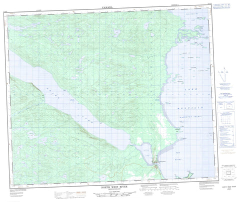
013F09 North West River Canada topo map, 1:50,000 scale
013F09 North West River NRCAN topographic map.
Includes UTM and GPS geographic coordinates (latitude and longitude). This 50k scale map is suitable for hiking, camping, and exploring, or you could frame it as a wall map.
Printed on-demand using high resolution, on heavy weight and acid free paper, or as an upgrade on a variety of synthetic materials.
Topos available on paper, Waterproof, Poly, or Tyvek. Usually shipping rolled, unless combined with other folded maps in one order.
- Product Number: NRCAN-013F09
- Parent Topo: TOPO-013F
- Map ID also known as: 013F09, 13F9, 13F09
- Unfolded Size: Approximately 26" high by 36" wide
- Weight (paper map): ca. 55 grams
- Map Type: POD NRCAN Topographic Map
- Map Scale: 1:50,000
- Geographical region: Newfoundland and Labrador, Canada
Neighboring Maps:
All neighboring Canadian topo maps are available for sale online at 1:50,000 scale.
Purchase the smaller scale map covering this area: Topo-013F
Spatial coverage:
Topo map sheet 013F09 North West River covers the following places:
- Hamilton Inlet - Sebaskachu Bay - Sebaskachu Cove - The Bight - Bottle Point - Cape Caribou - Cotters Point - Montagnais Point - North West Point - Paddon Point - Ten Mile Point - Sheshatshiu 3 - Ambrose Island - Bakeapple Islands - Butter Island - Dog Island - Edward Islands - Handy Islands - John Bull Island - Little Dog Island - Montagnais Islands - Sebaskachu Island - Thistle Island - Tickle Island - Upper Islands - Woody Islands - Grand Lake - Lake Melville - Little Lake - The Rapids - Cape Caribou River - North West River - Michelin Shoal - Montagnais Shoal - North West River - Sheshatsheits - Sheshatshiu


