
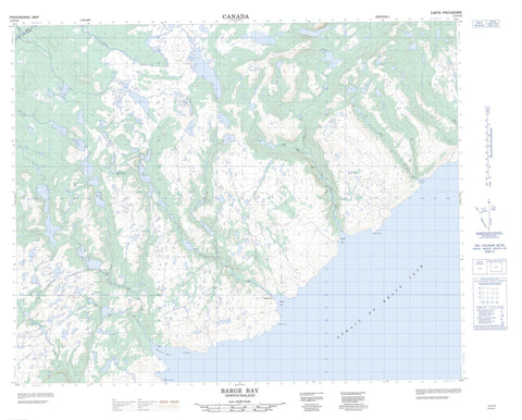
012P16 Barge Bay Canada topo map, 1:50,000 scale
012P16 Barge Bay NRCAN topographic map.
Includes UTM and GPS geographic coordinates (latitude and longitude). This 50k scale map is suitable for hiking, camping, and exploring, or you could frame it as a wall map.
Printed on-demand using high resolution, on heavy weight and acid free paper, or as an upgrade on a variety of synthetic materials.
Topos available on paper, Waterproof, Poly, or Tyvek. Usually shipping rolled, unless combined with other folded maps in one order.
- Product Number: NRCAN-012P16
- Parent Topo: TOPO-012P
- Map ID also known as: 012P16, 12P16
- Unfolded Size: Approximately 26" high by 36" wide
- Weight (paper map): ca. 55 grams
- Map Type: POD NRCAN Topographic Map
- Map Scale: 1:50,000
- Geographical region: Newfoundland and Labrador, Canada
Neighboring Maps:
All neighboring Canadian topo maps are available for sale online at 1:50,000 scale.
Purchase the smaller scale map covering this area: Topo-012P
Spatial coverage:
Topo map sheet 012P16 Barge Bay covers the following places:
- Barge Bay - Barge Point Cove - Big Cove - Black Bay - Fry's Cove - Green Bay - Woody Cove - Wreck Bay - Wreck Cove - Barge Point - East Point - Eastern Point - Green Bay Point - Gun Point - Salmon Point - Western Point - Wiseman Head - Wiseman Head - Wreck Point - Détroit de Belle Isle - Strait of Belle Isle - Green Bay Cliff - Big Head Pond - Big Stag Pond - Black Bay Pond - Black Bay Ponds - Chase Me Further Pond - Chateau Ponds - Grahams Pond - Green Bay Ponds - Inside Rocky Pond - Island Pond - Jib Pond - Juniper Pond - Laydens Pond - Little Stag Pond - Long Pond - Otter Pond - Outside Big Pond - Outside Rocky Pond - Pond Inside Long Pond - Rocky Ponds - Stag Pond - Steady Under the Pinch - Tear Fear Pond - Wild Cove Ponds - Wiseman Pond - Wreck Cove Ponds - Black Bay Jib - Stag Pond Jib - The Pinch - Barge Bay Brook - Black Bay Brook - Eastern Brook - Green Bay Brook - North Brook - Pinware River - Wiseman Brook - Wreck Cove Brook East Branch - Wreck Cove Brook West Branch - Bay Shoal - Halfway Rocks - Seal Rocks - Barge Bay


