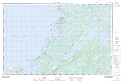
012P02 Brig Bay Canada topo map, 1:50,000 scale
012P02 Brig Bay NRCAN topographic map.
Includes UTM and GPS geographic coordinates (latitude and longitude). This 50k scale map is suitable for hiking, camping, and exploring, or you could frame it as a wall map.
Printed on-demand using high resolution, on heavy weight and acid free paper, or as an upgrade on a variety of synthetic materials.
Topos available on paper, Waterproof, Poly, or Tyvek. Usually shipping rolled, unless combined with other folded maps in one order.
- Product Number: NRCAN-012P02
- Parent Topo: TOPO-012P
- Map ID also known as: 012P02, 12P2, 12P02
- Unfolded Size: Approximately 26" high by 36" wide
- Weight (paper map): ca. 55 grams
- Map Type: POD NRCAN Topographic Map
- Map Scale: 1:50,000
- Geographical region: Newfoundland and Labrador, Canada
Neighboring Maps:
All neighboring Canadian topo maps are available for sale online at 1:50,000 scale.
Purchase the smaller scale map covering this area: Topo-012P
Spatial coverage:
Topo map sheet 012P02 Brig Bay covers the following places:
- Anchor Cove - Bird Cove - Black Duck Cove - Brig Bay - Dog Cove - East Cove - Fisherman Cove - Fisherman Cove - Golfe du Saint-Laurent - Gulf of St. Lawrence - North Cove - Old Ferolle Harbour - Pigeon Cove - Pond Cove - Seal Cove - South Bay - South Cove - Southeast Cove - St. Barbe Bay - St. Barbe Harbour - Ste. Genevieve Bay - Traitant Cove - Winter Cove - Anchor Point - Beach Point - Cape Ste. Genevieve - Debon Peninsula - Dog Peninsula - Dog Point - Forresters Point - Front Point - Genge Point - Grave Point - Grelee Point - Harbour Point - Ice Point - Northern Peninsula - Plum Point - Pond Point - Rock Point - Seal Point - Southwest Point - St. Barbe Point - Stony Point - Middle Pass - North Pass - Northern Pass - South Pass - Southern Pass - Beef Island - Bird Islands - Brushwood Island - Cape Island - Coot Island - Current Island - Entrance Island - Entry Island - Fish Island - Gooseberry Island - Green Islands - Lobster Island - Moyac Island - Mutton Island - Old Ferolle Island - Rase Island - Wooded Island - Angle Pond - Black Duck Lake - Castor Tilt Pond - East Castor Pond - Eastern Lake - Feeder Pond - Franks Pond - Grand Pond - Kellys Pond - Long Steady - Muskrat Pond - Muskrat Pond - Owl Pond - Round Lake - Ten Mile Lake - Tilt Pond - Western Brook Pond - Mount St. Margaret - Woody Hill - Bear Brook - East Castor Brook - East River - Eight Brook - Franks Brook - Kellys Brook - Manuels Feeder - Manuels River - Muskrat Brook - Roses Feeder - Salmon River - Ste. Genevieve River - West River - West Roses Feeder - Anchor Ledge - Crab Rocks - Grand Platter Rocks - Green Rocks - Porpoise Rock - Winter Flat - Anchor Point - Bird Cove - Black Duck Cove - Blue Cove - Brig Bay - Current Island - Forresters Point - Forrest's Point - Pidgeon Cove-St. Barbe - Pigeon Cove - Plum Point - Plum Point - Pond Cove - St Barbe


