
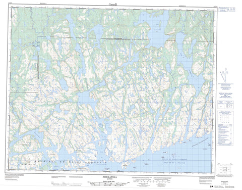
012O08 Shekatika Canada topo map, 1:50,000 scale
012O08 Shekatika NRCAN topographic map.
Includes UTM and GPS geographic coordinates (latitude and longitude). This 50k scale map is suitable for hiking, camping, and exploring, or you could frame it as a wall map.
Printed on-demand using high resolution, on heavy weight and acid free paper, or as an upgrade on a variety of synthetic materials.
Topos available on paper, Waterproof, Poly, or Tyvek. Usually shipping rolled, unless combined with other folded maps in one order.
- Product Number: NRCAN-012O08
- Parent Topo: TOPO-012O
- Map ID also known as: 012O08, 12O8, 12O08
- Unfolded Size: Approximately 26" high by 36" wide
- Weight (paper map): ca. 55 grams
- Map Type: POD NRCAN Topographic Map
- Map Scale: 1:50,000
- Geographical region: Quebec, Canada
Neighboring Maps:
All neighboring Canadian topo maps are available for sale online at 1:50,000 scale.
Purchase the smaller scale map covering this area: Topo-012O
Spatial coverage:
Topo map sheet 012O08 Shekatika covers the following places:
- Anse à la Cuillère - Anse Bull - Anse de la Vieille Maison - Anse Grant - Anse Grassy - Anse Scallop - Anse Spoon - Baie de Jacques-Cartier - Baie de Kingston - Baie de Shécatica - Baie des Homards - Baie des Rochers - Baie Mistanoque - Baie Napetipi - Baie Petit Pene - Baie Robin - Baie Shekatika - Golfe du Saint-Laurent - Havre Marsal - Havre Mistanoque - Passage de Bougainville - Passe East - Passe West - Archipel-de-Saint-Augustin - Bougainville - Brouague - Marsal - Pontchartrain - Archipel de Saint-Augustin - Archipel du Vieux Fort - Île Bayfield - Île Berthelot - Île Brouague - Île Canso - Île Chécatica - Île Crab - Île Cumberland - Île de l'Entrée - Île des Genévriers - Île du Forgeron - Île Écrevisse - Île Fournel - Île Inner - Île Mistanoque - Île Sandy - Île Wright - Îles Marsal - Le Boulet - Les Quatre Rochers - Rocher Cobblers - Rocher Éléonore - Rocher Ellinor - Rocher Mistanoque - Rocher Peril - Rochers aux Marsouins - Rochers Four - Rochers Porpoise - Lac Anik - Lac Chécatica - Lac du Rocher - Lac Jack's Hole - Lac Mairé - Lac Napetipi - Lac Paramé - Le Bilven Pond - Le First Long Pond - Le Second Long Pond - L'Island Pond - Port Jacques-Cartier - Port Saint-Servain - Petite rivière Coxipi - Rivière Chécatica - Rivière Coxipi - Rivière de la Baie des Rochers - Rivière des Rochers - Rivière du Vieux Fort - Rivière Leande - Rivière Napetipi - Portage Indian - Baie-des-Rochers - Port-Saint-Servain - Port-Saint-Servan - Rocky Bay - Shekatika - Saint-Augustin


