
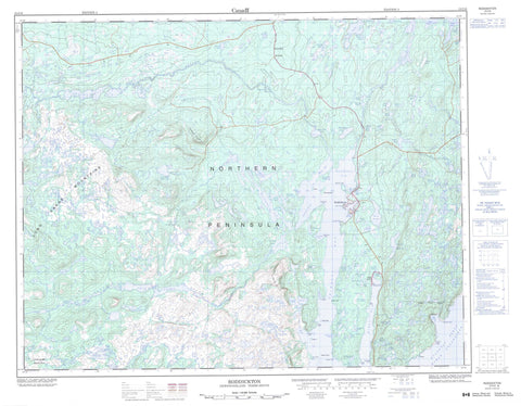
012I16 Roddickton Canada topo map, 1:50,000 scale
012I16 Roddickton NRCAN topographic map.
Includes UTM and GPS geographic coordinates (latitude and longitude). This 50k scale map is suitable for hiking, camping, and exploring, or you could frame it as a wall map.
Printed on-demand using high resolution, on heavy weight and acid free paper, or as an upgrade on a variety of synthetic materials.
Topos available on paper, Waterproof, Poly, or Tyvek. Usually shipping rolled, unless combined with other folded maps in one order.
- Product Number: NRCAN-012I16
- Parent Topo: TOPO-012I
- Map ID also known as: 012I16, 12I16
- Unfolded Size: Approximately 26" high by 36" wide
- Weight (paper map): ca. 55 grams
- Map Type: POD NRCAN Topographic Map
- Map Scale: 1:50,000
- Geographical region: Newfoundland and Labrador, Canada
Neighboring Maps:
All neighboring Canadian topo maps are available for sale online at 1:50,000 scale.
Purchase the smaller scale map covering this area: Topo-012I
Spatial coverage:
Topo map sheet 012I16 Roddickton covers the following places:
- Beaver Arm - Beaver Cove - Bide Arm - Canada Bay - Castor Cove - Chimney Bay - Chimney Cove - Dowers Harbour - Hilliers Harbour - Landing Cove - Long Arm - Muddy Hole - Northeast Arm - Northwest Arm - Otter Cove - Trap Cove - Weymouth Cove - Adams Point - Adamson Point - Birchy Neck - Boutitou Point - Brown Rock Point - Cabin Point - Chaine Point - Dieppe Point - Dolo Point - Fly Point - Good Point - Grosse Point - Marten Point - Milan Point - Miot Point - Northern Peninsula - Old House Point - Scott Point - Trap Cove Point - Weymouth Point - Wooded Point - Daveys Island - Drummond Island - Fane Island - Green Island - Rock Island - Barnes Pond - Bear Cave Ponds - Beaver Brook Pond - Beaver Pond - Beaver Pond - Bide Arm Big Pond - Big Burnt Brook Pond - Big Pond - Big Pond - Big Seal Cove Pond - Big Treytown Pond - Bills Pond - Boony Lake - Breaching Pond - Bridge Pond - Brophys Pond - Bucket Pond - Burnt Head Pond - Cannings Pond - Charlie Busheys Ponds - Clements Pond - Coles Pond - Constance Pond - Cutaway Pond - Dawes Pond - Deckers Pond - Deer Pond - Deer Ponds - Dry Pond - Duck Pond - Duck Ponds - East Pond - Elijaks Steady - Esaus Pond - First Clay Cove Pond - First Grassy Cove Pond - Flat Pond - Flat Waters - Francis Pond - Franks Pond - Fresh Pond - Frying Pans Pond - Genges Pond - Georges Pond - Gillards Pond - Gladsbury Pond - Godfreys Pond - Grassy Steady - Gull Pond - Hams Pond - Hancocks Pond - Hatters Pond - Herb Cannings Pond - High Mesh Ponds - Hynes Pond - Island Cove Pond - Island Steady - Jakes Farm Pond - Jaspers Pond - Joe Gillards Pond - John Lanes Pond - Lanes Pond - Leech Pond - Long Pond - Long Pond - Long Steady - Marble Pond - Montgomery Pond - Muddy Hole Pond - Muskrat Pond - Narrows Pond - Narrows Pond - Newmans Pond - Ocean Pond - Otter Cove Pond - Penny's Pond - Pinnacle Pond - Pot Hill Pond - Rattling Brook Pond - Rays Pond - Rocky Pond - Rocky Pond - Rocky Pond - Round Steady - Roy Cassells Pond - Rush Brook Pond - Rushy Pond - Salt Water Pond - Saltwater Pond - Second Clay Cove Pond - Second Grassy Cove Pond - Shoal Brook Pond - Shoal Cove Pond - Shoal Pond - Shoal Pond - Side Pond - Simons Pond - Small Seal Cove Pond - The Tangle - Third Clay Cove Pond - Third Grassy Cove Pond - Three Mile Steady - Tilt Pond - Timber Pond - Twin Lakes - Walters Pond - Weymouth Pond - Wigwam Pond - Wild Bight Pond - Black Nuddick - Cloud Hills - Horse Chops - John Reeves Backbone - Nyntens Ridge - Pot Hill - Puncheon Hill - Stans Hill - The Big Gun - The Pinnacle - The Saddle - Wizard Ridge - Beaver Brook - Cloud River - East Brook - Marble Brook - Northeast Brook - Northwest Brook - Pennys Brook - Rushy Brook - Shoal Brook - Under Ground Hole - Bad Rock - Bide Shoal - Boutitou Shoal - Dog Shoal - Marten Rock - Tenedos Rock - Zephyr Rock - Bide Arm - Englee - Roddickton - Roddickton-Bide Arm - Robert - High Mesh


