
012H15 Jackson s Arm Canada topo map, 1:50,000 scale
012H15 Jackson s Arm NRCAN topographic map.
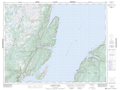
Includes UTM and GPS geographic coordinates (latitude and longitude). This 50k scale map is suitable for hiking, camping, and exploring, or you could frame it as a wall map.
Printed on-demand using high resolution, on heavy weight and acid free paper, or as an upgrade on a variety of synthetic materials.
Topos available on paper, Waterproof, Poly, or Tyvek. Usually shipping rolled, unless combined with other folded maps in one order.
- Product Number: NRCAN-012H15
- Parent Topo: TOPO-012H
- Map ID also known as: 012H15, 12H15
- Unfolded Size: Approximately 26" high by 36" wide
- Weight (paper map): ca. 55 grams
- Map Type: POD NRCAN Topographic Map
- Map Scale: 1:50,000
- Geographical region: Newfoundland and Labrador, Canada
Neighboring Maps:
All neighboring Canadian topo maps are available for sale online at 1:50,000 scale.
Purchase the smaller scale map covering this area: Topo-012H
Spatial coverage:
Topo map sheet 012H15 Jackson s Arm covers the following places:
- Allen's Cove - Apsey Cove - Aspy Cove - Back Arm - Batts Cove - Bear Cove - Big Cove - Big Cove - Birchy Cove - Birchy Cove - Breakfast Cove - Breakfast Cove - Breakheart Cove - Burnt Cove - Burnt Head Cove - Camp Cove - Clay Cove - Dark Gulch Cove - Deadmans Cove - Deep Cove - Dossenger Cove - Eagle Cove - Engine Cove - Fox Cove - Frenchman's Cove - Gales Cove - Gallows Cove - Garden Cove - Giles Cove - Gills Cove - Godfather Cove - Grassy Cove - Great Coney Arm - Hauling Cove - Jackson's Arm - Jockeys Cove - Little Coney Arm - Man O'War Cove - Munlan's Cove - New Jobs Cove - Old House Cove - Old House Cove - Otter Cove - Pound Cove - Punt Cove - Purbeck's Cove - Rosemary Cove - Rum Cove - Schooner Cove - Schooner Cove - Schooner Cove - Shoal Cove - Sops Arm - Sops Cove - Stuckless Cove - The Bottom - Toms Cove - Walker's Cove - Western Arm - Westport Cove - Whale Gulch - White Bay - White Iron Hill Cove - Wicks Cove - Wild Cove - Winterhouse Cove - Wiseman's Cove - The Straight Shore - Baie Verte Peninsula - Bartletts Point - Big Cove Head - Birchy Point - Breakfast Point - Capelan Point - Capelin Point - Cobbler Head - Coney Head - Crispin Point - Dark Gulch Point - Eastern Head - Eastern Head - Ford Point - Frenchman's Head - Godfather Point - Hauling Point - Hauling Point - Herbert Point - Herring Point - Low Point - Man O'War Point - Man Point - Northern Peninsula - Old House Point - Open Head - Otter Point - Red Point - Rocky Point - Salmon-House Point - Seal Point - Shale Point - Shoal Point - Spruce Point - Strutt Point - Tom Cod Point - Virgin Point - Western Head - White Point - Wild Cove Point - North Channel - South Channel - The Narrows - The Narrows - The Tickle - Western Tickle - Bad Island - Bear Cove Island - Georges Island - Little Pigeon Island - Pigeon Island - Pigeon Islands - Shellbird Island - Sops Island - Alderbed Pond - Apsey Cove Pond - Breakheart Cove Pond - Brians Pond - Deadmans Pond - Devils Pond - Fox Bait Pond - Grassy Steady - Hideaway Pond - Jackson's Arm Pond - Jackson's Arm Second Pond - Johns Pond - Little Tickle Pond - Long Steady - Lushs Pond - Old House Cove Pond - Pittmans Island Pond - Rattle Brook Pond - Round Pond - Ryans Pond - Saltwater Pond - Second Pond - Batteau Hill - Big Hill - Carrol Hill - Charity Hill - Devils Dressing Notch - Devils Dressing Place - Gulnare Hill - Harris Hill - Long Range Mountains - O'Adams Ridge - Penny Hills - Rice Mountain - Sops Hill - Stony Hill - Main River Waterway Provincial Park - Sop's Arm Provincial Park - Big Arm Brook - Doucers Brook - East Brook - Eastern Brook - Little Brook - Main River - Northern Feeder - Northwest Brook - Otter Trap Brook - Rattle Brook - West Brook - Western Arm Brook - Western Brook - Wild Cove Brook - Dossenger Rock - Fisherman's Bank - Gull Rocks - Mile Rocks - Shag Rock - Steering Rock - Steering Rock - The Shoals - Virgin Rocks - Jackson's Arm - Westport - Back Cove - Bear Cove - Coney Arm - Pound Cove - Purbeck's Cove - Sop's Arm - Sops Island - Stuckless Cove - Western Arm - Devonshire Valley


