
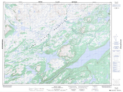
012A11 Star Lake Canada topo map, 1:50,000 scale
012A11 Star Lake NRCAN topographic map.
Includes UTM and GPS geographic coordinates (latitude and longitude). This 50k scale map is suitable for hiking, camping, and exploring, or you could frame it as a wall map.
Printed on-demand using high resolution, on heavy weight and acid free paper, or as an upgrade on a variety of synthetic materials.
Topos available on paper, Waterproof, Poly, or Tyvek. Usually shipping rolled, unless combined with other folded maps in one order.
- Product Number: NRCAN-012A11
- Parent Topo: TOPO-012A
- Map ID also known as: 012A11, 12A11
- Unfolded Size: Approximately 26" high by 36" wide
- Weight (paper map): ca. 55 grams
- Map Type: POD NRCAN Topographic Map
- Map Scale: 1:50,000
- Geographical region: Newfoundland and Labrador, Canada
Neighboring Maps:
All neighboring Canadian topo maps are available for sale online at 1:50,000 scale.
Purchase the smaller scale map covering this area: Topo-012A
Spatial coverage:
Topo map sheet 012A11 Star Lake covers the following places:
- Bear Pond - Butts Pond - Caines Pond - Caribou Lakes - Costigan Lake - East Tulks Pond - Finger Pond - Halls Pond - High Pond - Lake of the Hills - Otter Pond - Red Indian Lake - Saddler Lake - Star Lake - Tulks Lake - Annieopsquotch Mountains - Halfway Mountain - Lewaseechjeech Brook - Lloyds River - Mountain Brook - Otter Brook - Red Indian Brook - Shanadithit Brook - Star Brook - Tulks Brook


