
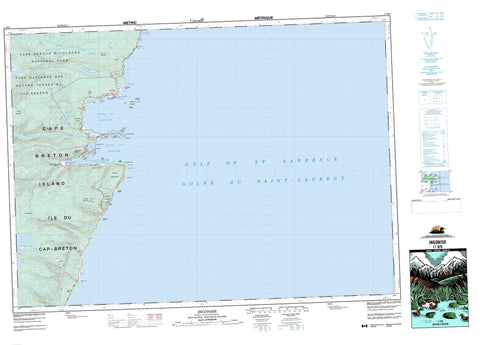
011K09 Ingonish Canada topo map, 1:50,000 scale
011K09 Ingonish NRCAN topographic map.
Includes UTM and GPS geographic coordinates (latitude and longitude). This 50k scale map is suitable for hiking, camping, and exploring, or you could frame it as a wall map.
Printed on-demand using high resolution, on heavy weight and acid free paper, or as an upgrade on a variety of synthetic materials.
Topos available on paper, Waterproof, Poly, or Tyvek. Usually shipping rolled, unless combined with other folded maps in one order.
- Product Number: NRCAN-011K09
- Parent Topo: TOPO-011K
- Map ID also known as: 011K09, 11K9, 11K09
- Unfolded Size: Approximately 26" high by 36" wide
- Weight (paper map): ca. 55 grams
- Map Type: POD NRCAN Topographic Map
- Map Scale: 1:50,000
- Geographical region: Nova Scotia, Canada
Neighboring Maps:
All neighboring Canadian topo maps are available for sale online at 1:50,000 scale.
Purchase the smaller scale map covering this area: Topo-011K
Spatial coverage:
Topo map sheet 011K09 Ingonish covers the following places:
- Annie Collins Cove - Bear Cove - Black Cove - Broad Cove - Corsons Cove - Dunphys Creek - Hawleys Cove - Ingonish Harbour - Mink Cove - North Bay - North Bay Ingonish - Rocky Bay - Seine Cove - South Bay - South Bay Ingonish - Two Rock Cove - Williams Cove - Wreck Cove - Broad Cove Beach - Duncans Beach - Ingonish Beach - North Bay Ingonish Beach - Ross Beach - Whitty Shore - Archibald Point - Black Point - Burke Head - Cape Smokey - Cape Smoky - Cape Smoky - Dundas Head - Flat Point - Hawleys Point - Jackson Point - Kings Point - Ladies Head - MacLeods Point - Middle Head - Pigeon Point - Red Head - Red Head - Rocky Point - Shag Roost - Smoky Cape - Spring Point - Stanley Point - Table Head - The Point - Two Rock Point - Western Point - Wreck Cove Point - Wreck Point - Victoria - Cape Breton Island - Île du Cap-Breton - Ingonish Island - Steering Island - Best Lakes - Boot Lake - Boyd Lake - Branch Pond - Broad Cove Mountain Lake - Browns Lake - Camerons Lakes - Canns Lake - Cavanaugh Lake - Cradle Lake - Freshwater Lake - Halfway Lake - Hardwood Hill Lake - Hummock Lake - Lake of the Islands - Little Canns Lake - Long Lake - Long Pond - Lynx Lake - MacDougalls Lake - Mary Ann Lake - Neils Lake - Pedlar Lake - Roper Lake - Round Pond - Rudderham Lake - Ski Lodge Lake - South Lake - Spud Lake - Warren Lake - West Lake - Wreck Cove Flowage - Wreck Cove Lakes - Broad Cove Mountain - Franey Mountain - Smokey Mountain - Smoky Mountain - Victoria - Cape Breton Highlands National Park of Canada - Cape Smokey Provincial Park - Parc national du Canada des Hautes-Terres-du-Cap-Breton - Big Sarahs Brook - Cameron Brook - Clyburn Brook - Dundas Brook - Ferrys Brook - Franey Brook - Ingonish River - MacInnis Brook - MacKeigans Brook - MacLeods Brook - Mary Ann Brook - McKinnon Brook - McLeod Brook - Mill Brook - Morrison Brook - Morrisons Brook - Pathend Brook - Power Brook - Red Head Brook - Rocky Brook - Roper Brook - Slate Brook - Smoky Brook - Soapstone Brook - Warren Brook - Wreck Cove Brook - Black Rock - Broad Cove Shoals - Deepwater Rock - East Rocks - Eastern Rocks - Fisherman Rock - Inside Net Rock - Mackerel Rock - Outside Net Rock - Ragged Rocks - Shag Roost - The Sunker - Whale Rock - White Rock - Birch Plain - Ingonish - Ingonish Beach - Ingonish Centre - Ingonish Ferry - Keltic Lodge - South Ingonish Harbour - Wreck Cove - Neils Barren


