
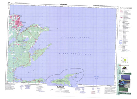
011J04 Glace Bay Canada topo map, 1:50,000 scale
011J04 Glace Bay NRCAN topographic map.
Includes UTM and GPS geographic coordinates (latitude and longitude). This 50k scale map is suitable for hiking, camping, and exploring, or you could frame it as a wall map.
Printed on-demand using high resolution, on heavy weight and acid free paper, or as an upgrade on a variety of synthetic materials.
Topos available on paper, Waterproof, Poly, or Tyvek. Usually shipping rolled, unless combined with other folded maps in one order.
- Product Number: NRCAN-011J04
- Parent Topo: TOPO-011J
- Map ID also known as: 011J04, 11J4, 11J04
- Unfolded Size: Approximately 26" high by 36" wide
- Weight (paper map): ca. 55 grams
- Map Type: POD NRCAN Topographic Map
- Map Scale: 1:50,000
- Geographical region: Nova Scotia, Canada
Neighboring Maps:
All neighboring Canadian topo maps are available for sale online at 1:50,000 scale.
Purchase the smaller scale map covering this area: Topo-011J
Spatial coverage:
Topo map sheet 011J04 Glace Bay covers the following places:
- Anchor Cove - Back Cove - Baird Cove - Big Glace Bay - Bordens Cove - Bridgeport Cove - Campbells Cove - Cary Rocks Cove - Cow Bay - Deadman Cove - Deep Cove - Deep Water Cove - Eastern Harbour - False Bay - Fluke Cove - Flukes Head Cove - Glace Bay - Glace Bay - Glace Bay Harbour - Glace Bay Harbour - Goulds Cove - Grandfathers Cove - Hatchet Rock Cove - Howards Cove - Jimmys Cove - Little Goulds Cove - Long Cove - MacDonald Cove - Macdonald Cove - Mackerel Cove - Mainadieu Bay - Main-à-Dieu Bay - Mainadieu Harbour - Main-à-Dieu Harbour - Millbrook Cove - Mira Bay - Morien Bay - Neal Cove - Northwest Cove - Pigeon Head Cove - Port Caledonia - Ragged Rocks Cove - Round Island Cove - Savage Cove - Schooner Cove - Schooner Pond Cove - Seal Rock Cove - Shallop Cove - Spencers Creek - Tin Cove - Wadden Cove - Waddens Cove - Wallaces Cove - Western Point Cove - Catalone Beach - False Bay Beach - Glace Bay Beach - Hatchs Rock Breaker - Long Beach - Mira Beach - Phalens Bar - Arnold Point - Battery Point - Blockhouse Point - Bordens Head - Burke Point - Burkes Point - Burnt Head - Campbell Point - Campbells Point - Cap Percé - Cape Morien - Cape Percé - Catalogne Point - Catalone Point - Coalhole Point - Eastern Head - False Bay Head - Flukes Head - Friar Point - Grandfathers Head - Gull Cape - Howe Point - Hub Head - Kellys Head - Lobster Point - MacAuleys Point - MacKeigans Point - Macpherson Point - MacRae Point - Macrae Point - Middle Point - Moque Head - Noneck Point - Northern Head - Northern Head - O'Neils Point - Pigeon Head - Quarry Point - Rock Point - Round Island Point - Savage Cove Head - Schooner Pond Head - South Head - South Head - Spencers Point - Steering Hummock - Table Head - Tin Cove Head - West Point - Western Point - Whelan Point - Winging Point - Wreck Point - Mainadieu Passage - Main-à-Dieu Passage - Mira Gut - Northwestern Bank - Cape Breton - Brown Islands - Cape Breton Island - Flint Island - Flint Islands - Fox Island - Hay Island - Île du Cap-Breton - Red Islet - Scatari Island - Scatarie Island - Beaver Pond - Beaverdam Pond - Big Glace Bay Lake - Big Glace Lake - Campbell Pond - Catalogne Lake - Catalone Lake - Cochran Lake - Crow Pond - Dixons Pond - Dyson Pond - False Bay Lake - Fergusons Pond - Hall Pond - Halls Pond - Holmes Pond - John Allen Lake - Little Lake - Long Pond - Loon Lake - MacDonalds Pond - MacKeigans Ponds - Mackenzies Pond - MacLean Barachois - MacVicars Pond - McDonald Pond - McVicker Pond - Morrison Lake - Sand Lake - Schooner Pond - Second Lake - Tank Pond - Buckleys Hill - Fergusons Hill - The Pinnacle - Cape Breton - Big Glace Bay Lake Bird Sanctuary - Lieu historique national du Canada Marconi - Marconi National Historic Site of Canada - Refuge d'oiseaux du Big Glace Bay - Scatarie Island Wildlife Management Area - Black Brook - Black Brook Morien - Blackwater Brook - Cadegan Brook - Cadogan Brook - Doctors Brook - Fergusons Brook - Henry Brook - Homeville River - Hughies Brook - Long Swamp Brook - MacAskills Brook - MacIntyre Brook - MacVicars Brook - McAskill Brook - McIntyre Brook - Mill Stream - Mira River - Morrison Brook - Renwick Brook - Sand Lake Brook - Spencer Creek - Spencer Creek - Spencers Brook - Spencers Brook - Cary Rocks - Cormorandière Rocks - Cow Reef - Duck Rock - Duck Rocks - Glace Bay Bar - Glace Bay Shoals - Great Shag Rock - Hall Rock - Halls Rock - Harbour Rock - Harbour Rock Shoals - Hatch Rocks - Hatchet Rocks - Hatchs Rocks - Little Shag Rock - Mad Dick Rock - Middle Rock - Middle Shoal - Nearings Rock - Neering Rock - Number One-B Reef - Red Rock - Schooner Rock - Shag Shoal - Wattie Rock - Bateston - Belloni - Big Glace Bay - Birch Grove - Bridgeport - Broughton - Caledonia - Caledonia Junction - Caledonia Mines - Catalogne Gut - Catalone Gut - Cochran Lake - Dixon - Dixons - Dominion No. 6 - Donkin - East Slope - Glace Bay - Homeville - Hub - Long Beach - Mainadieu - Main-à-Dieu - Marconi - Marconi Towers - McKay Corners - McKays Corner - McLeods Crossing - Mira - Mira Gut - Morien - Morien Hill - Morien Junction - New Aberdeen - Passchendaele - Port Caledonia - Port Morien - Round Island - Sand Lake - Scatari Island - Scatarie Island - Schooner Pond - South Port Morien - Steeles Hill - Sterling - Table Head - Wadden Cove - Waddens Cove - Black Brook Meadows - The Bog


