
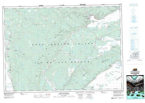
011F14 Whycocomagh Canada topo map, 1:50,000 scale
011F14 Whycocomagh NRCAN topographic map.
Includes UTM and GPS geographic coordinates (latitude and longitude). This 50k scale map is suitable for hiking, camping, and exploring, or you could frame it as a wall map.
Printed on-demand using high resolution, on heavy weight and acid free paper, or as an upgrade on a variety of synthetic materials.
Topos available on paper, Waterproof, Poly, or Tyvek. Usually shipping rolled, unless combined with other folded maps in one order.
- Product Number: NRCAN-011F14
- Parent Topo: TOPO-011F
- Map ID also known as: 011F14, 11F14
- Unfolded Size: Approximately 26" high by 36" wide
- Weight (paper map): ca. 55 grams
- Map Type: POD NRCAN Topographic Map
- Map Scale: 1:50,000
- Geographical region: Nova Scotia, Canada
Neighboring Maps:
All neighboring Canadian topo maps are available for sale online at 1:50,000 scale.
Purchase the smaller scale map covering this area: Topo-011F
Spatial coverage:
Topo map sheet 011F14 Whycocomagh covers the following places:
- Allans Cove - Barra Mens Cove - Blues Cove - Blue's Cove - Cassells Cove - Clarke Cove - Crooked Cove - Denys Basin - East Cove - Effies Cove - George Bay - Georges Bay - Gillis Cove - Golfe du Saint-Laurent - Gulf of St. Lawrence - Heckies Cove - MacDonald Cove - MacDonalds Cove - MacKenzie Cove - MacKenzie Cove - MacLean Cove - MacLeans Cove - MacLeod Creek - MacMillans Cove - Martin Cove - Morrison Cove - North Basin - North Cove - Pipers Cove - Plaster Cove - Ross Pond - Seal Cove - St. Georges Bay - Stumpy Cove - Walker Cove - West Bay - West Cove - Whycocomagh Bay - Wide Cove - Frasers Beach - Indian Point Beach - Allans Point - Cameron Point - Clarke Point - Eagle Point - Hector MacLean Point - Indian Point - Long Point - Lovett Point - MacDonalds Point - MacEacherns Point - MacKenzie Point - MacKenzies Point - MacKenzies Point - MacLean Point - MacMillans Point - Mahoneys Point - Martins Point - McLean Point - Ross Point - Stoney Point - Stony Point - Widow Point - St. Patricks Channel - The Boom - Myles Doyle Falls - Inverness - Juste au Corps - Whycocomagh 2 - Black Island - Boom Island - Calf Island - Cameron Island - Cape Breton Island - Clarke Island - Cow Island - Crammond Islands - Dumpling Island - Floda Island - Green Island - Île du Cap-Breton - Indian Island - Lewis Island - Little Island - Low Island - Macdonald Island - MacInnis Island - MacLeans Island - MacRaes Island - Martins Island - McIvor Island - McLean Island - Plaster Island - Ranald Island - Rook Island - Shallop Island - Sheep Island - Tailor Island - Beaver Lakes - Black Charlies Lake - Black Lakes - Bras d'Or Lake - Brileys Lake - Campbell Pond - Chisholm Pond - Chisholms Pond - Company Lake - Denas Pond - Glen Ponds - Indian Point Pond - Judique Pond - Little Beaver Lakes - Little Boom - Livingstones Lakes - MacArthurs Lake - MacAskills Lake - MacDonalds Lake - MacDonalds Pond - MacIver Pond - MacRaes Lakes - McDonald Pond - McIvor Pond - McKays Pond - Narrows Pond - Pooles Pond - Red Lake - Camerons Mountain - Craignish Hills - Creignish Hills - MacIntoshs Mountain - McIntyre Mountain - McIntyres Mountain - North Mountain - River Denys Mountain - Salt Mountain - The Big Ridge - Whycocomagh Mountain - Inverness - Richmond - Craigmore Provincial Park - Long Point Provincial Park - Whycocomagh Provincial Park - Abies Brook - Alder Brook - Allans Brook - Argyle Brook - Big Brook - Blues Brook - Blue's Brook - Blues Mountain Brook - Bridgend Brook - Camerons Brook - Campbell Brook - Campbells Brook - Captains Brook - Cariboo Creek - Chisholm Brook - Cove Brook - Dallas Brook - Dallas Brook - Diogenes Brook - East McPhail Brook - Fergusons Brook - Freshwater Brook - Glen Brook - Glendale Brook - Graham River - Indian River - Judique Intervale Brook - Kennedy Brook - Kennedys Big Brook - Kewstoke Brook - Lamey Brook - Lewis Brook - Little Blues Brook - Little Ferguson Brook - Little Intervale Brook - Little Judique Brook - MacColls Brook - MacCuspics Brook - MacInnes Brook - MacIntyres Brook - MacKenzie Brook - MacKenzies Brook - MacKenzies Little Brook - MacKinnons Brook - MacLean Brook - MacLeans Brook - MacLeod Brook - MacLeod Brook - MacLeods Brook - MacMaster Brook - MacMasters Brook - MacPhail Brook - MacPhee Brook - MacPherson Brook - MacPhersons Brook - MacPhersons Brook - MacRaes Brook - MacRitchies Brook - Maple Brook - McAskill Brook - McIntyre Brook - McKenzie Brook - McLennan Brook - McMaster Brook - McPhail Brook - McPherson Brook - Mill Brook - Miramichi Brook - Morleys Brook - Mull River - Neil Gobhas Brook - Pooles Brook - Queensville Brook - Red Brook - River Denys - River Inhabitants - Rory Brook - Ross Brook - Rough Brook - Saltwater Brook - School Bridge Brook - Skye River - Southeast Mabou River - Southwest Mabou River - Sydenham Brook - West McPhail Brook - White Brook - Will Brook - Boom Shoal - Mid Shoal - Ross Shoal - Tailor Shoal - Aberdeen - Alba - Alba Station - Ashfield - Ashfield Station - Ben Noah - Big Brook - Big Marsh - Big Meadow - Blue Mills - Blues - Blues Mills - Brigend - Campbell - Centennial - Churchview - Craigmore - Cummings - Denystown - Dunakin - Dunmore - Eden - Gillis Cove - Glencoe - Glencoe Mills - Glencoe Station - Glendale - Hawthorne - Hillsdale - Iron Mines - Judique - Judique Intervale - Judique North - Judique South - Kewstoke - Kingsville - Lime Hill - Little Judique - Long Point - Lower Hillsdale - MacLeod Settlement - Malagawatch Station - Maple Brook - Marble Mountain - Marshes (West Bay) - McArthur - McIntyres Mountain - McLeod Settlement - Melford - Munroe Bridge - Munroe Bridge Station - North Side Whycocomagh Bay - Orangedale - Orangedale East - Princeville - Rear Judique Chapel - Rear Judique South - Rhodena - River Centre - River Denys - River Denys Centre - River Denys Road - River Denys Station - Rosedale - Saint Ninian - Seal Cove - Skye Mountain - Soapstone Mine - South Side Basin of River Denys - South Side River Denys - South Side Whycocomagh Bay - Southwest Port Hood - South-West Port Hood - Upper Glencoe - Upper River Denys - Upper Southwest Mabou - Upper South-West Mabou - Valley Mills - Victoria Line - West Alba - Whycocomagh - Whycocomagh Portage - Whycocomagh Reserve - Wilburn


