
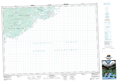
011F09 Framboise Canada topo map, 1:50,000 scale
011F09 Framboise NRCAN topographic map.
Includes UTM and GPS geographic coordinates (latitude and longitude). This 50k scale map is suitable for hiking, camping, and exploring, or you could frame it as a wall map.
Printed on-demand using high resolution, on heavy weight and acid free paper, or as an upgrade on a variety of synthetic materials.
Topos available on paper, Waterproof, Poly, or Tyvek. Usually shipping rolled, unless combined with other folded maps in one order.
- Product Number: NRCAN-011F09
- Parent Topo: TOPO-011F
- Map ID also known as: 011F09, 11F9, 11F09
- Unfolded Size: Approximately 26" high by 36" wide
- Weight (paper map): ca. 55 grams
- Map Type: POD NRCAN Topographic Map
- Map Scale: 1:50,000
- Geographical region: Nova Scotia, Canada
Neighboring Maps:
All neighboring Canadian topo maps are available for sale online at 1:50,000 scale.
Purchase the smaller scale map covering this area: Topo-011F
Spatial coverage:
Topo map sheet 011F09 Framboise covers the following places:
- Bear Cove - Capelin Cove - English Cove - Fourchu Bay - Fourchu Harbour - Fourchu Inlet - Fox Cove - Framboise Cove - Hardys Cove - Kate Rock Cove - Kelpy Cove - Long Beach Cove - MacLeans Cove - McLeods Cove - North Arm Breeches Lake - Seal Rock Cove - Shooting Cove - Strachans Cove - Bend Breaker - Long Beach - MacIntoshs Inner Breaker - MacIntoshs Outer Breaker - Marie Joseph Breaker - Morrisons Beach - Morrisons Breaker - St. Esprit Beach - The Bar - Barren Point - Bear Cove Point - Canns Point - East Head - Fourchu Head - Fox Cove North Cape - Fox Cove South Cape - French Point - MacKays Point - Munros Point - Rafuse Point - Red Cape - Southern Head - The Tongue - Urquharts Point - West Head - Winging Point - False Passage - Framboise Gut - Fullers Gut - Marcoche Gut - Marie Joseph Gut - Mulcuish Gut - Cape Breton - Richmond - Big Henrys Island - Butter Island - Cape Breton Island - Île du Cap-Breton - St. Esprit Island - Bagnell Lake - Bagnells Lake - Barren Lake - Bear Cove Pond - Bells Lake - Blue Lake - Breeches Lake - Canns Pond - Capelin Cove Lake - Church Lake - Cricket Lake - Crooked Lake - English Pond - Fishermans Lake - Five Island Lake - Fox Cove Lake - Framboise Round Lake - Hay Hill Lake - Lac du Rat - Little Lake - Little Lake - Long Beach Pond - Lower Kelpy Cove Lake - Lower Marie Joseph Lake - MacAskills Lakes - MacDermids Lake - MacKenzie Lake - MacKillops Lake - MacKillops Pond - MacKinnons Lake - MacLeans Lake - MacLeods Ponds - Marie Joseph Lake - Mary Anns Lake - Mulcuish Lake - Mullcuish Lake - Pattersons Lake - Peters Lake - Rat Lake - Red Lake - Rory Neils Lakes - Seal Rock Lake - Sgadan Lake - South Arm Breeches Lake - St. Esprit Lake - Stewarts Pond - Upper Kelpy Cove Lake - Upper Marie Joseph Lake - White Rocks Lake - White Rocks Ridge - Cape Breton - Richmond - Bagnells River - Black Brook - Eel Brook - Ferguson River - Framboise River - Framboise River - Fullers River - Jessies Brook - Jimmy MacLeods Brook - Klondikes Brook - Little Johns Brook - MacCormicks Brook - MacKenzies River - MacLeods Brook - MacLeods Ponds Brook - Marie Joseph Brook - Mary Anns Brook - Middle River Framboise - Morrisons Brook - Northeast Framboise River - Rattling Brook - Rocky Brook - South Brook - Strachans Brook - Taylors Brook - West Branch of Marie Joseph Brook - MacLeods Stillwaters - MacQuinns Stillwaters - Morrisons Breaker - Reads Rock - Seal Rock - Seal Rocks - Winging Point Shoal - Bad Neighbour Shoal - Big Shoal - Dog Rocks - Flat Ledge - Fourchu Black Rocks - Fourchu Rock - Framboise Shoal - Georges Rocks - Goose Rocks - Gut Rock - Haliburton Shoal - Herring Shoal - Kate Rock - Liver Rock - Lorway Rock - Lorway Shoal - Outer Breaker Reef - Pot Rock - Reads Rock - Sea Dolphin Shoal - Seal Rock - Seal Rocks - Seal Rocks - The Washerwoman - Tilbury Reef - Tilbury Rocks - Winging Point Shoal - Yellow Rock - Fourchu - Framboise - Framboise Intervale - Lower St. Esprit - North Fourchu - North Framboise - Stirling - MacAulays Haymarsh - Malcolms Meadows - Munroes Barren


