
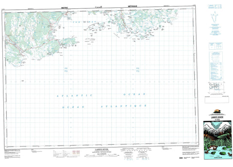
011F03 Larrys River Canada topo map, 1:50,000 scale
011F03 Larrys River NRCAN topographic map.
Includes UTM and GPS geographic coordinates (latitude and longitude). This 50k scale map is suitable for hiking, camping, and exploring, or you could frame it as a wall map.
Printed on-demand using high resolution, on heavy weight and acid free paper, or as an upgrade on a variety of synthetic materials.
Topos available on paper, Waterproof, Poly, or Tyvek. Usually shipping rolled, unless combined with other folded maps in one order.
- Product Number: NRCAN-011F03
- Parent Topo: TOPO-011F
- Map ID also known as: 011F03, 11F3, 11F03
- Unfolded Size: Approximately 26" high by 36" wide
- Weight (paper map): ca. 55 grams
- Map Type: POD NRCAN Topographic Map
- Map Scale: 1:50,000
- Geographical region: Nova Scotia, Canada
Neighboring Maps:
All neighboring Canadian topo maps are available for sale online at 1:50,000 scale.
Purchase the smaller scale map covering this area: Topo-011F
Spatial coverage:
Topo map sheet 011F03 Larrys River covers the following places:
- Back Cove - Bread Cove - Cabbage Garden Cove - Caseys Cove - Cashins Cove - Cashman Cove - Charlos Cove - Crane Cove - Crow Bunch Cove - Doliver Cove - Dover Bay - Factory Cove - Fair Weather Harbour - Farewell Harbour - Floating Island Cove - Flying Point Cove - Gammon Cove - Gammons Basin - Grovers Cove - Gull Island Cove - Heffernans Cove - John Wrights Cove - Langes Cove - Little Crane Cove - Little Harbour - Louse Harbour - Marshall Cove - Molasses Harbour - Mud Cove - New Harbour Cove - Northeast Arm - Pond Cove - Port Felix Harbour - Port Howe - Raspberry Cove East - Raspberry Cove West - Sand Cove - Sand Cove - Seine Berth Cove - Sugar Harbour - Summer Harbour - The Basin - Tor Bay - Uloths Cove - Webber Cove - Whale Cove - Whitehaven Harbour - Whitehead Harbour - Wine Cove - Witch Cove - Yankee Cove - Bones Ledge Beach - Currys Breaker - Eastern Breaker - Grovers Breaker - Long Beach - New Harbour Beach - Western Breaker - Berry Head - Black Point - Cole Harbour Head - Deming Point - Dogfish Point - Dogfish Point - Doliver Point - Dover Head - Durhams Point - Eastern Head - Eastern Point - Flat Point - Fluid Point - Flying Point - Goose Point - Green Point - Haulover Point - Howe Point - John Gammons Point - Larrys Point - Larry's Point - Leblanc Point - Mars Head - New Harbour Head - Pilot Point - Poule Point - Red Head - Rodmans Point - Shoal Point - Spry Point - The Cape - The Sand Spit - Verges Point - Well Point - Witch Cove Point - Allies Run - Dover Passage - Eastern Passage - Mussel Run - Southern Passage - The Gap - The Passage - Western Passage - Western Run - White Cliff - Guysborough - Bakers Island - Big Island - Big Island - Black Duck Island - Bluff Island - Bonds Island - Boudreaus Island - Cahoon Island - Charlies Island - Cooks Island - Deming Island - Doliver Island - Dorts Island - Dover Island - Fisherman Island - Flag Island - Forster Island - Gammon Islands - Gooseberry Island - Gull Island - Harbour Island - Hog Island - John Wrights Islands - Larrys Island - Louse Harbour Island - Louse Island - Mattee Island - Millstone Island - Mink Island - Passage Island - Patate Island - Pearls Island - Port Island - Prices Island - Ram Island - Ram Island - Raspberry Island - Richards Island - Sand Cove Island - Sheep Island - Sheep Island - Sheep Island - Sugar Harbour Islands - Sugar Islands - Tanner Island - The Bull - Three Top Island - Webber Island - Western Island - Whale Island - White Head Island - White Islands - Winter Island - Witch Island - Woody Island - Yankee Island - Admiral Lake - Basin Lake - Bears Big Lake - Bears Little Lake - Bellamys Lake - Black Ledge Pond - Bridge Lake - Camp Lake - Cranberry Lake - Crane Lake - Donovans Lake - Double Farm Lake - Double Lake - Duck Lake - Eastern Cove Lake - First Lake - Floating Island Lake - Fougère Lake - Gaspereaux Lake - Goose Lake - Grand Étang - Gull Lake - Hardwood Hill Lakes - Henry Brook First Lake - Henry Brook Second Lake - Henry Brook Third Lake - Henrys Lake - John Kirbys Lake - Johns Lake - La Trappe Lake - Lac des Sauts - Last Lake - Lily Lake - Little Crane Cove Lake - Little Harbour Lake - Little Lake - Little Lake - Little Lake - Long Lake - Lower Wood Lake - Mark Lake - Moosehorn Lakes - North Lake - Northeast Lake - Otter Lake - Pipe Lake - Red Head Pond - Rocky Lake - Rocky Lake - Rocky Lake - Second Lake - Second Lake - Simons Lake - Southeast Lake - Third Lake - Twin Lakes - Twin Lakes - Upper Wood Lake - Wood Lake - Bull Hill - Indian Peak - Guysborough - Basin Brook - Canters Lake Run - Eastern Brook - Henry Brook - Kyak Brook - Kyak Brook - Larrys River - Larry's River - Little River - New Harbour River - Patterson Brook - Bears Pool - First Stillwater - Fourth Stillwater - Second Stillwater - Third Stillwater - Big Shoal - Dead Cow Shoals - Flake Shoal - Haut-fond de Roche - Middle Ground - Net Rock - Outside Dry Rock - Pollock Ground - Avery Shoal - Bald Rock - Bald Rock - Bald Rock Reef - Bay Shoal - Bear Trap Ledge - Benoits Ledge - Big Shoal - Big Shoal - Black Ledge - Black Ledge - Black Ledge - Black Ledge - Black Rock - Black Rock - Black Rocks - Blackman Shoal - Bones Ledge - Brandy Ledge - Brig Rock - Bull Rock - Cape Shoal - Cedar Ledge - Charlos Reef - Charlos Shoal - Coote Rock - Country Island Shoal - Cow Rock - Crow Bunch Shoal - Dead Cow Shoals - Dogfish Rock - Dover Shoals - Dry Rocks - East Bull - East Bull - Fanning Shoal - Farewell HarbourLedges - Flake Shoal - Flat Ledge - Flying Point Shoals - French Rock - Georges Rock - Goose Point Shoal - Green Ledge - Gull Ledge - Gull Rock - Harbour Ledge - Harris Shoal - Haut-fond de Roche - Henrys Ledge - Indian Rocks - Inner Gull Ledge - Jacks Shoal - Jarvis Ledge - Joe Ground - John Davids Rock - Kelp Shoal - Kings Marsh Reef - Langley Shoal - Larrys Reef - Larry's Reef - Lisas Shoal - Little Ledge - Long Ledge - MacLeans Shoal - Michaud Ledge - Middle Ground - Middle Ground - Middle Rock - Monroe Rock - Moses Shoal - Mosses Shoal - Net Ledge - Net Ledge - Net Ledge - Net Rock - Net Rock - Net Rock - New Harbour Rock - Outer Gull Ledge - Outside Dry Rock - Paddy Ledge - Pellerins Ledge - Pollock Ground - Rock of the Bay - Rock of the Point - Rock Shoal - Rocket Shoals - Rocky Ledge - Round Rock - Sampson Rock - Sampsons Rock - Sculpin Rock - Seal Rocks - Seal Rocks - Seal Rocks - Shag Ledge - Shag Rock - Shot Ledge - Small Ledge - Snorting Rocks - Southeast Ledge - Southwest Bull - Split Rock - Split Rock - Sunken Rock - Sunken Rock Reef - The Bull - The Niblet - The Yankees - Three Fathom Shoal - Topstone Ledge - Tor Bay Ledges - Torbay Ledges - Tuffin Bank - Turtle Rock - Vache Ledge - Vache Shoals - Webber Shoal - West Bull - Western Ledge - Western Reef - Whale Rocks - Whale Shoal - Worm Shoal - Wry Widow Rock - Charlo - Charlo Cove - Charlos Cove - Fougere Farm Lake - Larrys River - Larry's River - Lower Whitehaven - Lower Whitehead - New Harbour - New Harbour East - New Harbour West - Port Felix - Tor Bay - Torbay - Upper West New Harbour - Whitehead - Yankee Harbour - Joes Marsh


