
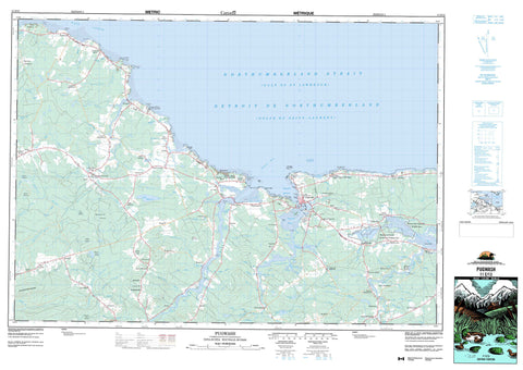
011E13 Pugwash Canada topo map, 1:50,000 scale
011E13 Pugwash NRCAN topographic map.
Includes UTM and GPS geographic coordinates (latitude and longitude). This 50k scale map is suitable for hiking, camping, and exploring, or you could frame it as a wall map.
Printed on-demand using high resolution, on heavy weight and acid free paper, or as an upgrade on a variety of synthetic materials.
Topos available on paper, Waterproof, Poly, or Tyvek. Usually shipping rolled, unless combined with other folded maps in one order.
- Product Number: NRCAN-011E13
- Parent Topo: TOPO-011E
- Map ID also known as: 011E13, 11E13
- Unfolded Size: Approximately 26" high by 36" wide
- Weight (paper map): ca. 55 grams
- Map Type: POD NRCAN Topographic Map
- Map Scale: 1:50,000
- Geographical region: Nova Scotia, Canada
Neighboring Maps:
All neighboring Canadian topo maps are available for sale online at 1:50,000 scale.
Purchase the smaller scale map covering this area: Topo-011E
Spatial coverage:
Topo map sheet 011E13 Pugwash covers the following places:
- Baie Verte - Bennetts Creek - Camerons Creek - Deep Cove - Dochertys Creek - Fox Creek - Golfe du Saint-Laurent - Goose Creek - Gordons Creek - Gulf of St. Lawrence - Matheson Cove - Mattinson Cove - McPherson Creek - Mud Creek - Pugwash Basin - Pugwash Harbour - Pugwash Road - Scale Creek - Stewarts Creek - Toney Creek - Wallace Bay - Wallace Harbour - Cameron Beach - Crescent Beach - Heather Beach - Mitchells Beach - Philip Bar - Pugwash Bar - Aggermore Point - Andersons Point - Annabelle Blacks Point - Bergeman Point - Bergmans Point - Biglow Point - Birch Head - Boss Point - Boss Spit - Chapel Point - Coldspring Head - Cunard Point - Fishing Point - Fox Point - Goose Point - Hussey Point - Jackson Point - Jacksons Point - Lewis Head - MacLeans Point - Marsh Point - Marsh Point - McLean Point - McNutts Point - Moore Point - Oxley Point - Page Point - Pineo Point - Pugwash Point - Roche Head - Rodger Point - Scale Point - Steven Point - Stevens Point - Stewarts Point - Toney Point - Détroit de Northumberland - Northumberland Strait - The Narrows - Hannons Falls - Mansfield Woods - Cumberland - Coney Island - Goose Islands - Mitchells Island - Victoria Island - DeWolf Lake - Eel Lake - Freshwater Lake - Lake Killarney - McLeod Lake - Pineo Lake - Ross Lake - Simpson Lake - Simpsons Lake - Williams Lake - Leicester Ridge - Mount Pleasant - Cumberland - Amherst Shore Provincial Park - Gulf Shore Provincial Park - Heather Beach Provincial Park - Northport Beach Provincial Park - Réserve nationale de faune de Wallace Bay - Shinimicas Provincial Park - Wallace Bay National Wildlife Area - Akerley Brook - Akerley Creek - Angus Mill Brook - Annabelles Brook - Bear Brook - Beharrell Brook - Beherrel Brook - Beherrel Brook - Big Hollow Brook - Black Brook - Bland Brook - Britton Brook - Brown Brook - Brown Brook - Burntwood Creek - Canfield Creek - Canfields Brook - Canfields Creek - Carter Brook - Chapman Brook - Chapman Brook - Chestnut Brook - Chisholm Brook - Colburn Brook - Conn Brook - Conns Brook - De Wolf Brook - De Wolfs Brook - Deep Hollow Brook - DeWolf Brook - DeWolf Brook - Dickson Brook - Dickson Brook - Dobson Brook - Dochertys Brook - Dochertys Brook - Dogden Brook - Doherty Brook - Doyle Brook - Duck Creek - Eel Creek - Emery Creek - Fisher Brook - Fitzsimmons Brook - Forshner Brook - George O. Brook - Gload Creek - Goose Creek - Goose River - Gordon Brook - Gordon Brook - Gordons Brook - Grady Brook - Hackney Creek - Henderson Brook - Henderson Creek - Holt Mill Brook - Howel Brook - Hurd Brook - Hurd Brook - Ibbitson Brook - John Smith Brook - Little River - Lowther Brook - Matheson Brook - McCloskey Brook - McElmon Brook - McMillan Brook - Meadow Brook - Meadow Brook - Meads Brook - Milltown Brook - Mud Brook - Mud Creek - Oulton Creek - Oultons Brook - Oxley Creek - Peers Creek - Pineo Brook - Plaster Creek - Poplar Brook - Poplar Brook - Pugwash River - Purdy Brook - River Philip - Rockwell Brook - Sam Moore Brook - Scott Brook - Seaman Brook - Shinimicas River - Shinimicas River - Shinimikas River - Still Brook - Tidemill Brook - Tidnish River - Treen Brook - Tuttle Brook - Wallace River - West Brook - Camp Ground Pool - Howards Pool - Kerrs Bridge Pool - Ballast Ground - Fanning Ground - Hape Reef - Jackson Reef - Lewis Reef - MacLeans Reef - Pugwash Reef - Rocky Ledge - The Chambers - The Hickey - Amherst Head - Amherst Shore - Beckwith - Beecham Settlement - Cameron Beach - Carrington - Chapman Settlement - Conn Mills - Conns Mills - East Leicester - East Linden - Fountain Road - Gulf Shore - Hartford - Head of Amherst - Head of Wallace Bay - Heather Beach - Irishtown Road - Kerrs Mill - Kerrs Mill Road - Kolbec - Kolbeck - Lake Killarney - Linden - Linden - Little River - Lorneville - Lower Gulf Shore - Lower Shinimecas - Lower Shinimicas - Mansfield - Middleboro - Miller Road - Mount Pleasant - North Middleboro - North Wallace Bay - Northport - Port Howe - Port Philip - Pugwash Junction - Pugwash Point - Pugwash River - Ripley Loop - Riverview - Rockley - Rockly - Roslin - Rossendale - Seagrove - Shinimecas Bridge - Shinimicas Bridge - Six Mile Road - South Middleboro - South Pugwash - South Wallace Bay - Upper Gulf Shore - Upper Linden - Wallace Bay - Wallace Bridge - Wallace Bridge - Wallace Bridge Station - Wallace River - West Linden - West Pugwash - Ben Smith Meadow - Dickson Meadows - Hingley Meadow - Lowther Meadows - Murray Carter Meadow - Roberts Meadows - Thompson Reid Meadow - Pugwash


