
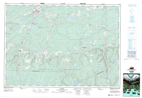
011E12 Oxford Canada topo map, 1:50,000 scale
011E12 Oxford NRCAN topographic map.
Includes UTM and GPS geographic coordinates (latitude and longitude). This 50k scale map is suitable for hiking, camping, and exploring, or you could frame it as a wall map.
Printed on-demand using high resolution, on heavy weight and acid free paper, or as an upgrade on a variety of synthetic materials.
Topos available on paper, Waterproof, Poly, or Tyvek. Usually shipping rolled, unless combined with other folded maps in one order.
- Product Number: NRCAN-011E12
- Parent Topo: TOPO-011E
- Map ID also known as: 011E12, 11E12
- Unfolded Size: Approximately 26" high by 36" wide
- Weight (paper map): ca. 55 grams
- Map Type: POD NRCAN Topographic Map
- Map Scale: 1:50,000
- Geographical region: Nova Scotia, Canada
Neighboring Maps:
All neighboring Canadian topo maps are available for sale online at 1:50,000 scale.
Purchase the smaller scale map covering this area: Topo-011E
Spatial coverage:
Topo map sheet 011E12 Oxford covers the following places:
- Colchester - Cumberland - Angevine Lake - Barber Lake - Bass River Lake - Bear Lake - Big Lake - Black Lake - British Lake - Carter Lake - Chain Lake - Chase Lake - Dead Lake - Dead Lake - Dewar Lake - Dominic Lake - Duck Pond - Folly Lake - Fountain Lake - Goose Pond - Hart Lake - Isaac Lake - Lily Lake - Lily Pond - Little Dead Lake - Little Duck Pond - Little Long Lake - Long Lake - McCormack Lake - McPherson Lake - Moose Lake - Newfound Lake - Park Lake - Poison Lake - Purdy Pond - Rock Lake - Round Lake - Salt Lake - Silica Lake - Simpson Lake - Slack Lake - Slade Lake - Stevens Lake - Sutherland Lake - Trout Pond - Vickery Lake - Weatherhead Lake - Webb Lake - Webbs Lake - West Branch Lake - West Lake - Wigmore Lake - Zollers Pond - Claremont Hill - Cobequid Mountains - Cross Road Mountain - Folly Mountain - Higgins Mountain - Pigeon Hill - Scotch Hill - Stevens Mountain - Sugarloaf Mountain - Swallow Hill - The Boarsback - Colchester - Cumberland - Wentworth Provincial Park - Arsenic Brook - Ash Brook - Bass River - Bass River of Five Islands - Beeswanger Brook - Betts Brook - Big Lake Brook - Bigney Brook - Black Brook - Black Brook - Black River - Bulmer Brook - Burntland Brook - Caldwell Brook - Centre Branch Swan Brook - Chain Lake Brook - Chain Lake Stream - Chase Brook - Chase Brook West Branch - Chase Lake Brook - Chisholm Brook - Colonel Brook - Colonels Brook - Conn Brook - Conns Brook - Crowley Brook - Dan Brown Brook - Davidson Brook - Dewar River - Dominic Meadow Brook - Douglas Meadow Brook - Drennan Brook - East Branch - East Branch Folly River - East Branch Wallace River - East Folly River - East Wallace River - Emery Brook - Emery Brook - Emery Brook - Five Islands River - Flemming Brook - Folly River - Fountain Lake Brook - Giles Brook - Gleason Brook - Glenville Brook - Gough Brook - Grant Brook - Great Village River - Griffin Brook - Hart Lake Brook - Harty Brook - Henderson Brook - Higgins Brook - Horse Pasture Brook - Little River - Long Lake Brook - Matheson Brook - McElman Brook - McElmon Brook - McMullen Brook - Mile Brook - Montrose Brook - Mountain Brook - Mountain Brook - Murphy Brook - North Sherman Brook - Otter Brook - Palmer Brook - Pine Brook - Polly Brook - Portapique River - Pugwash River - Racetrack Brook - Ralston Brook - River Philip - River Philip - Roaring River - Roaring River - Rockland Brook - Rockland River - Rushton Brook - Second River - Sherman Brook - Smith Brook - Snider Brook - South Drennan Brook - Spruce Brook - Steepbank Brook - Still Brook - Sugarloaf Brook - Surveyor Brook - Surveyors Brook - Swail Brook - Swan Brook - Teed Brook - Tillit Brook - Tillits Creek - Totten Brook - Treen Brook - Tunnel Brook - Village Brook - Wallace River - Webb Brook - West Branch Economy River - West Branch of River Philip - West Branch River Philip - West Branch Swan Brook - West Branch Wallace River - West Economy River - West River Philip - West Wallace River - Westchester Branch of Wallace River - Whetstone Brook - Wigmore Brook - Wilson Brook - Bent Dam Pool - Chase Gravel Pool - Myatts Bend - Oak Tree Pool - Redmond Pool - Tidd Pool - Oxford - Aikens - Atkinson - Birchwood - Black River Road - Castlereagh - Claremont - Collingwood Corner - East Hansford - East Wentworth - Farmington - Folly Lake - Folly Lake Station - Glenville - Greenville Station - Hansford - Hartford - Henderson Settlement - Jackson - Jersey - Lake Road - Leroy - Lily - Lower Greenville - Lower Wentworth - Mahoneys Corner - Mattatall Lake - Millvale - New Jersey - North Greenville - Oxford Junction - River Philip - River Philip Centre - Rose - Salt Springs - South Middleboro - South Victoria - Street Ridge - Streets Ridge - Swallow Settlement - Thomson Station - Valley Road - Victoria - Wentworth - Wentworth Centre - Wentworth Station - Wentworth Valley - West Hansford - West Wentworth - Westchester - Westchester Mountain - Westchester Station - Westchester Valley - Williamsdale - Williamsdale East - Windham Hill - Wyvern - Big Swales - Dicks Meadows - Dismal Swamp - Dominic Meadow - Douglas Meadow - Emery Meadows - Horse Pasture Meadows - Moose Bog - Thompson Reid Meadow


