
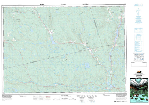
011E08 Lochaber Canada topo map, 1:50,000 scale
011E08 Lochaber NRCAN topographic map.
Includes UTM and GPS geographic coordinates (latitude and longitude). This 50k scale map is suitable for hiking, camping, and exploring, or you could frame it as a wall map.
Printed on-demand using high resolution, on heavy weight and acid free paper, or as an upgrade on a variety of synthetic materials.
Topos available on paper, Waterproof, Poly, or Tyvek. Usually shipping rolled, unless combined with other folded maps in one order.
- Product Number: NRCAN-011E08
- Parent Topo: TOPO-011E
- Map ID also known as: 011E08, 11E8, 11E08
- Unfolded Size: Approximately 26" high by 36" wide
- Weight (paper map): ca. 55 grams
- Map Type: POD NRCAN Topographic Map
- Map Scale: 1:50,000
- Geographical region: Nova Scotia, Canada
Neighboring Maps:
All neighboring Canadian topo maps are available for sale online at 1:50,000 scale.
Purchase the smaller scale map covering this area: Topo-011E
Spatial coverage:
Topo map sheet 011E08 Lochaber covers the following places:
- The Gut - The Narrows - Black Brook Falls - Antigonish - Guysborough - Pictou - Sydney - Sheep Island - Archibald Lake - Archibalds Mill Lake - Archie Lake - Battery Lake - Battery Lakes - Bear Lake - Beaver Lake - Beaver Lake - Big Bog Lake - Birch Brook Lake - Black Brook Lake - Black Brook Lake - Black Brook Lake - Black Brook Lakes - Black Gully - Black Lake - Black Lake - Black Lake - Boggs Lake - Boot Lake - Brora Lake - Broro Lake - Bruce Lake - Bryden Lakes - Burrough Lake - Burroughs Lake - Campbell Lake - Charlie Lake - Chisholm Lake - Christie Lake - Christy Lake - Clarkes Lakes - College Lake - Corner Lake - Cranberry Lake - Cranberry Lake - Cranberry Lake - Cranberry Lakes - Cranberry Lakes - Cranberry Lakes - Cumminger Lake - D Lake - Demmons Lake - Duck Pond - Duncan Wood Lake - East Lake - Eden Lake - Elbow Lake - Fraser Lake - Garvie Lake - Garvies Lake - Gaspereaux Lake - Glencross Lake - Glencross Lake - Glencross Lakes - Glenelg Lake - Glenelg Lakes - Gunn Lake - Gunn Lake - Haggard Lake - Haggarts Lake - Hattie Lake - Hattie Lake - Hattie Lake - Hattie Lakes - Hay Lake - Hunters Lake - Indian Man Lake - Island Lake - Jocks Lake - John Miller Lake - Jordy Mitchells Lake - Juniper Hill Lake - Kent Lake - Kirk Lake - Kirks Lake - Lake Henry - Leech Lake - Leitch Lake - Lily Pond - Little Lake - Little Liscomb Lake - Little Pond - Little Sandy Lake - Lochaber Lake - Lochiel Lake - Long Lake - Long Lake - MacEacherns Lake - MacKay Lake - MacKays Lake - MacLeans Lake - McCarthy Lake - McInnis Lake - McIsaac Lake - McKay Lake - McKay Lake - McKeen Lake - McLeod Lake - Middleton Lakes - Mill Pond - Milldam Lake - Mitchell Lake - Mitchell Lake - Murray Lake - Normans Lake - Oak Lake - Pats Lake - Pemmon Lake - Peter Allen Lake - Peter Bills Lake - Peter Gill Lake - Pot Lake - Round Lake - Round Lake - Sandy Gunns Lake - Sandy Lake - Sandy Lake - Shallow Lake - Siloam Lake - Silver Lake - Simon Lake - Sinclair Lake - Smith Lake - Stewart Lake - Stewarts Lake - Sucker Lake - Sucker Lake - Sutherland Lake - Sutherland Lake - Sutherlands Lake - Tait Lake - Taylor Lake - Taylor Lake - The Bog - Trout Lake - Trout Lake - Turtle Lake - Twin Lakes - Twin Oak Lakes - Two Mile Lake - Upper Dam Lake - Wallace Lake - White Lake - Wood Lake - Z Lake - Blue Mountain - Cochrane Hill - Hardwood Hill - Mount Adam - Sutherlands Mountain - The Keppoch - Antigonish - Guysborough - Pictou - St. Mary's - Lochiel Lake Provincial Park - Two Mile Lake Provincial Park - West River Run - Archibald Brook - Archibald Brook - Archibalds Mill Brook - Barren Brook - Beaver Brook - Big Meadow Brook - Black Brook - Black Brook - Black Brook - Bogg Brook - Boggs Brook - Bryden Brook - Campbell Brook - Campbells Brook - Chisholm Brook - Chisholm Creek - Churn Brook - Clark Brook - Cross Brook - Cummingers Run - Donny Brook - East Branch Donny Brook - East River - East River of Pictou - East River St. Mary - East River St. Marys - East River St. Mary's - Ellis Brook - Fraser Brook - Fraser Brook - Frasers Brook - French River - Garden River - Glencross Brook - Green Brook - Greens Brook - Gusset Brook - Gut Brook - Harry Gunns Brook - Hattie Brook - Hemlock Brook - Hurlbert Brook - Indian Man Brook - Jordan Brook - Kelly Brook - Kirks Gully - Kittle River - Leitch Lake Brook - Little River - MacKay Brook - MacQuarries Brook - McDonald Brook - McDonald Mill Brook - McFarlen Brook - McGillivray Brook - McIntosh Brook - McKay Brook - McKeen Brook - McNab Brook - McNaughton Brook - McQuarrie Brook - Mitchell Brook - Mitchells Brook - Moose River - Normans Brook - North River St. Marys - North River St. Mary's - Ohio River - Palmer Brook - Ross Brook - St. Mary River - St. Marys River - St. Mary's River - Sutherland Brook - Sutherland River - Sutherlands River - Tait Brook - Thompson Brook - Walsh Brook - West Barneys River - West Barney's River - West Branch French River - West River St. Mary - West River St. Marys - West River St. Mary's - Archibald Pool - Barren Brook Pool - Footbridge Pool - Gunns Hole - Harrisons Pool - Head of the Lake Pool - Indian Lake Stillwaters - Indian Man Pool - Lead Mines Pool - MacQuarries Pool - McKeens Pool - Oak Stillwater - Rock Island Pool - Rock Pool - Silvers Pool - Sutherlands Bridge Pool - The Weir - West River Bridge Pool - Archibalds Mill - Aspen - Blanchard Road - Blue Mountain - Caledonia - Cameron Settlement - College Grant - Cross Roads Ohio - Denver - East River St. Marys - East River St. Mary's - East River St. Marys West Side - Eden Lake - Garden of Eden - Glen Alpine - Glenelg - Greens Brook - Green's Brook - Hillcrest - Ireland - Kerrowgare - Lochaber - Lochiel Lake - Lower Caledonia - Melrose - Moose River - New Town - Newtown - North Lochaber - Rocky Mountain - Smithfield - South Lochaber - Sunny Brae - Sunnybrae - Upper Barneys River - Upper Smithfield - West Lochaber - Willowdale - Garden of Eden Barrens - Jim Camerons Meadow - Kent Bog - The Meadow


