
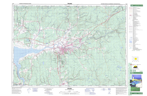
011E06 Truro Canada topo map, 1:50,000 scale
011E06 Truro NRCAN topographic map.
Includes UTM and GPS geographic coordinates (latitude and longitude). This 50k scale map is suitable for hiking, camping, and exploring, or you could frame it as a wall map.
Printed on-demand using high resolution, on heavy weight and acid free paper, or as an upgrade on a variety of synthetic materials.
Topos available on paper, Waterproof, Poly, or Tyvek. Usually shipping rolled, unless combined with other folded maps in one order.
- Product Number: NRCAN-011E06
- Parent Topo: TOPO-011E
- Map ID also known as: 011E06, 11E6, 11E06
- Unfolded Size: Approximately 26" high by 36" wide
- Weight (paper map): ca. 55 grams
- Map Type: POD NRCAN Topographic Map
- Map Scale: 1:50,000
- Geographical region: Nova Scotia, Canada
Neighboring Maps:
All neighboring Canadian topo maps are available for sale online at 1:50,000 scale.
Purchase the smaller scale map covering this area: Topo-011E
Spatial coverage:
Topo map sheet 011E06 Truro covers the following places:
- Cobequid Bay - Eagles Nest Point - Lockherds Point - Lyons Head - Sam Higgins Falls - Colchester - Hants - Pictou - Millbrook 27 - Truro 27A - Truro 27B - Truro 27C - Smith Island - Yuill Island - Barren Lake - Bentley Lake - Big Lake - Bob Lake - Deyarmont Lake - Dick Pike Lake - Fentons Lake - Flat Iron Lake - Gibbs Lake - Harts Lake - Hay Lake - Higgins Pond - Hingley Lake - Hydes Lake - Irwin Lake - Irwins Lake - June Lake - Little Lake - Little Lake - Long Lake - MacElmons Pond - Maitland Millpond - Moose Lake - Pratts Lake - Sibleys Pond - Three Lakes - Totten Lakes - Trenholms Lake - Trout Lake - Twin Lakes - Withrows Lake - Champ de tir Debert - Debert Range - Beech Hill - Cobequid Mountains - Foundry Hill - Half Moon Hill - Penny Mountain - Wilson Mountain - Colchester - East Hants - Pictou - Debert Game Sanctuary - Debert Wildlife Management Area - MacElmons Pond Provincial Park - Manganese Mines Wildlife Management Area - Alder Brook - Andrew Brook - Baird Brook - Barren Brook - Bear Brook - Beaver Brook - Beaver Brook - Black River - Blair Brook - Brandy Brook - Braynion Brook - Braynton Brook - Browns Brook - Calvary River - Calvary Stream - Campbell Brook - Canoe Brook - Carter Creek - Chapman Brook - Chiganois River - Christie Brook - Clifford Brook - Coal Mine Brook - Cranberry Brook - Crooked Ash Brook - Crowe Brook - Crowes Brook - Debert River - Dunlop Brook - Farnham Brook - Field Brook - Fields Brook - Fisher Creek - Five Mile River - Fivemile River - Fraser Brook - Galloping Brook - Gowan Brook - Grassy Brook - Greenfield Brook - Greens Creek - Half Moon Brook - Higgins Brook - Hingley Siding Brook - Jack Brook - Johnny Brook - Lake Brook - Lamby Brook - Legge Brook - Lepper Brook - Lightbody Brook - Little River - Mass Creek - Maynard Brook - McClures Brook - McCurdy Brook - McKenzie Brook - McLure Brook - McNutt Brook - Meadow Brook - Middle Branch North River - Middle Branch of North River - Mill Brook - Mill Brook - Murray Brook - Murray Brook - Narrow Mouth Brook - North River - Old Sams Brook - Otter Brook - Pembroke River - Pine Brook - Pitch Brook - Plaster Brook - Pleasant Brook - Putnam Brook - Rutherford Brook - Salmon River - Shubenacadie River - Soley Brook - South Branch North River - South Brook - South North River - Staples Brook - Steele Run - Totten Brook - Tunnel Brook - Walls Brook - Weatherbe Brook - Weatherby Brook - West Branch North River - West Branch of North River - West North River - Wetherbe Brook - Whidden Brook - Wilson Brook - Truro - Archibald - Beaver Brook - Belmont - Black Rock - Brookfield - Brookside - Camden - Central North River - Central Onslow - Clifton - Cottam Settlement - Crowe Mills - Crowes Mills - Debert - Delaney Settlement - East Folly Mountain - East Mines - East Mountain - Fort Belcher - Green Oaks - Greenfield - Harmony - Harmony Road - Hilden - Kemptown - Lower Harmony - Lower Onslow - Lower Pleasant Valley - Lower Truro - Maitland - Manganese Mines - Masstown - McCallum Settlement - McClures Mills - McCurdy - McCurdys Corner - Millbrook - Murray - Murrays Siding - North River - Old Barns - Onslow - Onslow Mountain - Pleasant Valley - Princeport - Princeport Road - Riversdale - Salmon River - Smithfield - South Maitland - Staples Brook - Truro Heights - Union - Upper Brookfield - Upper Brookside - Upper Kemptown - Upper North River - Upper Onslow - Upper Pleasant Valley - Valley - Valley Cross Roads - Valley Station - Totten Meadow - Bible Hill


